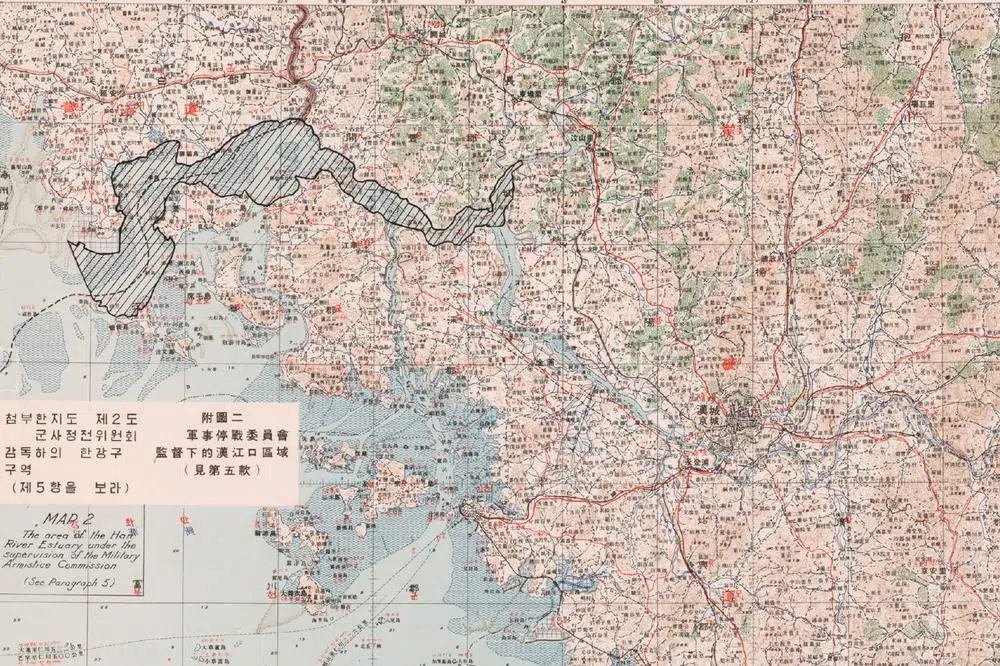
Han River Estuary
조강

A visitor looks at North Korea, on the other bank of the Han River, through a telescope at the Aegibong observatory (February 2024).
The Han River, or Hangang, is one of South Korea’s major rivers, flowing through Seoul before emptying into the Yellow Sea. It has played an important role in Korean history and was a trade route to China.
Its estuary, often called Jogang (the “Grandfather River”), marks the border between North and South Korea since 1953. This has deprived Seoul of direct access to the sea, navigation in the estuary having become impossible.
After the very precisely demarcated MDL and DMZ, the Jogang is the place where the border begins to dissolve in the brackish water. From the confluence of the Han and Imjin rivers in Paju to the tiny Maldo islet in the Yellow Sea, we are here in what the armistice agreement calls “the Neutral Zone of the Han River Estuary,” commonly referred to as the “Maritime DMZ.” A 67 km-long no-mans-river bordered on both sides by fortifications, minefields and death traps of all kinds.
Direct consequence of geopolitical tensions, as well as the majesty of the landscape, what strikes you when you contemplate the Jogang is its emptiness. No human being can enter its waters without being arrested or shot. No fishing boat can venture here without being immediately sunk, probably by both sides.
Is this river border more or less difficult for defectors to cross than the land one? Impossible to say. But a few brave or desperate people have made it – in one direction or the other.
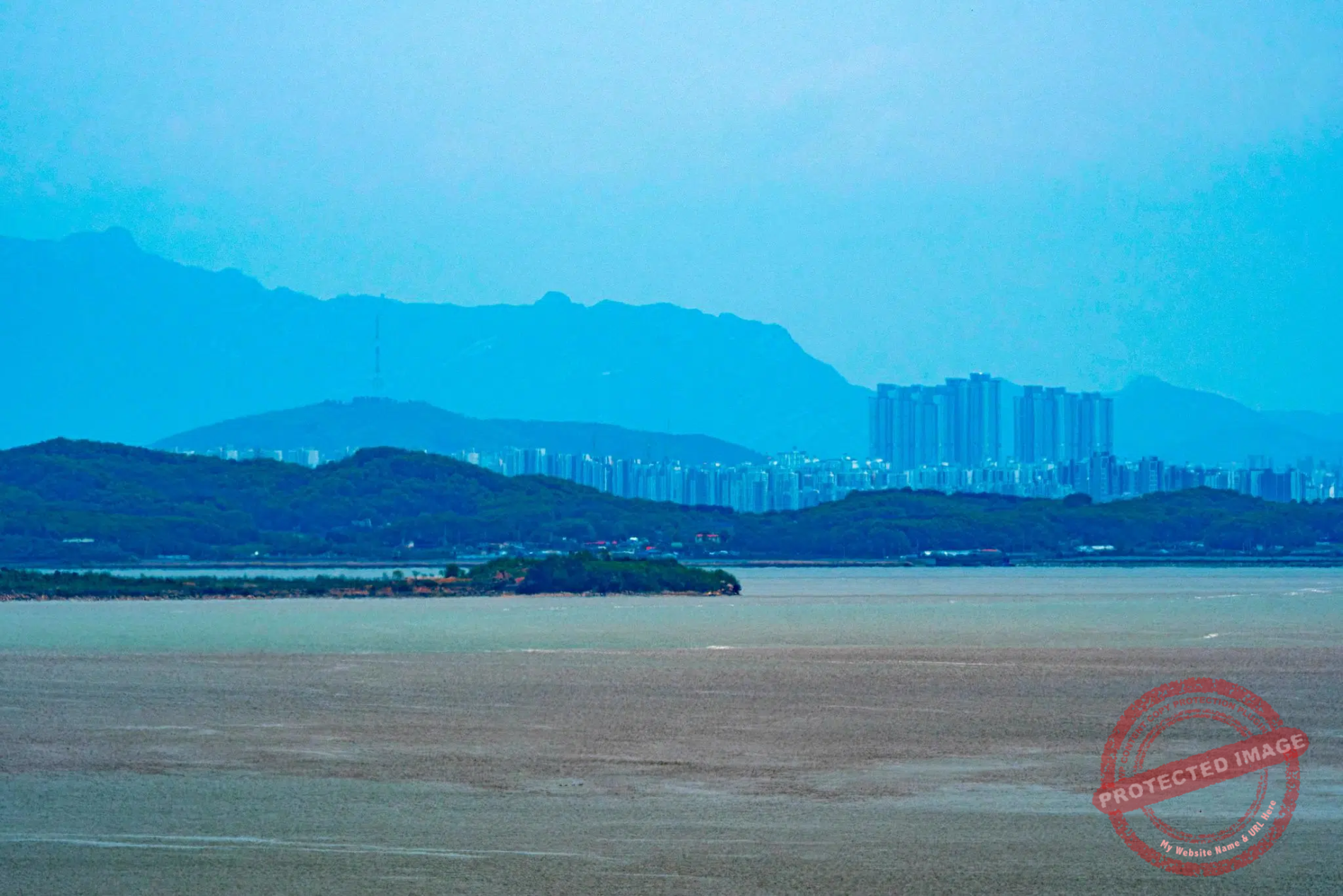
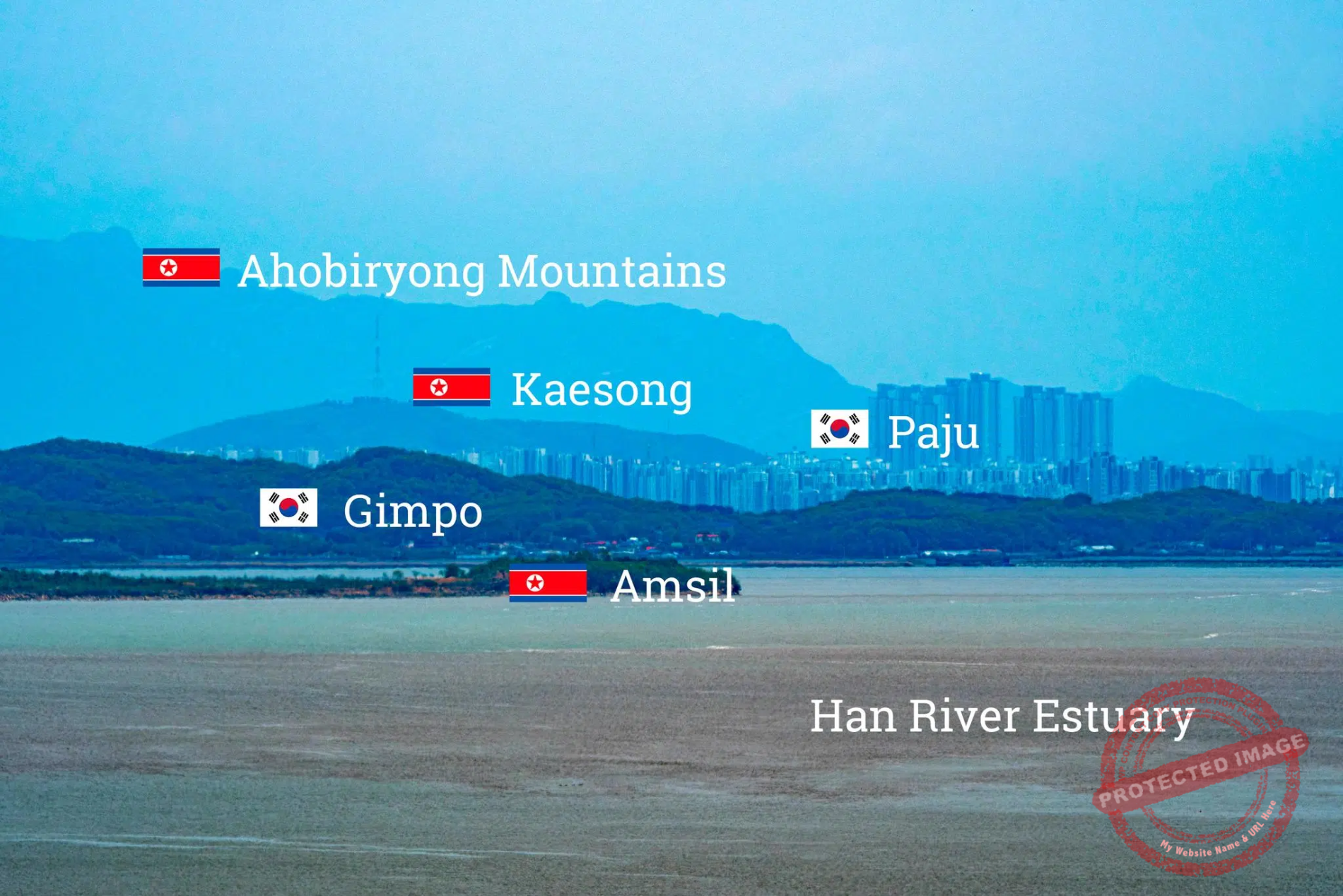
The perspective from the Ganghwa observatory on a clear day. The city of Gimpo and the high-rise buildings of Paju, on the outskirts of Seoul, wedged between two North Korean tongues of land as the Han River Estuary meanders between the two enemies (May 2025).
Although the 1953 armistice agreement stipulated that ‘The waters of the Han River Estuary shall be open to civil shipping of both sides’, and despite some negotiations in this regard during the rare periods of détente between the two Koreas, this never happened.
In a normal world, a place like this should be teeming with human activity, merchant ships passing through on their way to Seoul, families picnicking on the banks, fishing boats stalking eels or strollers collecting shellfish at low tide – when you could practically walk from one shore to the other.

The road running along the Han River Estuary in the northern part of Ganghwa Island (September 2025).
Instead, it’s eerily empty and quiet. At least when there are no ‘loudspeaker duels’ between the two Koreas across the border, or when groups of South Korean hardline rightists do not come to shout insults and anti-communist slogans at the North.
The contrast between the South Korean and North Korean mountains is also striking: the former are mostly covered in thick forests, the latter are brown and peeling – wood is still the most widely used fuel for heating in the North.
A buffer zone between two extremes, with a fascinating strangeness.

The Siam-ri Wetland in the northern tip of the Gimpo Peninsula, next to the border fence and with the North Korean mountains in the background (May 2025).
Right at the beginning of the estuary, opposite the Odusan Observatory, the north of Gimpo Peninsula is a bucolic area of rice paddies and canals, and a popular spot for weekend strollers in fine weather.
With the mountains of North Korea in the distance and the imposing South Korean fortifications and watchtowers as their neighbors, farmers cultivate their rice paddies, Sunday cyclists pedal peacefully, birdwatchers look out for whooping cranes and herons behind their binoculars, and anglers wait for their catch in their folding chairs under their parasols. At the northern tip of the peninsula, protected by the Civilian Control Line which restricts human access, the Siam-ri Wetland has become a stopover and habitat for many migratory birds like the Black-Faced Spoonbill, the Chinese Gray Shrike and the White-tailed Eagle.

A flooded rice paddy in the Siam-ri Wetland (May 2025).
The nearby Aegibong Peace Eco Park, also in Gimpo City, and the Ganghwa Peace Observatory are among the best places from which to observe rural life in North Korea.
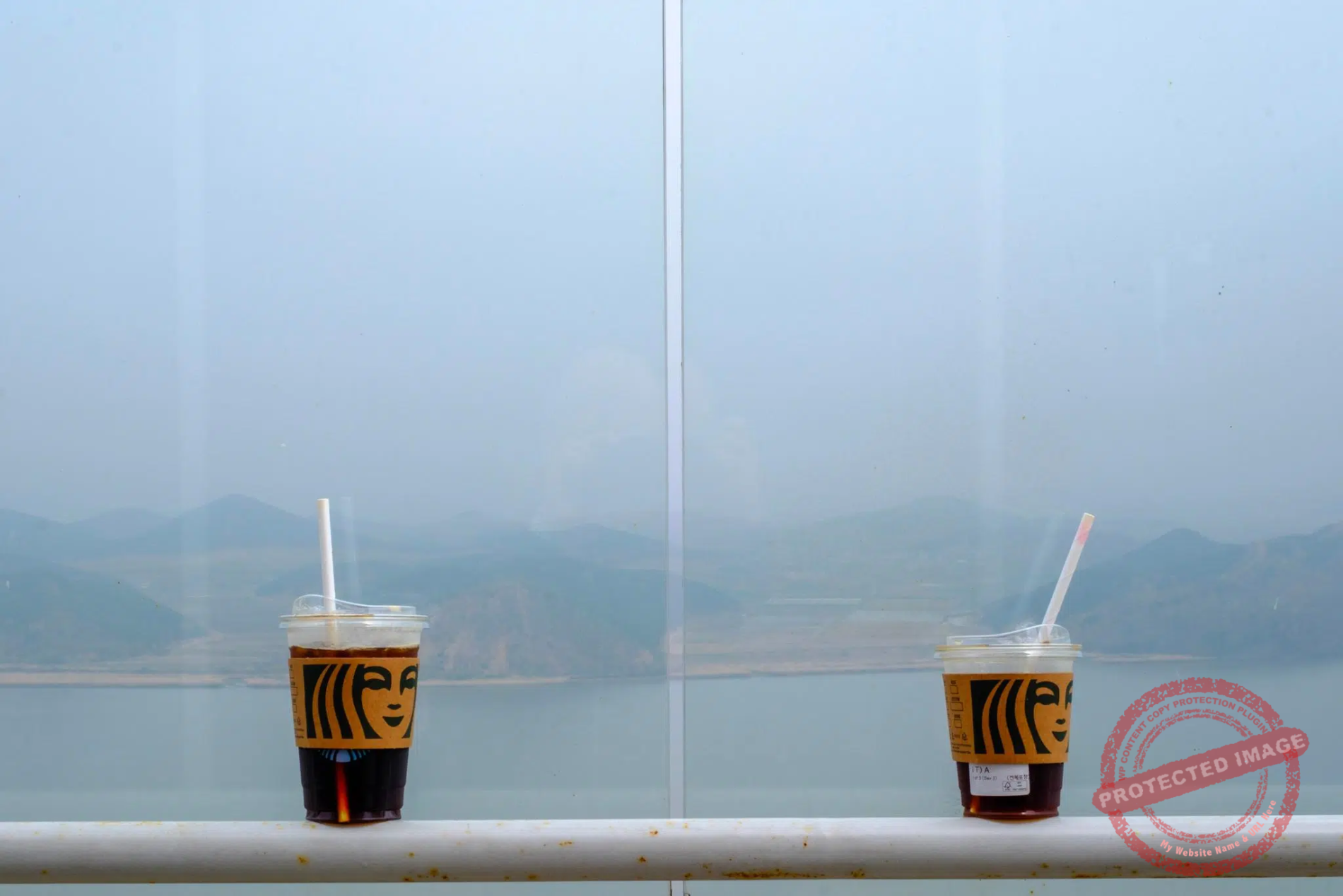
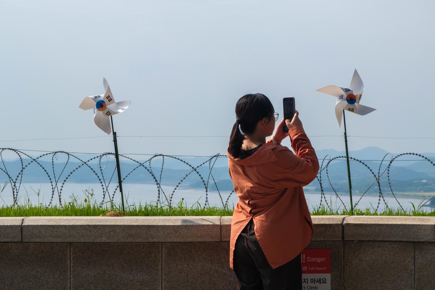
The Aegibong Jogang Observatory is built inside the Civilian Control Zone on Hill 154, a fierce battle site during the Korean War. The place was little-known and received few visitors until November 2024, when the municipality of Gimpo came up with the idea of inviting the American coffee shop brand Starbucks to open a franchise there. Since then, thanks to the buzz on social media, visits to the observatory have been booming: around 120,000 in the first seven months after the café opening, almost double the total number for the entire previous year.
A number of travel agencies have jumped at the chance to organize tours to the unusual “DMZ Starbucks”. Taking a photo of your caramello machiatto, vanilla latte or iced americano in front of a derelict North Korean village across the river, where ragged peasants do all the farm work by hand under slogans glorifying Kim Jong Un, has become the latest fashionable thing to do in South Korea. Crowds are particularly large on weekends, during which the military personnel manning the checkpoint at the entrance to this restricted area are somehow overwhelmed with work.
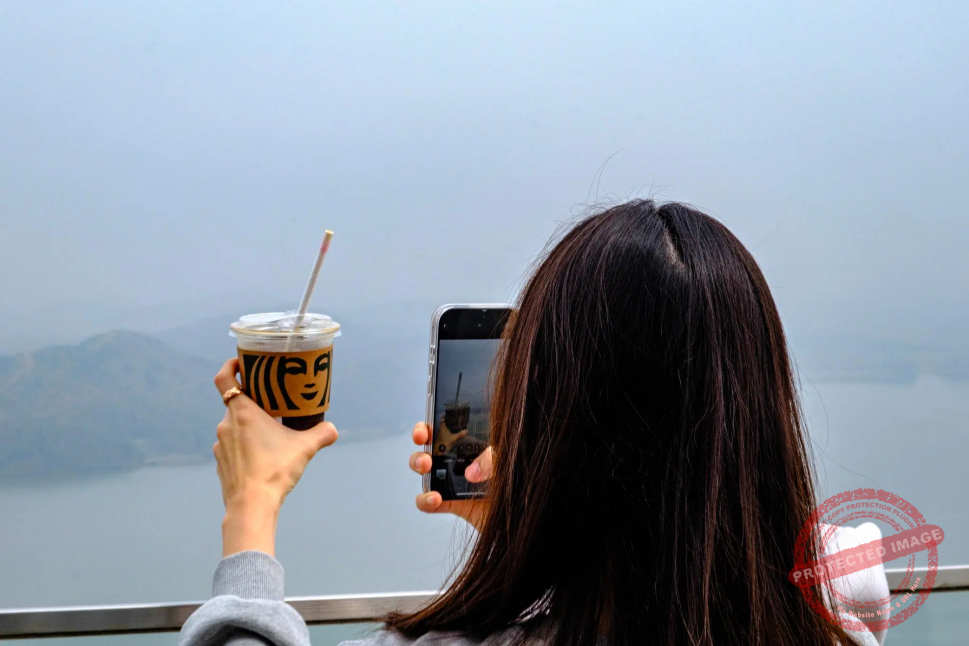

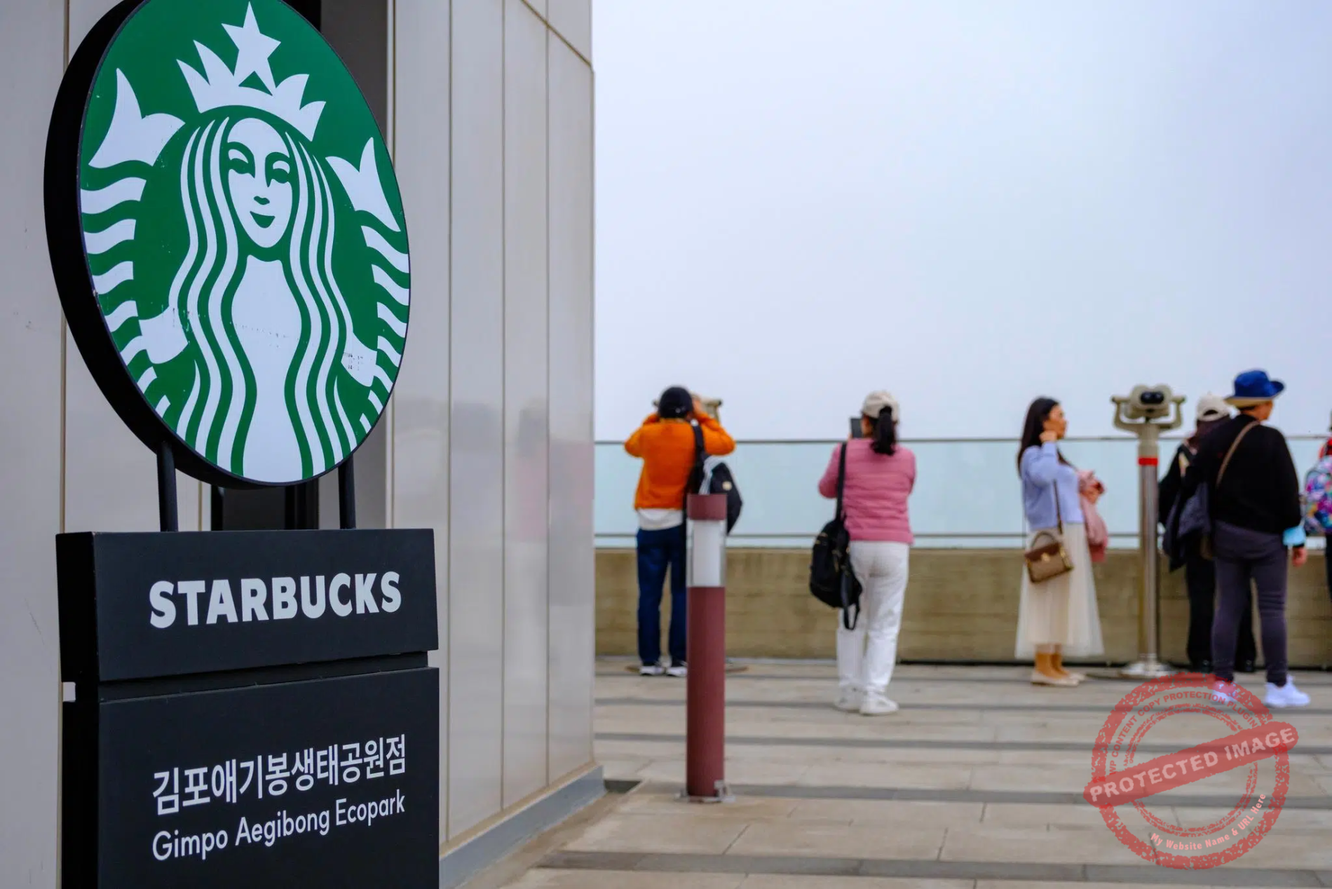
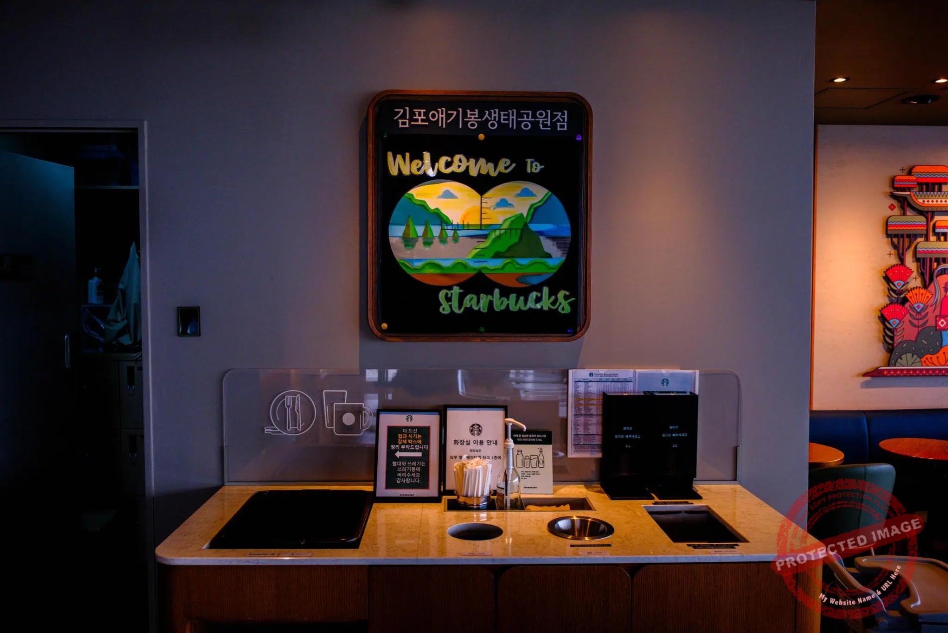
Opened in autumn 2024, the Starbucks Cafe overlooking North Korea has boosted tourist numbers at the Aegibong Observatory (April 2025).
From Aegibong, the North Korean bank is only 1.4 kilometer away. Like many observatories along the border, this one offers a fascinating, somehow voyeuristic peek into a forbidden world, just over an hour’s drive from sprawling, capitalist Seoul.
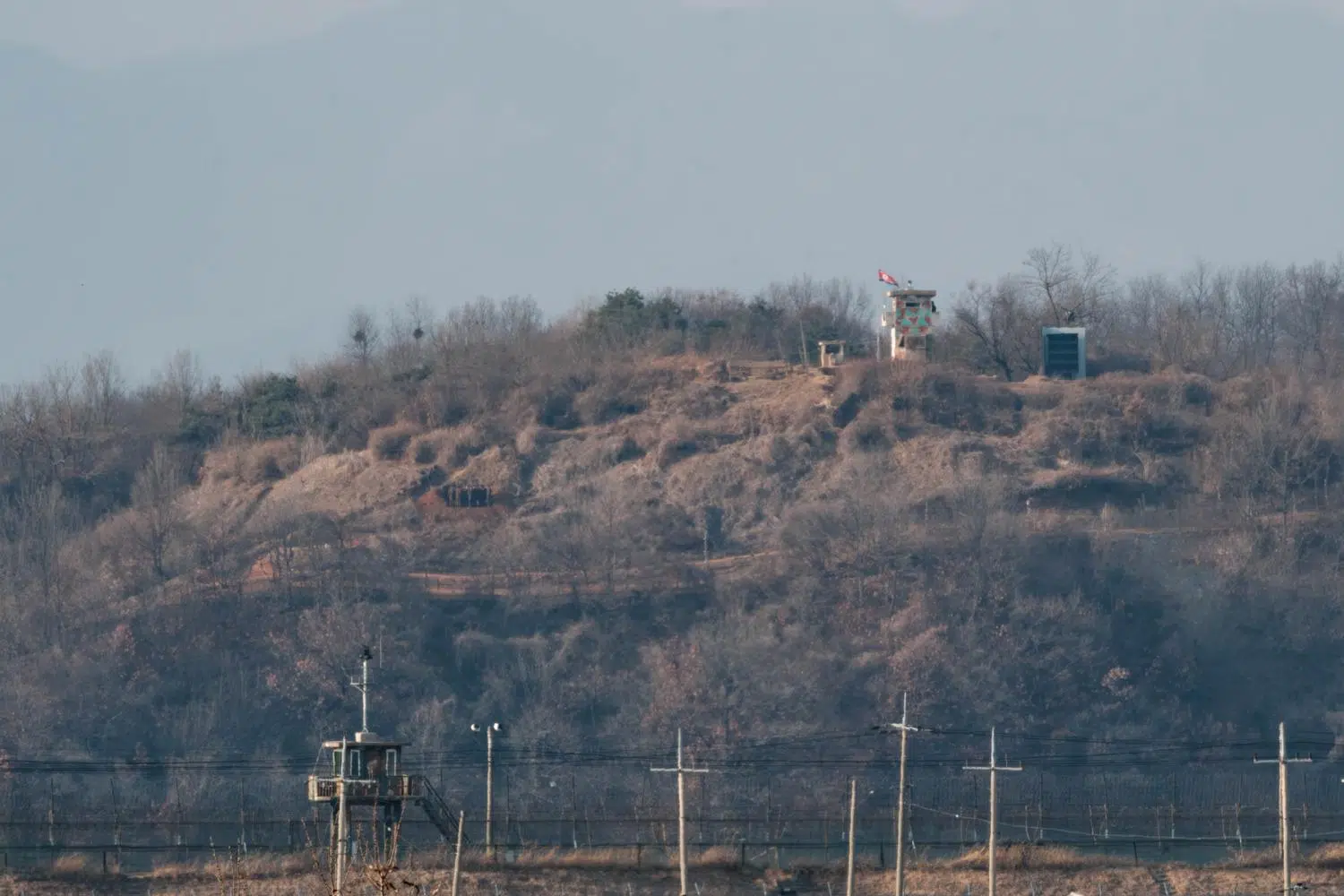
The picture below shows the village of Haemulseonjeon, with its “Immortality Tower” that commemorates the “eternal president” Kim Il Sung and the “eternal general” Kim Jong Il. Under North Korean law, every village must have one.

The North Korean village of Haemulseonjeon seen from the Aegibong Observatory (February 2024).
The large building in the center of the image is the “House of Culture”, a community center designed to promote socialist ideology, education, and arts. These facilities are integral to North Korea’s state-controlled cultural and educational system. They host collective activities and cultural events, as well as lectures and study sessions focused on Juche (the state ideology of self-reliance) and the teachings of the country’s leaders.
Houses of culture are part of a broader network of institutions aimed at shaping the cultural and ideological landscape of North Korea, ensuring that the state’s narrative and values are deeply ingrained in society.
The upper slogan, between the House of Culture and the Immortality Tower, says: “Long live the great Comrade Kim Jong-un’s revolutionary ideology!” (위대한김정은동지 혁명사상만세, “Wideahan Kim Jong Un—dongji hyeongmyeongsasang manse!”). The other one on the right says: “Let’s defend our revolution with rice!” (쌀로써 우리혁명을 보위하자, “Ssal rosseo uri hyeongmyeong eul bowihaja!”)

Aegibong Peak has been the scene of a particular form of psychological warfare between South and North Korea, centered on Christmas lights.
In the 1970s, under the presidency of fervent anti-communist Park Chung-hee, South Korea began installing giant Christmas trees and other religious-themed decorations facing North Korea -an officially atheist country that does not celebrate Christmas – so that people on the other side of the river could see multicoloured lights shining at night and experience a culture shock, as chronic electricity shortages kept them in the dark most of the time.
Over the years, the decision whether or not to install Christmas lights in Aegibong has followed periods of détente or renewed tension between North and South Korea. The North protested tirelessly when the lights were installed, even threatening to shell them. In 2014, it called them “an unbearable insult and mockery” to it’s front-line soldiers and a “direct declaration of a war”. After that, there were no Christmas trees in Aegibong until 2023, when the light ceremony was reinstated under the presidency of hardliner Yoon Suk-yeol, with a laser light show as a bonus. The following year, due to security concerns, the organizers simply installed Christmas lights along the path leading to the observatory.

A tour guide gives explanations in the amphitheatre of the Aegibong Observatory facing the North Korean bank of the Han River Estuary (April 2025).
It is also surprising to see that the defences on the north side of the border are, apparently, much less imposing than those on the south side.
On the north bank, you can generally see two simple barbed wire or electric fences separated by a sentry walk. While the fortifications on the south side are reminiscent of the Iron Curtain during the Cold War. In the north, you can see shepherds venturing out with their flocks very close to the river’s edge, something unthinkable in the south
This may give the impression that South Korea is protecting itself against both the threat from the North and the defection to the Socialist Paradise of its own citizens, while North Korea fears neither. Which is obviously done on purpose.
There are several reasons for this.

Samples of North Korean propaganda on display inside Ganghwa Observatory (April 2025).
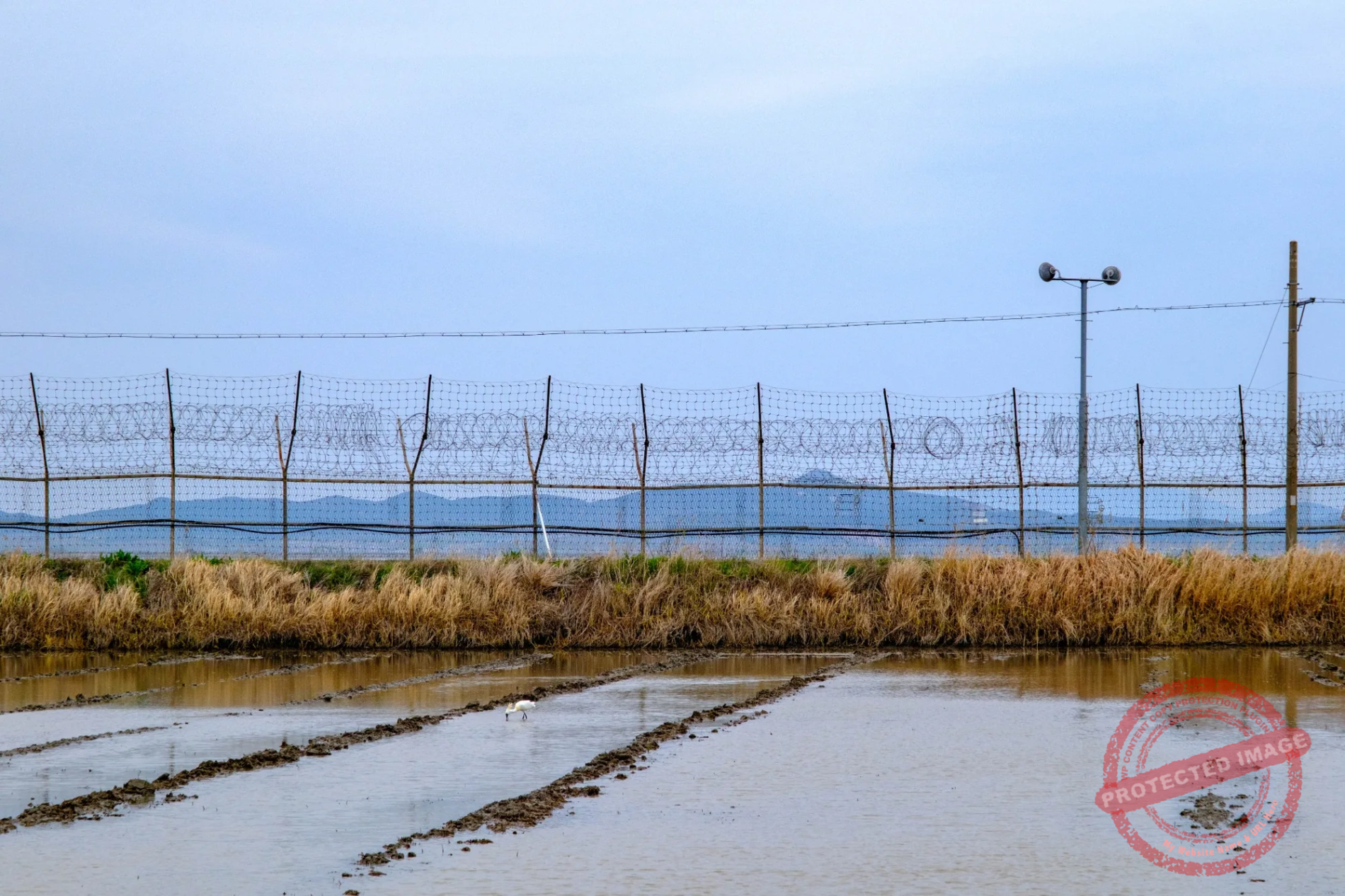
South Korea’s main concern is to prevent infiltration by North Korean commandos or spies, as has happened many times in history. Hence the double or triple barbed wire and electric fences, thermal surveillance cameras, night vision devices and massive fortifications lining the Han river from the Yellow Sea to the gates of Seoul.
North Korea’s main concern is not to deter infiltration by the South Korean and American armies (although this happens) but to prevent its inhabitants from defecting to the South. It doesn’t need a lot of barbed wire for that, as the authorities exercise such strict control over the entire population, all over the country.

Slogans, red flags and collective housing: a North Korean village seen from the Ganghwa Peace Observatory (May 2025).
The songbun, the socio-political caste system in force in the country since 1957, classifies all citizens into three categories: “core”, “wavering” and “hostile”, each of which contains a number of subcategories.
The songbun status is determined by the government, specifically through the Workers’ Party of Korea and the state security agencies. It is typically assigned at birth. It is influenced by the political background of one’s ancestors, particularly focusing on their actions and allegiances during the Japanese occupation, the Korean War and the early years of the North Korean state. Having family members living in South Korea has a negative impact one’s songbun, and while it is very difficult to move up to the next class, sudden falls are common for anyone who commits an act considered to be anti-revolutionary (and for the entire family of the culprit).
Almost every aspect of a citizen’s life is determined by their level of songbun: education, employment, housing, access to resources, right to travel around the country, etc. Only citizens with the highest songbun can live in the capital Pyongyang, become members of the Workers’ Party of Korea or hold positions of responsibility within the state. Individuals and families with low songbun are often relocated to rural or remote areas, where living conditions are harsher.

While there haven’t been widespread, forced displacements of the entire population in the regions near the South Korean border, specific groups or individuals with low songbun have been relocated to other parts of the country to minimize the risk of defections.
In addition, all travel within North Korea requires a permit, which is systematically checked at the exit of every major city and at the border of every province. Access to border provinces requires a special permit, which must be approved by the dreaded Bowibu, the Ministry of State Security.

Young men take pictures of themselves in front of North Korea at Yeonmijeong Pavilion, in Ganghwa Island (September 2025).
The high songbun population living along the banks of the Han River estuary is therefore considered to be generally safe, hence the lack of need to enclose them behind high fences.
However, in late 2024, North Korea has vowed to fortify its southern border with “strong defense structures” to cope with “confrontational hysteria” by South Korean and United States forces. South Korean officials believe that this increased border security is also intended to prevent soldiers from defecting.

The Ganghwa Peace Observatory (April 2025).
Although very rare, defections across the Han River estuary do occur.
In 2014, a father and son, who had used bribes to obtain the right to live near the border, took advantage of the ebb tide to let themselves be carried by night by the Ryesong River, which flows into the estuary opposite the South Korean island of Ganghwa, using makeshift buoys made from bicycle inner tubes. They had previously spent a year studying the tidal cycle. They were rescued by the South Korean army as they waded through the muddy estuary.
In July 2025, a North Korean defector was rescued by the South Korean military near Gyodong Island after swimming in the estuary for around 10 hours, clinging to makeshift polystyrene buoys.

A North Korean security dam on the Yeseong River, which flows into the Han River estuary opposite South Korea, designed to prevent infiltration and, above all, defections (May 2025).
Sometimes North Korean fishermen drift south unintentionally due to engine failure or other reasons. Those who express a desire to return home are repatriated via the Joint Security Area or put back on their boats and sent back to the North across the maritime border in the East Sea.
In 2020, a 24 year-old defector who had been living in South Korea for some time made his way back to the North, swimming across the estuary after passing through a drain under barbed wire fences in Ganghwa Island. In the process, he is believed to have introduced Covid-19 to North Korea, at a time when the country had completely cut itself off from the world to avoid being affected by the pandemic.
Sometimes North Korean defectors, unable to adapt to their new life in the capitalist, ultra-competitive South where social status is everything and where they are nothing, make desperate attempts to return to their former side of the border. Some of them succeed. We don’t know what happens to them, but the story is probably not a happy one.
Saving the Peace Cow

Yu Island seen from the Yeonmijeong Pavilion in Ganghwa Island (September 2025).
The uninhabited Yu-do (or Yu Island) was the scene of the famous “Peace Cow” incident in 1996.
In the summer of that year, torrential floods in North Korea swept a young bull downstream. It washed up on Yu-do, located in the middle of the “Neutral Zone” of the Han River Estuary and for months, neither side could simply go in and fetch it.
After lengthy negotiations through armistice channels, South Korea organized a rescue. On January 17, 1997, eight Marines and a military veterinarian pushed off in rubber boats, tranquilized the emaciated, badly injured bull and ferried it to shore.
Gimpo City took the animal in and christened it “Peace Cow.” It later received a mate ceremonially dubbed the “Unification-Wish Cow” from the subtropical Jeju Island, and sired calves, turning into a small, living symbol of détente along the Han River Estuary.
The bull died of natural causes in 2006, leaving behind numerous offspring. Its ashes are kept in an urn by a local culture center in Gimpo.
This page was last updated on : November 18, 2025
Previous : Gyodong Island
Next : Odusan
Understand
Themes