K-Scar: A Journey Along the Korean Division
K-Scar is an online documentary project by journalist Roland de Courson exploring the inter-Korean border, its history, landscapes, and the people living in its shadow.


Click on locations on the map or choose from the list below.
Baengnyeong
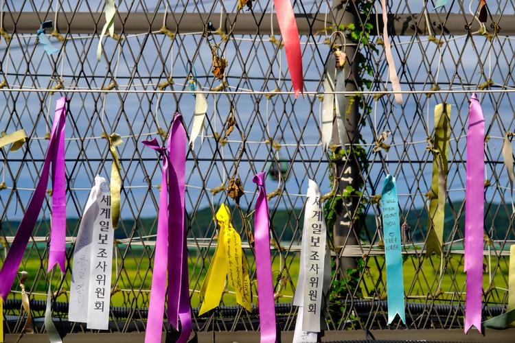
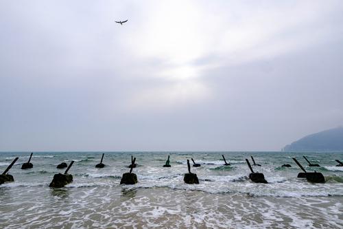
Baengnyeong-do’s beaches have signs reading “North Korean defectors, we welcome you — press the button.” Behind them: minefields, artillery caves, and 6,000 civilians, on South Korea’s most remote island just a stone’s throw from the enemy.
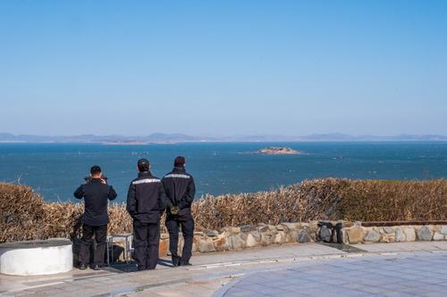
Yeonpyeong
Every road in Yeonpyeong-do leads to a Marine base. Air-raid shelters are always stocked. And in 2010, the island burned for hours after a North Korean artillery strike.
Gyodong
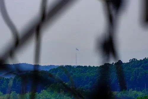
Through a telescope on Gyodong Island, you can read “Long Live Socialism” on a North Korean hillside. The other bank is 2.6 km away — and forever unreachable.
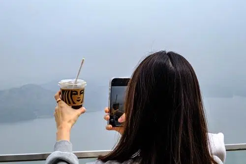
Han River Estuary
Where the Han River meets the Yellow Sea lies one of the strangest stretches of the inter-Korean border: a 67-kilometer “Maritime DMZ” that should be Seoul’s gateway to the sea but has been a silent no-man’s-river since 1953. Its eerily empty waters are lined with fences, watchtowers, and a Starbucks cafe where visitors now shoot selfies with lattes facing North Korean villages.
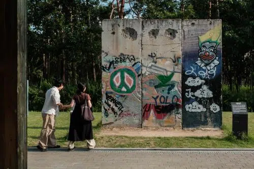
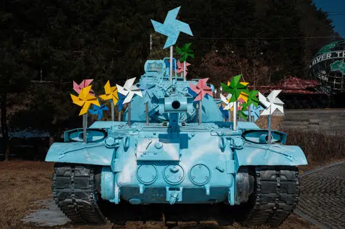
Peace Culture Bunker
A former anti-tank fortress strategically located along an invasion corridor at Seoul’s northern edge, converted into an art and culture venue.
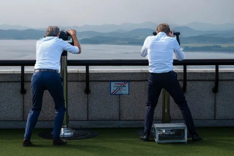
Odusan
On the left, farmers working in the fields beneath red flags and barren hills. On the right, forests of high-rise buildings in the suburbs of Seoul. Odusan is the North Korea observatory closest to the capital.
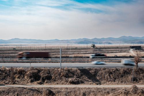
Jayu-ro
Every morning, commuters heading to Seoul scroll their phones as the North Korean landscape slides past the bus window. A drive along South Korea’s strangest motorway.
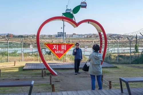
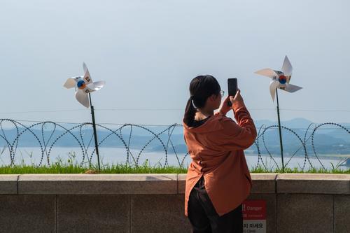
Imjingak
You cannot see North Korea from Imjingak. Yet more than a million people come every year for the thrill, the souvenir shops, and the selfie spots near real minefields.
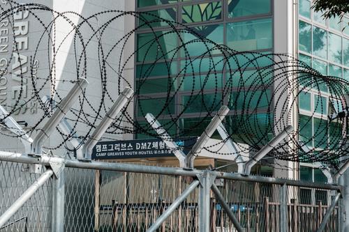
Camp Greaves
The powder magazines are now art galleries. The bowling alley is an exhibition hall. A Cold War combat base 2 km from the DMZ, reached by Peace Gondola.
Abductees Memorial
North Korea abducted a 13-year-old girl from a Japanese beach, a film director in Hong Kong, and 95,456 Korean civilians. A little-known memorial near the DMZ.

Dorasan Station
The last station before North Korea—as beautiful as it is useless— remains one of the most powerful symbols of hope for reunification.
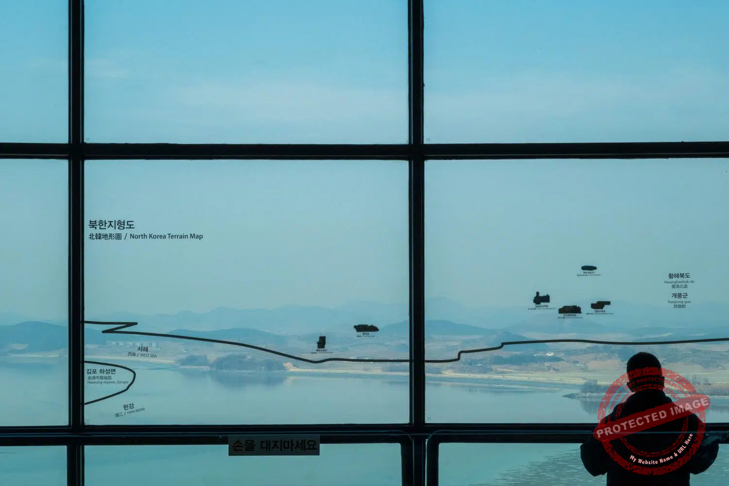
Dora Observatory & 3rd Tunnel
An observation deck offering spectacular views of the North Korean city of Kaesong, located next to one of the four tunnels dug by the North under the DMZ to invade the South (not for those with claustrophobia).
Unification Village
One of the few civilian villages inside the border buffer zone, where residents farm under military regulations, with a direct view of a giant flagpole flying North Korea’s colours.
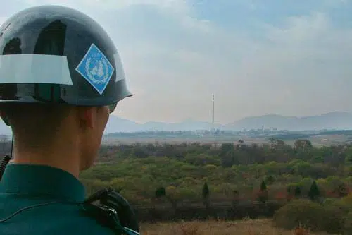
Joint Security Area
A death waiver to visit. A defection mid-tour. Donald Trump crossing to North Korea on foot. The JSA has always been stranger than fiction.
Swiss & Swedish Camp
Swiss and Swedish soldiers have been slipping reports into a letterbox in the DMZ since 1953. North Korea no longer picks up the mail. They keep writing anyway.
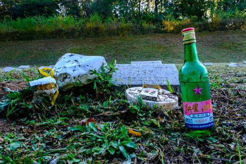
Enemy Cemetery
There are no signs to find it. Intelligence reportedly hid cameras there to spot communist sympathizers. Yet someone keeps leaving flowers, cigarettes and booze on the graves of the North Korean soldiers and spies.
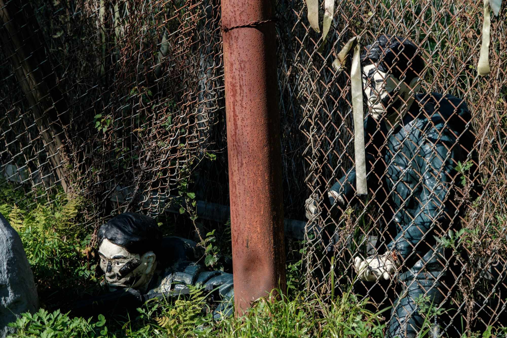
Blue House Raid Infiltration Place
In 1968, 31 North Korean commandos crossed the DMZ here with the aim of reaching Seoul to assassinate the president. No action movie comes close to matching the intensity of their bloody saga. A bizarre diorama is there to remind us of it.
Yeoncheon
Over 92 percent of Yeoncheon County lies under military restriction, and yet the last stop on Seoul Metro Line 1 drops you into a place where a flower park runs along the barbed wire, a 10-meter steel figure bows toward North Korea four kilometers away, and a United Nations crematorium built in 1952 has no record of how many bodies passed through it.
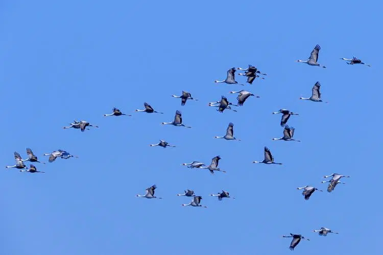
Cheorwon
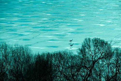
The same fields where 15,000 soldiers died in 9 days now shelter thousands of endangered cranes each winter, protected by the border.
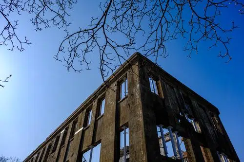
Workers' Party H.Q.
The very embodiment of evil in the eyes of some, the North Korean Workers’ Party headquarters in Cheorwon has been left exactly as the Korean War left it: bombed, roofless, and steeped in the tragic memory of those who were tortured to death there.

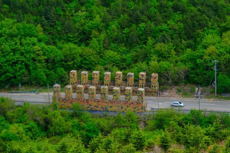
Central Front
The remote mountainous region where the heavily militarized border winds through ravines and ridges that have been seized by one side or the other at the cost of tens of thousands of lives.

Paroho
The scenic and tranquil reservoir where 30,000 Chinese soldiers drowned in one week.
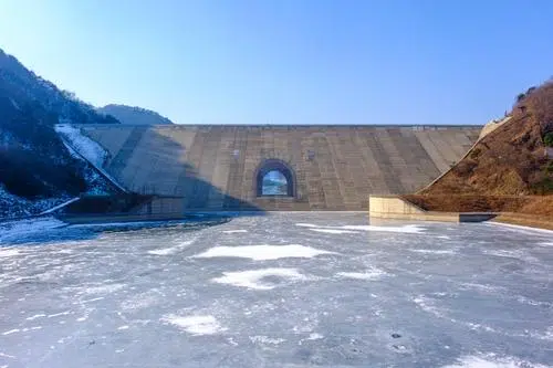
Peace Dam
Just as the Demilitarized Zone is actually the most militarized zone in the world, the history of the Peace Dam, built against a “water bomb” that never existed, is anything but peaceful.
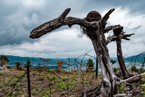
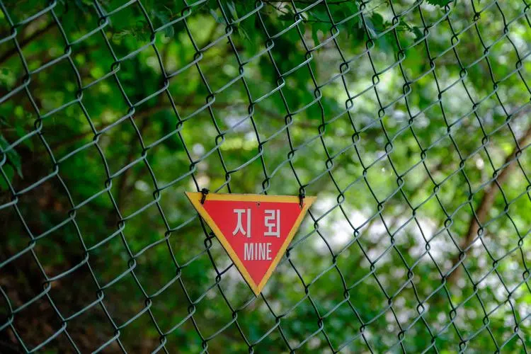
Punchbowl
After the armistice, veterans were given land in the Punchbowl to farm. Many were killed or maimed clearing it. The mines they missed are still there, marked on the hiking trail maps.
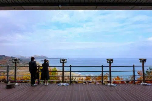
Eastern Front
The Korean DMZ ends where the mountains meet the sea. From Goseong Observatory, the barbed wire runs down a ridge, into the water, and stops. Beyond it, Mount Kumgang and North Korea.
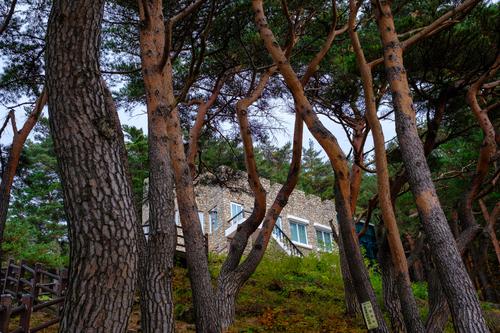
Kim Il Sung's Villa
The founder of the Kim dynasty in the North vacationed here with his family before the Korean War. Afterwards, his mortal South Korean enemy Syngman Rhee built his own summer cottage just down the road.
Abai Village
On Christmas Eve 1950, a cargo ship built for 60 passengers sailed from North Korea with 14,000 refugees aboard. A small handful of them, and their many descendants, still live in Abai Village, Sokcho.