Baengnyeong Island
백령도

Dragon’s teeth, designed to disembowel any enemy landing craft, protect the coast of Baengnyeong Island (March 2025).
Ever since I first spotted the South Korean Yellow Sea islands on a map, when I was a geography-geek teenager who had never reallly traveled, I’ve dreamed of going there.
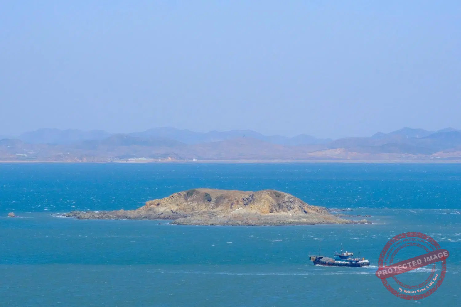
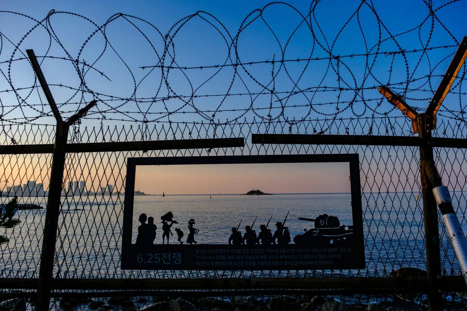
A cartographic strangeness. Islands on the edge of another world, hundreds of kilometers from mainland South Korea but a stone’s throw from enemy North Korea, whose dark, menacing cliffs sometimes emerge from the fog on the other side of the maritime frontline.
Heavily fortified exclaves where a deluge of fire from the North could strike at any moment, but where life goes on for its 6,000 or so permanent residents, many of whom are devote Christians – the island has a dozen churches of various denominations – and fierce anti-communists.
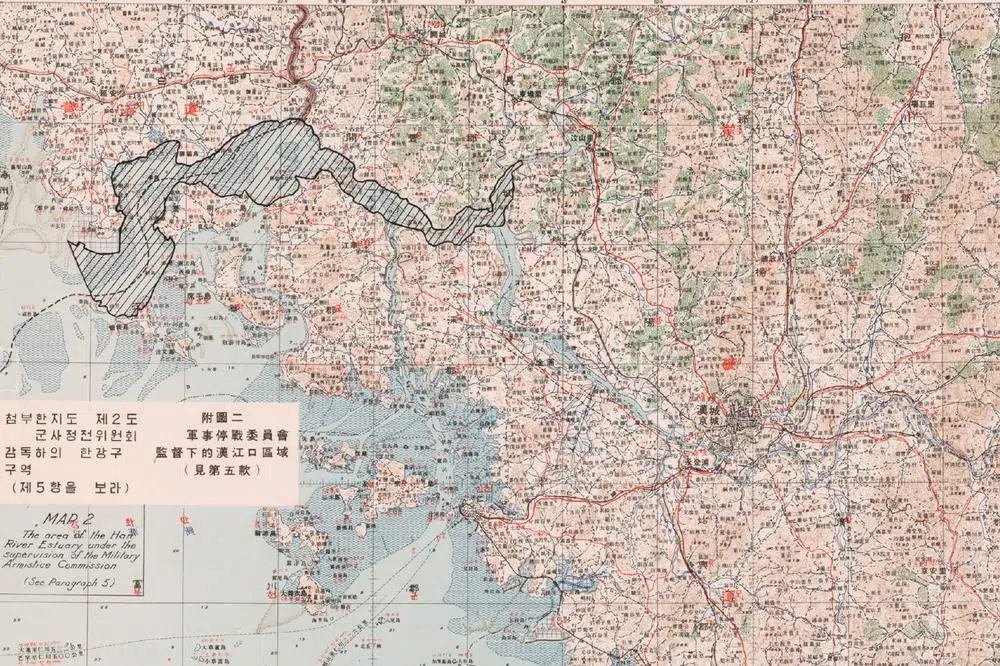
The 1953 armistice agreement stipulates that five island groups in the West Sea close to North Korea remain under the control of the United Nations Command: Baengnyeong-do, Daecheong-do, Socheong-do, Yeonpyeong-do and the tiny U-do.

On board the high-speed ferry between Incheon and Baengnyeong Island: a five-hour journey along a narrow shipping lane in the middle of disputed waters (March 2025).

Dumujin Coast in Baengnyeong Island, a rock formation carved by wind and pounding waves over millions of years (March 2025).
The reason is that these islands, located just below the 38th parallel, were allocated to the American occupation zone in 1945, and then to South Korea three years later. Baengnyeong and other islands were invaded by North Korea for a short period of time at the start of the Korean War, then recaptured by the United Nations forces during the counter-offensive launched with the Incheon landing in September 1950.
The five island groups are attached to the Metropolitan City of Incheon, west of Seoul, and are symbolically part of a South Korean-created “Ongjin County” (the city of Ongjin, which should be the capital of such county, is in North Korea).
Of the five West Sea Islands, Baengnyeong-do is the most extreme: the largest in surface and population, the most northerly and the most remote: 190 kilometers from the South Korean mainland – China is closer -, and four hours from Incheon on a high-speed ferry notorious for cancellations due to thick fog, rough seas or military activity, and that sails in a broad curve to avoid entering the North Korean claimed waters.

If it weren’t for the heavy military presence, Baengnyeong-do would look like any other South Korean quiet provincial town, with its CU convenience stores, Mom’s Touch fried chicken fast-food joint, Paris Baguette bakery and plenty of Korean seafood and barbecue restaurants run by exuberant, warm-hearted aunties. It is also a splendid island with dramatic cliffs and rock formations, huge wild beaches (most of them are surrounded by razor-wired fences and closed at night) and home to a colony of endangered spotted seals.
Baengnyeong-do – sometimes also called Baekryeong or Paengnyong – was off-limits to civilians until 1989. Since then, it attracts many Korean tourists from early spring to mid-autumn, despite the unstability of ferry connections that sometimes strand everyone on the island for weeks, with supplies from the mainland running short.
Some of the visitors have roots in the North Korean Ongjin County, just across the strait, and come here to try and glean a glimpse of the land of their parents or grandparents, fog conditions permitting, before ending the day drinking soju and singing nostalgic Korean balads at the top of their lungs along with conscripts at one of the many karaoke joints.

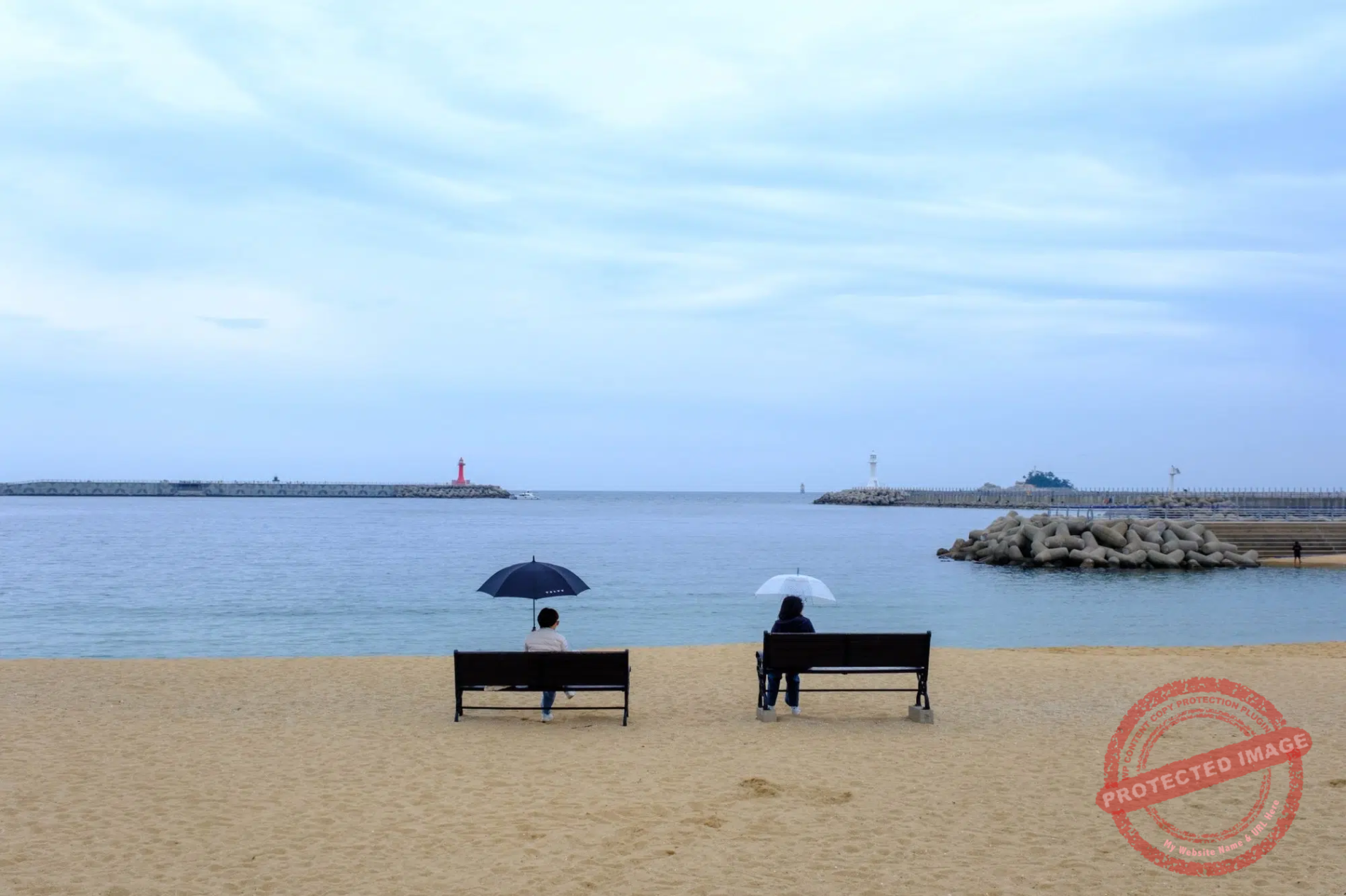
Welcome to the beach !
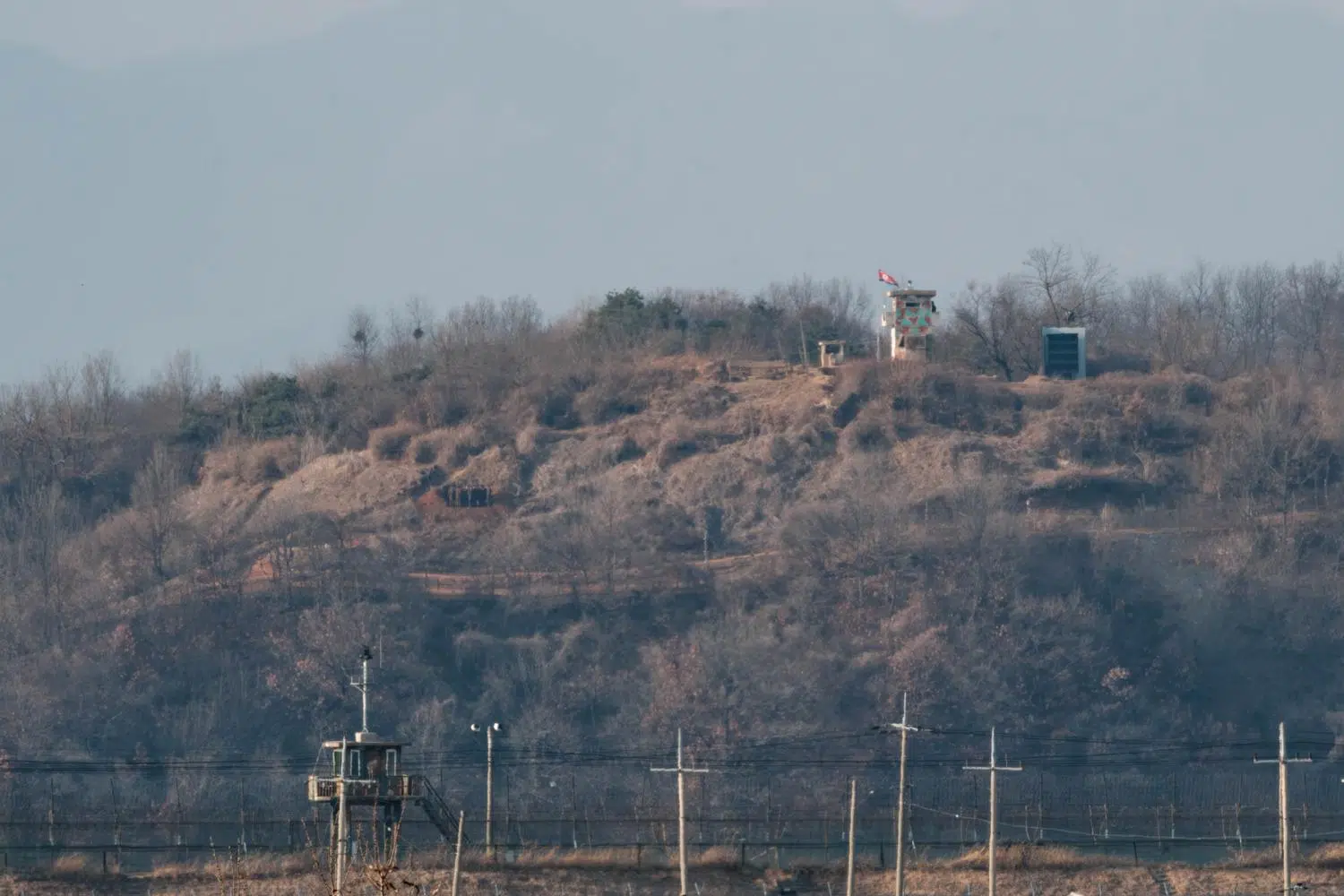
Tensions are very much palpable on this island fortress riddled with minefields and artillery caves, criss-crossed by tunnels and whose mountains are topped with radar and other mysterious antennas – Baengnyeong is crucial for early warning of North Korean air and missile attacks on the South.
The population is mostly made up of soldiers from the Republic of Korea Marines Corps and their families – the exact number of military personnel here is classified. Several times a day, pairs of Marines in full combat gear patrol the whole coast on the run and thoroughly check for signs of infiltration at key points such as gates and drains.
In October 2024, North Korea accused Seoul of repeatedly launching drones from Baengnyeong-do to spread “political motivational rubbish” leaflets at night over Pyongyang, only 143 kilometers away. The Kim Jong Un regime warned that “the source of all misfortunes and provocations will disappear forever by the merciless offensive” by the North should this provocation happen again.
South Korea never confirmed or denied having committed it. But it does not seem implausible in the political context in Seoul at the time, when right-wing president Yoon Suk Yeol was desperately seeking a pretext to impose martial law on his country. According to South Korean news reports, handwritten notes about a plan to induce North Korean attacks to justify the seize of civilian power were discovered during the investigation of Yoon’s failed autocoup in December 2024. As of July 2025, the investigation is still ongoing.

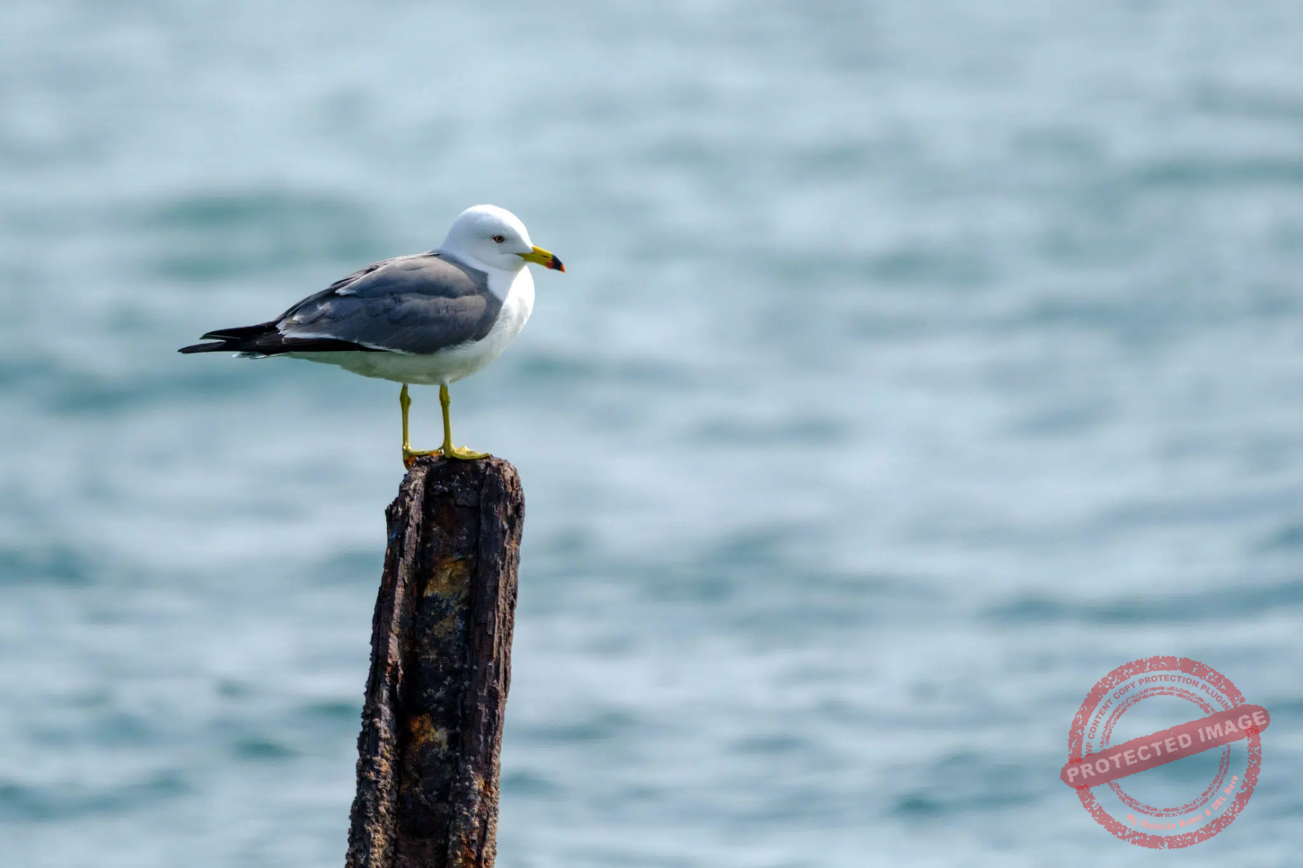
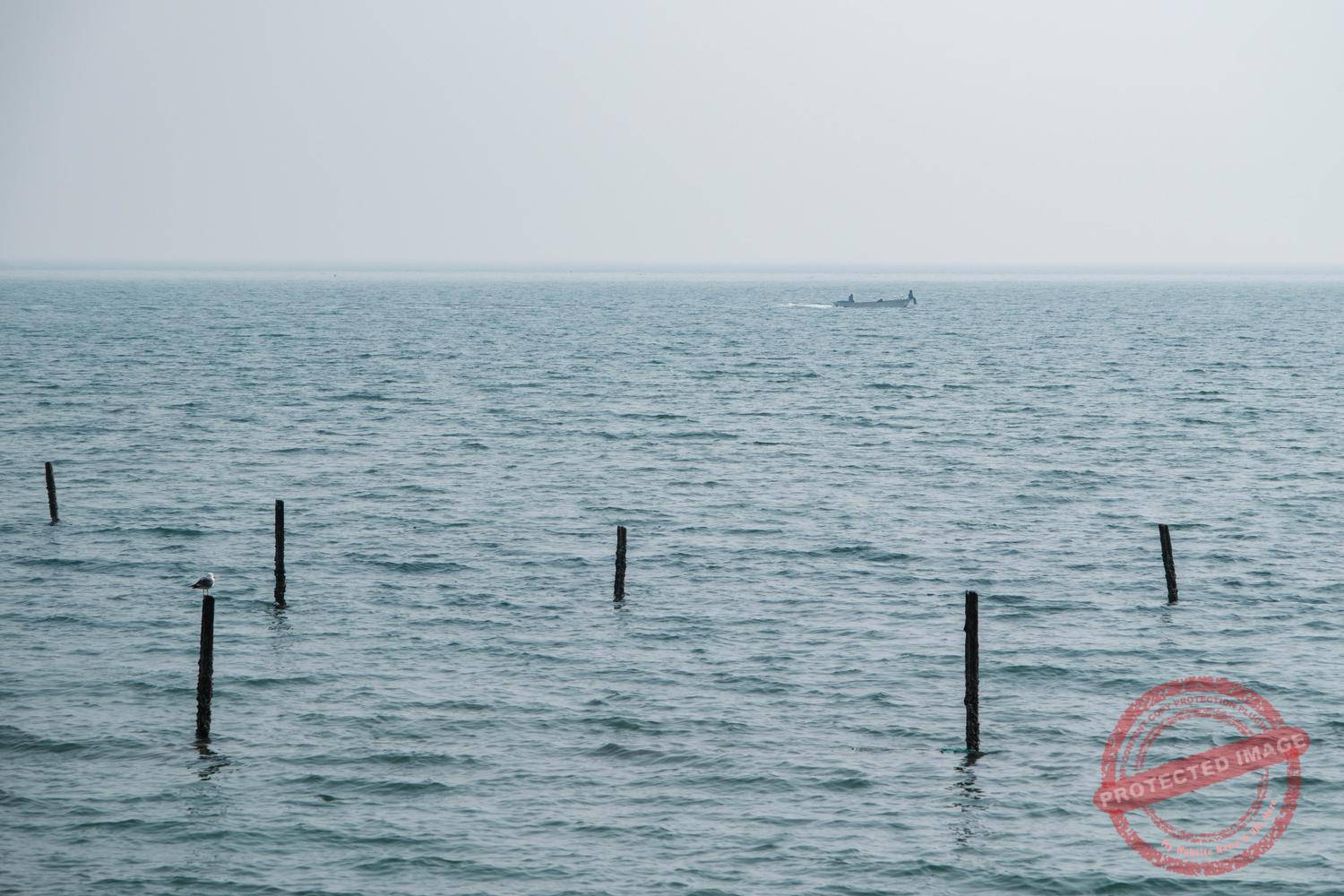
In Baengnyeong, anyone can go to the beach during the day, watch the local oyster-pickers at work and perhaps catch a glimpse of a few seals, while taking care to avoid any lost mines that may wash up on the shore (signs show how to recognize them).
The gates to the beaches are double-locked at sunset. But an emergency call button is available should any North Korean defector land here at night. “The Republic of Korea welcomes you”, says the sign. “This is Baengnyeong Island, South Korea. Press the signal button below and we will guide you to a safe area”. This type of installation is widespread on all the islands of the Yellow Sea and along the Han River estuary.

Welcome sign and emergency button for North Korean defectors landing on a Baengnyeong-do beach. The red sign says: “The Republic of Korea welcomes you. This is Baengnyeong Island, South Korea. Press the signal button below and we will guide you to a safe area”.
One of the favorite activities of some border-geek visitors is to rummage through the garbage that washes up on the island’s beaches in the hope of discovering North Korean plastic bottles, packaging, clothing and other stuff. A university professor, Kang Dong-wan, has even written a book on the subject after spending years collecting North Korean trash on South Korean beaches. In it, he explains how North Korean economic and social developments can be read in the garbage.
The exercise is not recommended for non-experts, however, because of the lost mines and other North Korean explosive devices that can get mixed in with the trash. The chances of coming across detritus from the North also vary according to the season and prevailing winds. For my part, almost all the garbage I saw on the beaches of Baengnyeong-do was from China, brought there by the currents or thrown overboard by the Chinese fishing vessels that swarm in the North Korean waters around the island.

Garbage washed up on a beach next to a coastal battery. Some people rummage through this rubbish in the hope of discovering North Korean artifacts.


A sign at the entrance to a beach warns of the risk of coming across North Korean mines washed ashore (March 2025).
After its recapture by the South in October 1950, Baengnyeongdo, under the code name of “Leopard Base”, became the secret rear base for betwen 8,000 and 12,000 North Korean anti-communist partisans, organized into the so-called “Donkey Units” (the origin of the name is uncertain).
Trained by the CIA and under the unofficial control of the U.S. Army, they were tasked with conducting sabotage, intelligence gathering and other special operations behind enemy lines along North Korea’s west coast.
One of their commanders, American artillery colonel Jay Vanderpool, came up with the idea of bringing sewing machines to the island, so that the partisans’ wives could make enemy uniforms, enabling their husbands to carry out secret operations disguised as North Korean soldiers or policemen.
Vanderpool also equipped the fishing junks aboard which the partisans infiltrated behind enemy lines with powerful diesel engines and hidden 75 mm recoilless cannons to prevent any attempt at interception by the North’s coastal surveillance. It is estimated that the guerrilla actions forced the Communist forces to keep some 50,000 men behind the front line to hunt them down.
A colorful character, Vanderpool pushed things a little too far when he sent an entire company to attack a North Korean radar station near the Chinese border disguised as World War II German paratroopers in order to stun the enemy. The radar was destroyed, but the partisans were decimated.

When the United Nations forces retreated from North Korea under pressure from the Chinese army, which entered the war at the end of 1950, tens of thousands of refugees flocked to the islands. Baengnyeong-do became home to over 62,000 of them, for a local population of less than 18,000 at the time.
The island was defended by Korean and United States Marines, and by the US Air Force who established a temporary airfield, named K-53, on Sagot Cape Beach.This immense, perfectly flat beach is made of fine grains of quartz bound together by the salt water, making the ground as hard as asphalt. At low tide, it could be used as a runway by medium-sized cargo planes.

The huge Sagot Cape Beach, used as a military airfield during the Korean War.

Bunker and murals at Sagot Cape Beach (March 2025).
In addition to the ones carried out by the “Donkey Units”, numerous missions, particularly search and rescue ones, were carried out from Baengnyeong-do using Sikorsky helicopters. After the war, the beach continued to be used by transport aircraft until the 1970s. Even nowadays, it is registered and has been given an airport code (RKSE) by the International Civil Aviation Organization (ICAO).
There is a plan to build a full-fledged civilian and military airport at Baengnyeong by 2030 to further open up the island and improve its defense, but it should be located elsewhere than on the beach, which is designated and protected as a Natural Monument by South Korea’s government. The airport project is decried by environmentalists, who point to the negative impact on the island’s ecosystems and the large number of birds in the area, which would not only be disturbed but would pose a serious risk to air safety.


The cenotaph in honor of the victims of the ROKS Cheonan sinking (March 2025).
North Korea has never disputed that Baengnyeong-do and the four other islands belong to South Korea, as stipulated in the armistice agreement.
But on the other hand, there has never been any agreement on the delineation of the maritime border, which more than 70 years later continues to be the subject of intractable disputes and deadly incidents.
In the southwest of Baengnyeong Island, a cenotaph commemorates the torpedoing on March 26, 2010 by a North Korean submarine of the South Korean corvette ROKS Cheonan, which was conducting routine patrol operations about one nautical mile (1.9 km) off the coast of the island. Of the 104 sailors on board, 46 perished. A South Korean diver also died during rescue operations.

Fishermen off the northern coast of Baengnyeong Island (March 2025).
Four months before the attack, North Korean patrol boats had engaged with the South Korean navy near the neighbouring island of Daecheong before pushing back, and Pyongyang had openly declared its intention to retaliate. However, it has always denied any responsibility for the sinking. The official Korean Central News Agency (KCNA) called it a “regretful accident that should not happen in the light of the fact that many missing persons and most of rescued members of the crew are fellow countrymen forced to live a tiresome life in the puppet army”. South Korean investigators later recovered the remains of a North Korean CHT-02D torpedo at the site.
In 2023, a newly commissioned ROKS Cheonan frigate set sail, with Captain Park Yeon-su, a survivor of the 2010 attack, assuming command.
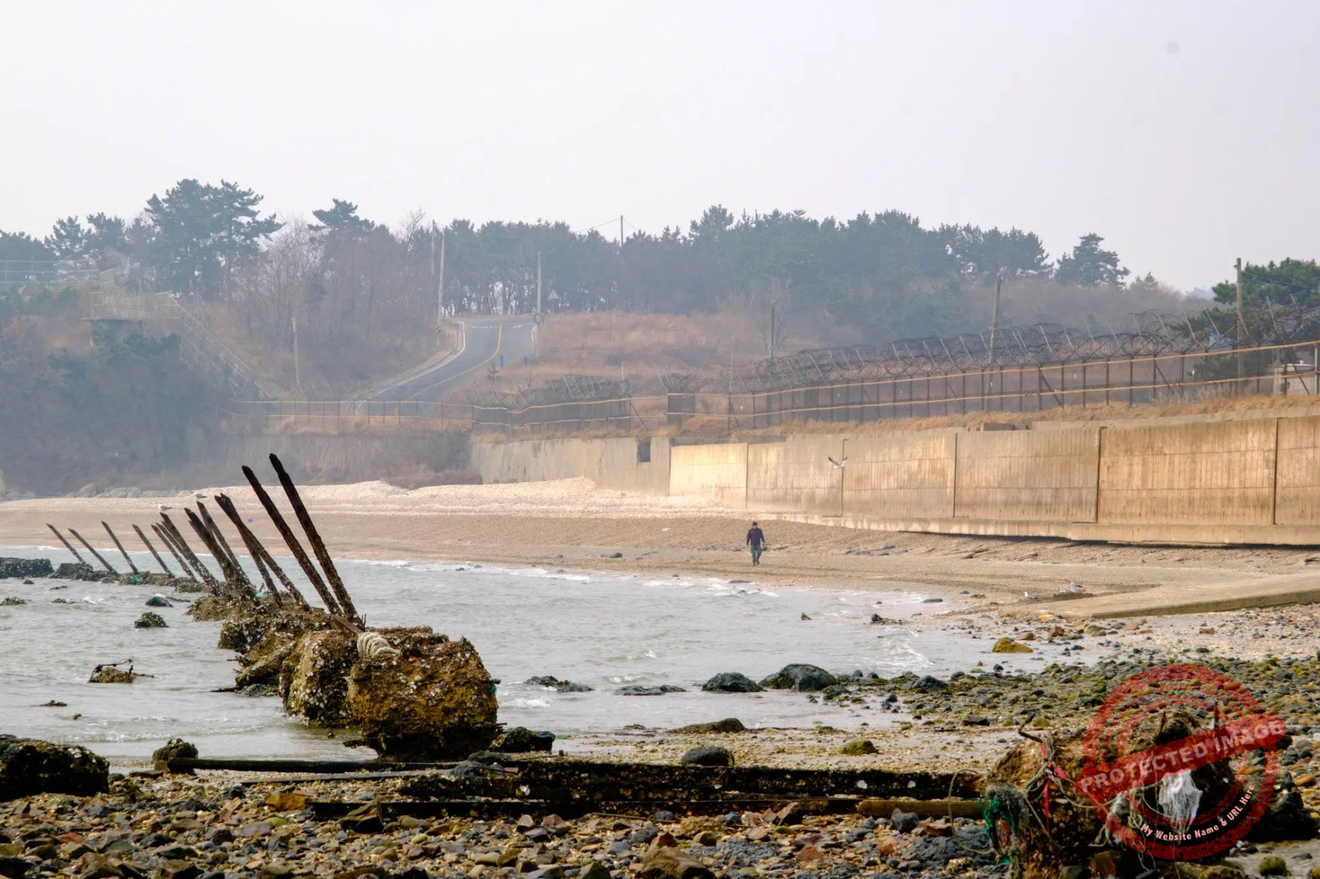
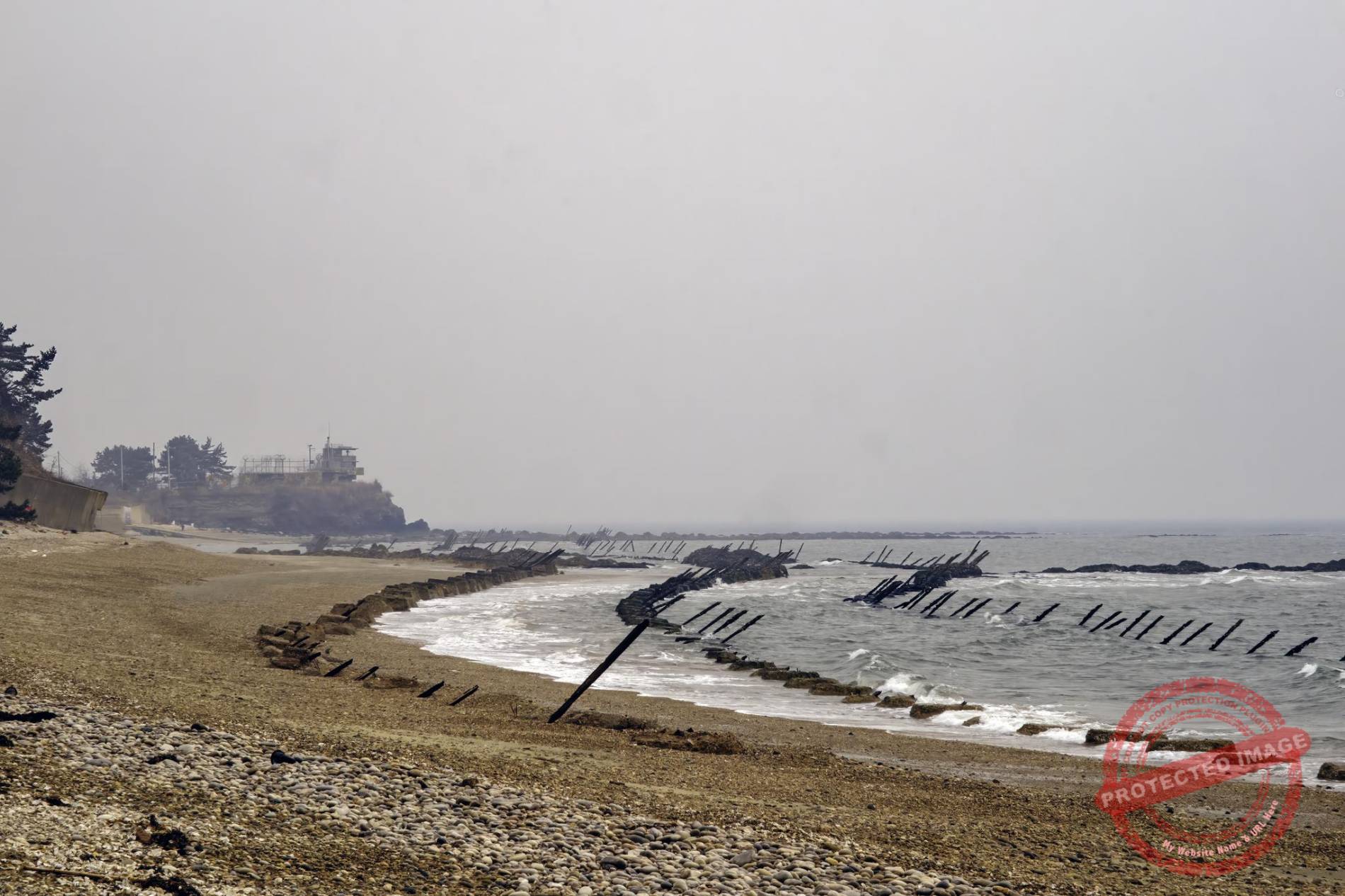
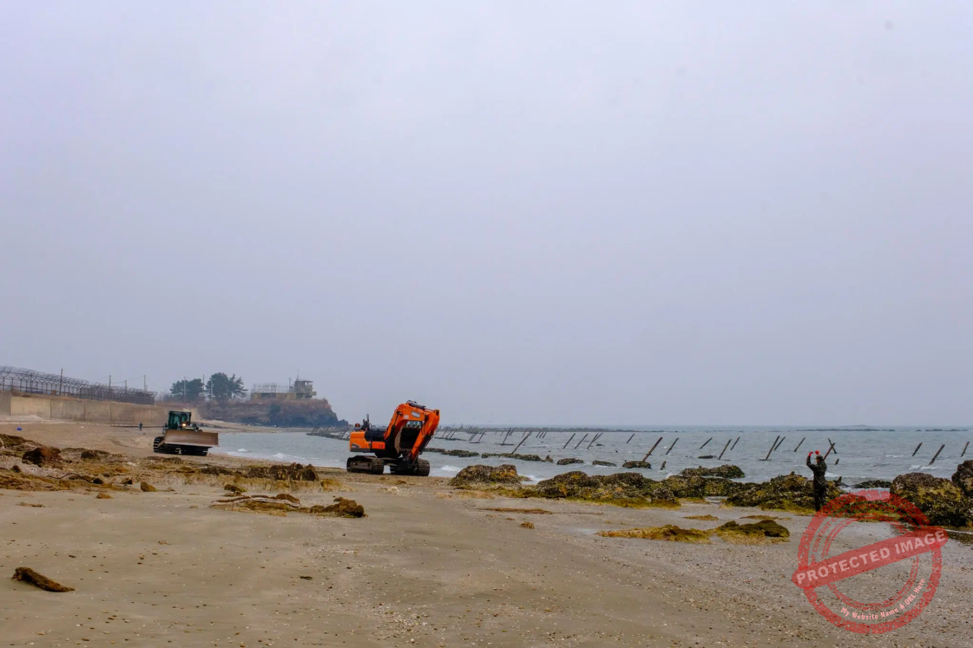
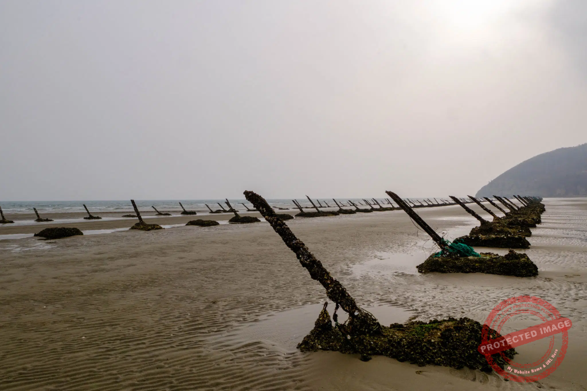
“Dragon’s teeth” on Hani Beach on the northern coast of Baengyeong Island.
Most of Baengnyeong’s beaches are dotted with “dragon’s teeth”, apparently dating from the 1960’s or 1970’s.
These huge steel spikes, planted at a 45° angle in a reinforced concrete base, were designed to disembowel any enemy landing craft attempting an invasion of the island. In peacetime, local oyster pickers and seabirds are the main users.
Prevention of invasion and infiltration now relies heavily on sophisticated technologies, such as military-grade, high-security coastal surveillance systems equipped with night vision capabilities. At first glance, “dragon’s teeth” appear to be fortifications from another age. But although they have lost some of their effectiveness in the face of modern amphibious and airborne forces, they remain useful in the event of a surprise attack or technological failure. Last but not least, their rusty, shell-encrusted silhouettes are ominous and threatening, and serve to remind everyone that the enemy is close at hand.


The west coast of Baengnyeong Island (March 2025).
In ancient times, Baengnyeong-do was on the sea route from the Shandong peninsula in China to Kaesong, the capital of the early Joseon Dinasty. So the island was well connected to the rest of the world and there are claims that Christianity was introduced to Korea through it.
Protestant missionaries first visited Baengnyeong-do it in the early 1800s. Kim Taegon, the first Korean Catholic priest, travelled to the island in 1846 where he enlisted Chinese fishermen to help him bring French missionaries to Korea (he was executed shortly after that, and canonized in 1984).
There are more than a dozen churches on Baengnyeong-do, which is a lot for such a small population. Around 75% of the islanders are Christian. At night, the luminous crosses atop the steeples of all Christian denominations glow in the dark.
In 2020, there was even a bizarre plan to build a “Bible Land” on Baengnyeong-do, a huge and concrete-heavy theme park with giant statues of Jesus, saints, replicas of ancient ships, “immersive biblical attractions”, and potentially a large shopping mall.
The project faced opposition from many islanders and from environmental groups due to its potential impact on the nature and its lack of consideration for local interests. It was eventually cancelled.

An artillery piece in a bunker dug into a cliff on the north coast of Baengnyeong Island (March 2025).

A church’s luminous red cross shines in the night in Baengnyeong Island’s main town (March 2025).
This post was last updated on : April 25, 2026.