Yeonpyeong Island
연평도

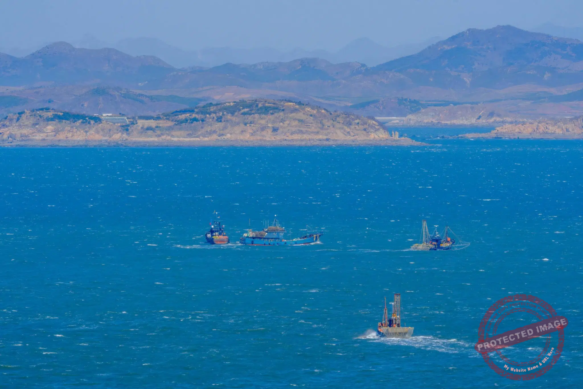
South Korean coast guards monitor the activity of Chinese and unflagged fishing vessels in North Korean waters off Yeonpyeong (March 2025).
Another island on the edge of the world.
Smaller, less populated, less religious and closer to the South Korean mainland than its sister Baengnyeong-do. But also a very short stone’s throw from threatening North Korea, whose first islets seem a stone’s throw away.
The disputed sea around Yeonpyeong was the scene of two fierce naval battles in 1999 and 2002, and the island was heavily shelled by the North in 2010. Several memorials across the island recall these bloody episodes.
Yeonpyeong is actually a cluster of islands, with Dae-yeonpyeong-do (Great Yeonpyeong Island) being the main one. Around 2,000 people live here permanently, a third of whom are displaced persons from North Korea’s Hwanghae province or their descendants.
It is one of five group of windswept islands in the East Sea close to the North Korean coast that are part of South Korean territory under the 1953 armistice agreement. The others are Baengnyeong-do and its neighbors Daecheong-do and Socheong-do, as well as the tiny U-do, whose only inhabitants are South Korean Marines and Navy personnel.
As in the other West Sea Islands, most of Yeonpyeong’s beaches are fenced and closed at night, but are always equiped with an emergency button for North Korean defectors to call for help upon arrival.

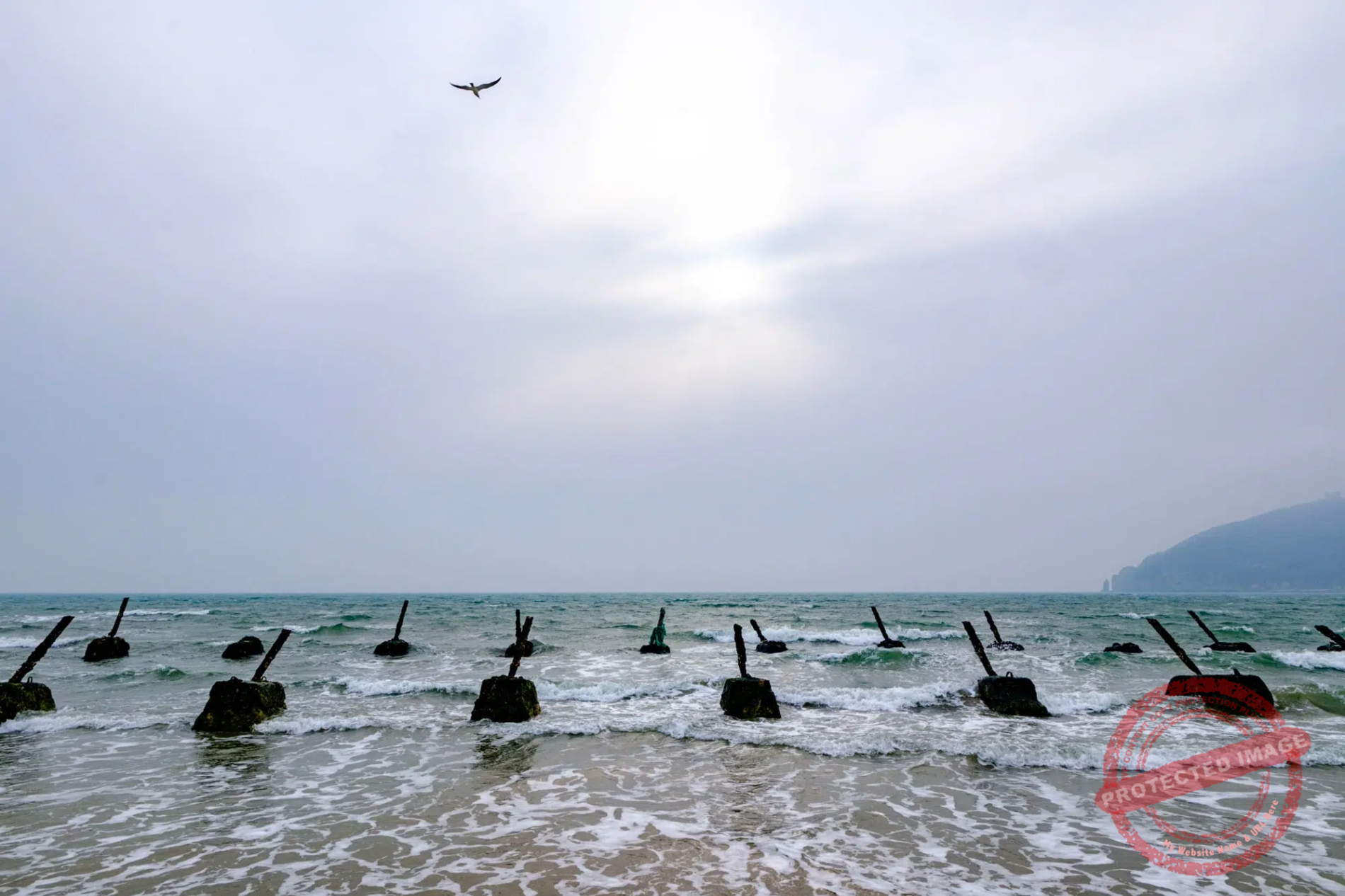
A South Korean warship patrols near Yeonpyeong Island, where the beaches are still dotted with the remains of the “dragon’s teeth” designed to prevent enemy landings (March 2025).
Of the five West Sea Islands, Yeonpyeong has the most turbulent history and is also the most directly threatened.
Unlike its big sister Baengnyeong-do, located at a relatively respectable distance from North Korean waters, Yeonpyeong-do is literally glued to the disputed maritime border, only 1,500 meters off its northern coast.
The nearest uninhabited North Korean islet, Baek-do, is only 3 kilometers away. The second closest island, Gal-do, is 4.5 kilometers away and has been transformed into a fortress by North Korea, with bunkerized batteries, rocket launching points, an observation post used to improve the accuracy of fire against the South, and around a hundred military personnel believed to be stationed there.
Hence the massive military presence in Yeongpyeong. Here, every road leads to a Marine Corps base. There are bunkerized pillboxes at every junction. The coastline is surrounded by concertina wire fences and guarded by a network of bunkers believed to be linked by underground tunnels.
An air-raid shelter is never far away, and all are ready to welcome civilians for several days if necessary as soon as the alarm siren sounds. The last time this happened was in January 2024, when North Korean artillery fired some 200 shells in the direction of Yeonpyeong during an exercise, without any projectiles reaching South Korean territory, however.

Cliffs on the west coast of Yeonpyeong Island, and the North Korean islets and coastline on the horizon (March 2025).
The island is still traumatized by the memory of the North Korean bombing on November 23, 2010, the most serious incident against civilians since the end of the Korean War in 1953.
Infuriated by a South Korean artillery exercise in disputed waters near Yeonpyeong, North Korea fired around 170 artillery shells and rockets at military and civilian targets in the island, killing four – two South Korean Marines and two civilian construction workers- and wounding dozens. In retaliation, South Korean K9 Thunder 155 mm howitzers fired around 80 rounds of artillery towards the island of Mu and the mainland village of Kaemo, from where North Korea had launched its attack.
The artillery duel lasted over two hours, leaving Yeonpyeong without electricity and with extensive destruction.
The attack started widespread wildfires that destroyed around 70 percent of the island’s forests and fields. Most of the civilian population was evacuated in the following hours to Incheon aboard fishing boats and government ships.

The ROKS Han Sang Guk, a PKG (Patrol Killer Guided) missile patrol vessel, sails near the coast of Yeonpyeong in March 2025. Its primary role is fast interception, coastal defense and engagement of small hostile naval units such as North Korean patrol boats. The ship is named in honor of one of the South Korean sailors killed during the Second Battle of Yeonpyeong in 2002.
The escalation could have continued and turned into a full-scale confrontation.
In Duty, his memoirs published in 2014, Robert Gates, who was the U.S. Secretary of Defense during the Yeonpyeong bombardment, wrote:
“South Korea’s original plans for retaliation were, we thought, disproportionately aggressive, involving both aircraft and artillery”.
Gates also wrote that U.S. president Barack Obama was on the phone with his South-Korean counterpart Lee Myung-bak for several days to cool him down and avoid a second Korean War. Secretary of State Hillary Clinton and the U.S. Chairman of the Joint Chiefs of Staff also put pressure on their South-Korean counterparts to stop the situation from escalating.
“There was evidence the Chinese were also weighing in with the North’s leaders to wind down the situation,” Gates wrote.
No one knows exactly what prompted North Korea to carry out this aggression, which can only have been ordered at the highest level in Pyongyang.
It was at a time when the ailing, aging leader Kim Jong Il had just announced that his very young son Kim Jong Un would be his successor. The rest is speculation.
An entire city block, destroyed by North Korean bombs in 2010, is preserved in its original state at the Yeonpyeong-do Security Education Center, serving as a reminder of the incident. This small but well-designed museum also recalls the two bloody naval battles that pitted the two Koreas against each other in the disputed waters around the island years before the bombardment.
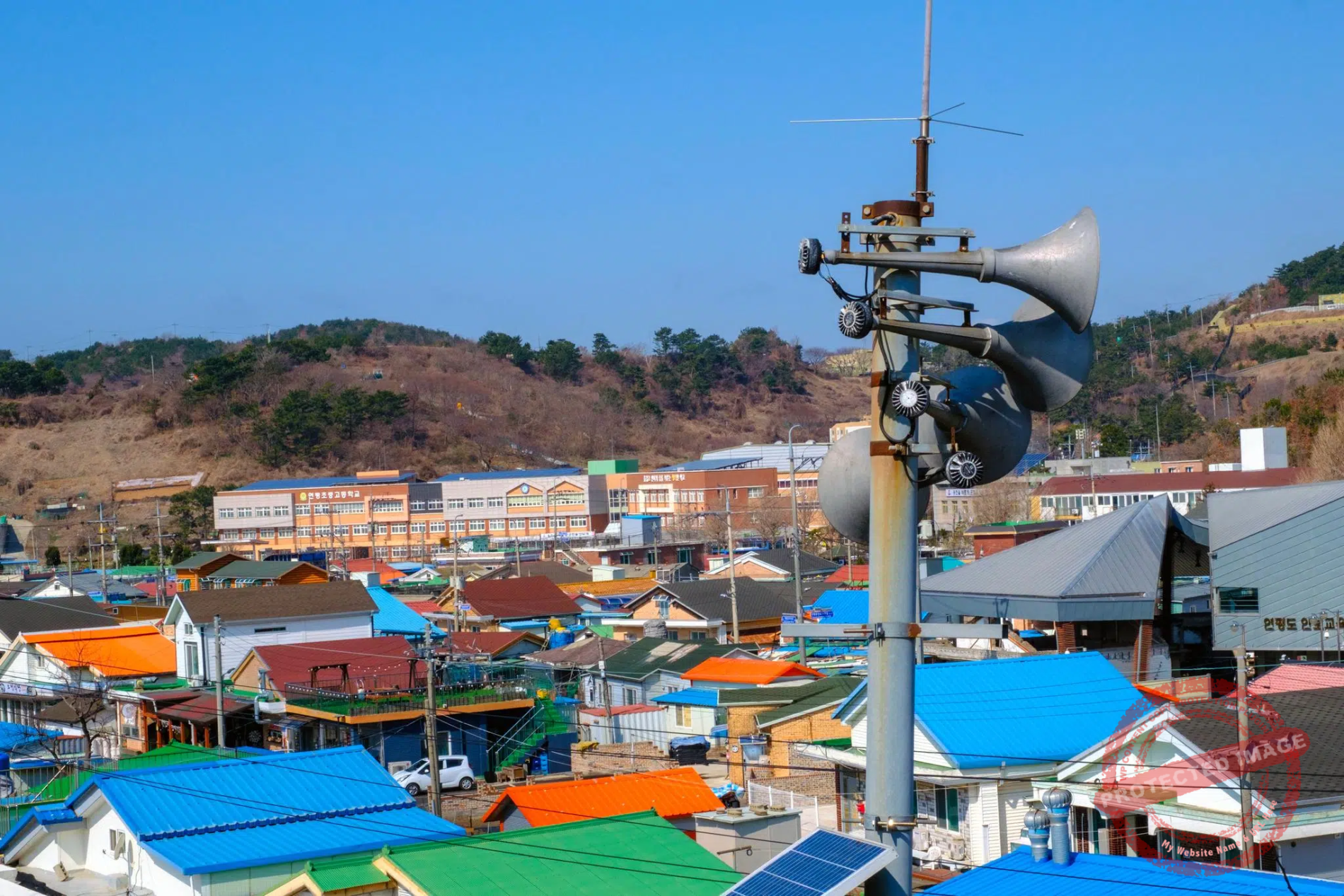
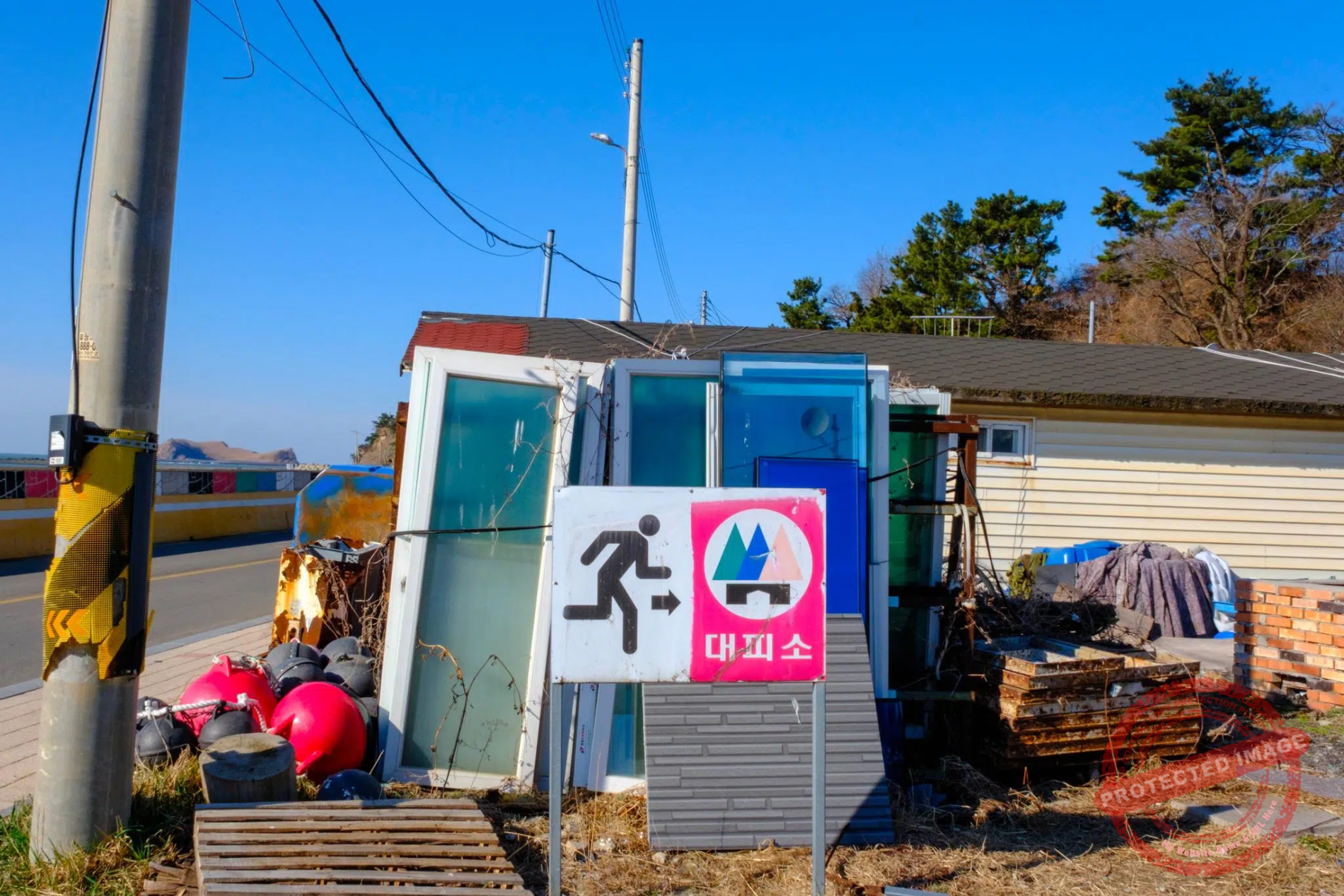
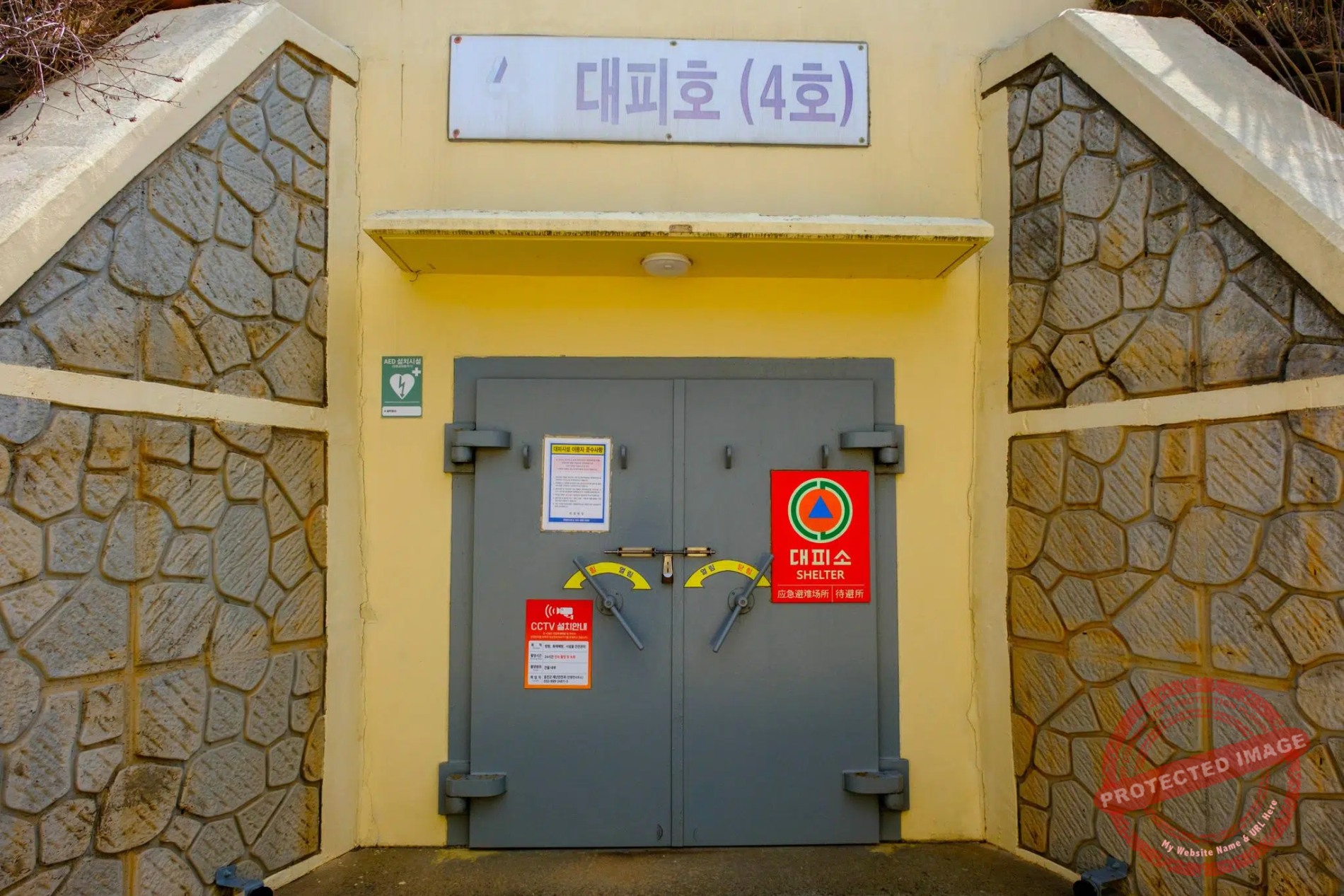
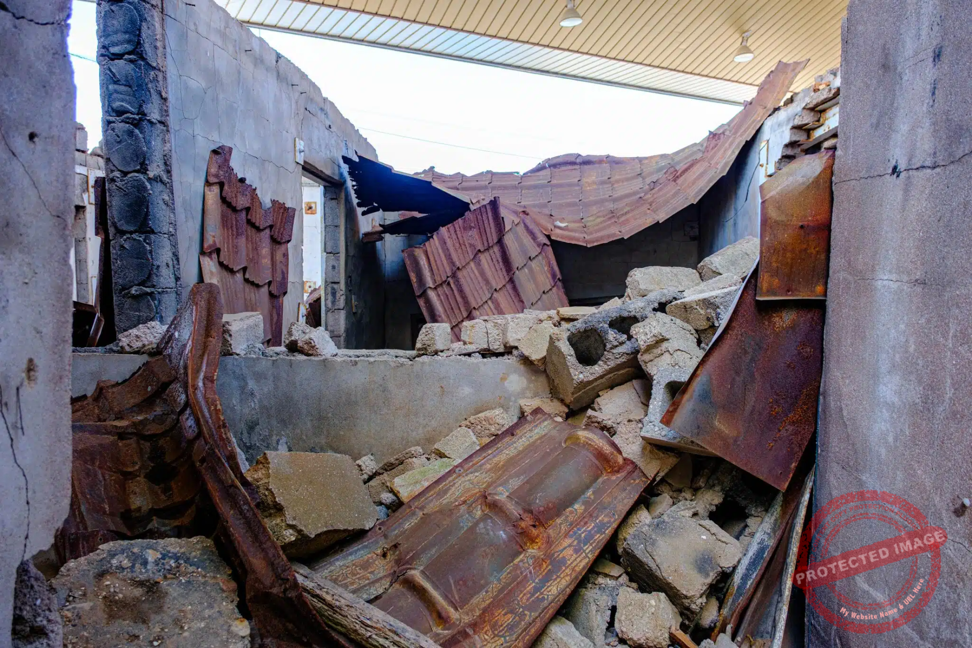
Everywhere on Yeonpyeong Island, loudspeakers are ready to roar in the event of an air alert, and shelter is never far away. The island’s Security Education Center preserves the ruins of houses destroyed by North Korean bombing in 2010 (March 2025).
The first battle of Yeonpyeong broke out in June 1999, when dozens of North Korean fishing boats escorted by military vessels repeatedly crossed the Northern Limit Line (NLL) – a maritime border drawn unilaterally by the United Nations Command in 1953 but never recognized by Pyongyang.
After several days of demonstrations of strength from both sides, the South Korean Navy launched on June 11 a “bumping offensive”, using its boats to physically push aside the North Koreans.
The North Koreans retaliated the following day by attempting their own “bumping offensive”. The dangerous escalation continued, with North Korea deploying three torpedo launchers and South Korea two Pohang-class corvettes to the area.

Former military equipment on display at an open-air memorial in western Yeonpyeong Island (March 2025).
On the morning of June 15, twenty North Korean fishing boats escorted by seven North Korean warships crossed the NLL and joined the scrum. A North Korean patrol boat was bumped by two South Korean fast craft simultaneously. In response, its crew fired machine guns and 25 mm cannon at the two South Korean boats. The South Koreans retaliated.
The exchange of fire lasted 14 minutes and resulted in the sinking of a North Korean torpedo boat and in severe damage to many other vessels. Nine South Korean sailors were injured. North Korean losses have never been made public, but South Korean authorities estimate that between seven and thirty DPRK sailors perished in the battle. Unofficial estimates suggest that the figure might be over 100.

South Korean Marines and sailors disembark from the ferry from Incheon on Yeonpyeong Island (March 2025).
The second naval battle of Yeongpyeong was even more violent.
On 29 June 2002, two North Korean patrol boats crossed the NLL and fired at two South Korean Patrol Killer Medium (PKM) boats that had been monitoring them. Two more PKMs and two corvettes arrived in reinforcement and severely damaged one of the North Korean vessels. Thirteen North Koreans were killed and twenty five wounded in the engagement. The South Koreans suffered six fatalities. A damaged South Korean PKM sank while under tow. It was later raised and towed to Pyeongtaek Naval Base, where she is now a museum. A faithful replica (including bullet holes) is on display at the War Memorial of Korea in Seoul.
All these deadly skirmishes in the Yellow Sea stem from the absence of a commonly accepted maritime border between the two Koreas (unlike their clearly demarcated land border) and the richness of these disputed waters for fishing. These repeated armed incidents are sometimes dubbed “The Crab War”, in reference to the highly sought-after crustacean that inhabits the surrounding waters.

The Chinese fishing fleet, anchored a few feet north of the maritime border between the two Koreas off Yeonpyeong (March 2025).
The mysterious, continuous ballet of Chinese and non-flag vessels (probably North-Korean) off Yeonpyeong is indeed fascinating.
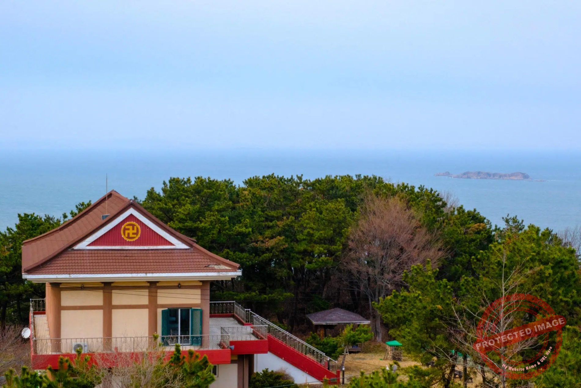
I spent a great deal of my time here observing their activities from a hill at the northeastern tip of the island where a monument has been erected for people who have their ancestors in the North.
This monument is called the Manghyang Viewpoint. The Korean word manghyang (망향) expresses a deep emotional longing for one’s home, often used in the context of people who have been displaced or separated from their homeland due to the Korean division. Manghyang observatories can be found all along the border from East to West.
Every morning, new Chinese vessels arrive from the west, skimming the invisible maritime border to join the swarm of trawlers and small boats anchored a stone’s throw away the island’s coast, and undaunted by the loudspeaker messages in Mandarin from South Korean forces ordering them to leave.

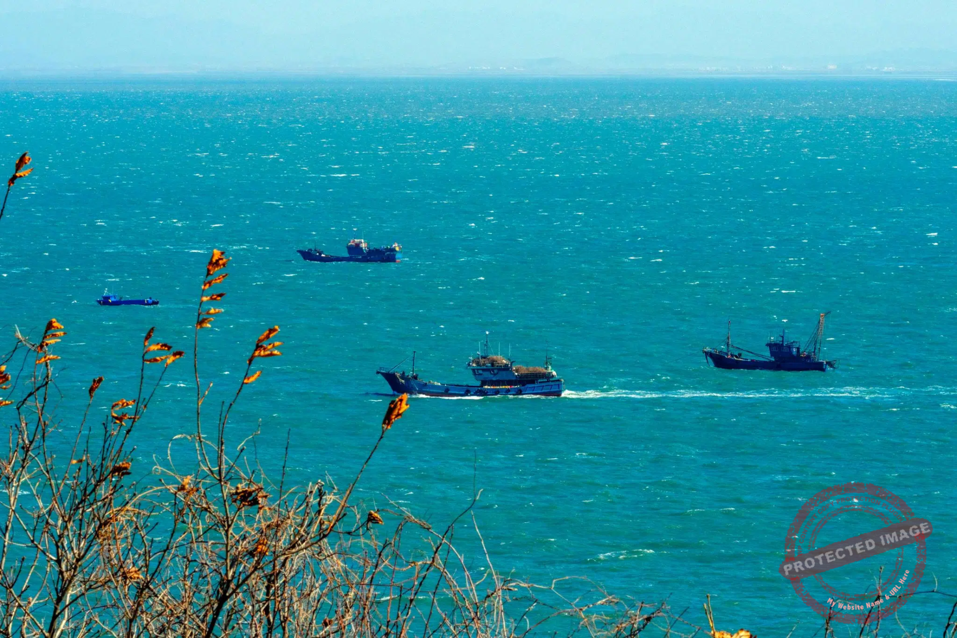
Chinese fishing boats near the North Korean rocky islet of Seok-do, 3 kms from South Korea’s Yeonpyeong Island. The background is mainland North Korea (March 2025).
The apparently illogical to-and-fro of some boats between the main fleet and the isolated vessels near North Korean islands is disconcerting.
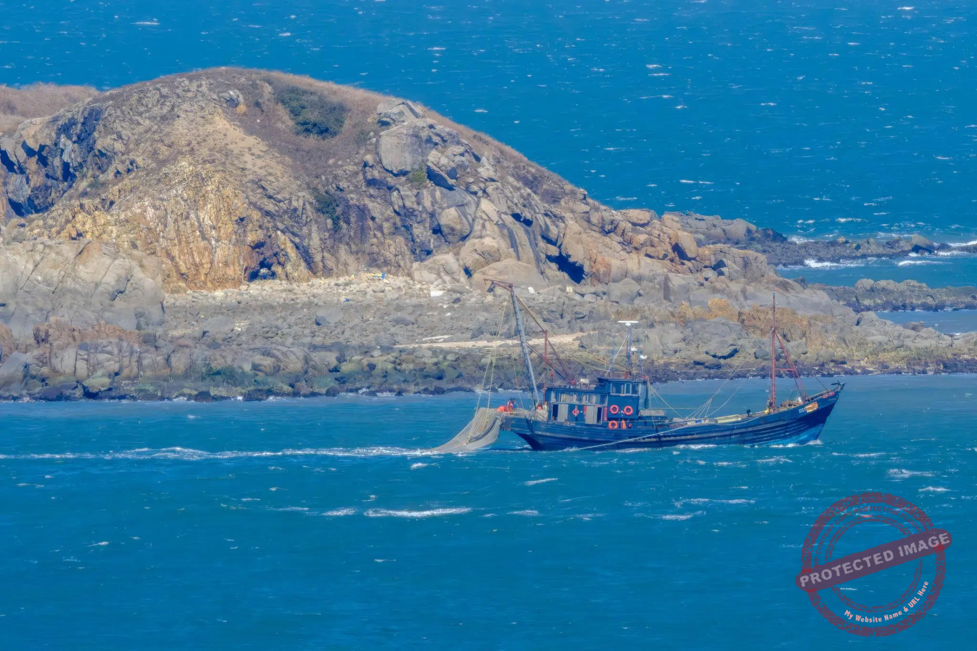
Everything is concentrated around the North Korean rocky, uninhabited islet of Seokdo, just 3 km off Yeonpyeong.
Simple fuel, food and water supply operations between Chinese fishing boats?
Or smuggling of goods between China and North Korea?
Probably both, I was told by the South Korean coastguards who come every day at the top of the hill to monitor this bizarre merry-go-round, and who became curious about what I could see of it through my 500 mm Tamron super telephoto lens (though in fact, the powerful telescopes available to visitors free of charge on this terrace offered a much better view).

Members of the Korean Coast Guard look at the author’s camera from an observation point north of Yeonpyeong Island (March 2025).
Whatever activities these vessels engage in are illegal. Their owners have necessarily purchased fishing rights in these crab-rich waters from North Korea at high price, in violation of United Nations sanctions.
Most Chinese boats also use bull trawling, a fishing method that is highly productive but also extremely destructive to the seabed.
Banned in South Korea, bull trawling, also known as pair trawling, involves dragging a net along the seafloor, picking up everything in bulk. South Korean fishermen, who a few hundred meters away catch crabs using the more environmentally-friendly but less profitable basket method, are naturally furious.
Yet I’ve never seen any coastguard or navy ships on either side. This area of the Yellow Sea is explosive, and any show of force could quickly degenerate, as demonstrated by the two battles of Yeonpyeong. Too bad for the blue crabs, and for the fishermen who respect sustainable methods to catch them.

Chinese fishing vessels in North Korean waters, near the South Korean island of Yeonpyeong (March 2025).
After the deadly 2010 bombardment, many of the evacuated and shell-shocked inhabitants wanted to relocate permanently on the South Korean mainland. But the government refused to support them, arguing that the island could become a permanent conflict zone if all civilians left and only the military remained. The exodus had begun long before, as the island had never recovered from the collapse of the yellow croaker fishing industry in the 1960s as the result of heavy overfishing.
Like Baengnyeong, Yeongpyeong lives on economic perfusion from the South Korean government which is trying to promote tourism, even though the island still lacks the necessary infrastructure like hotels (which, on the other hand, makes it a great destination for fans of unusual places and of cozy pensions run by overwhelming Korean aunties).

A swarm of seagulls surrounds a South Korean fishing vessel near Yeonpyeong Island, with the North Korean coast in the background (March 2025).

The sun sets behind the mountains of North Korea, seen from the west of Yeonpyeong Island (March 2025).
Yeonpyeong is also a good vantage point for observing North Korea.
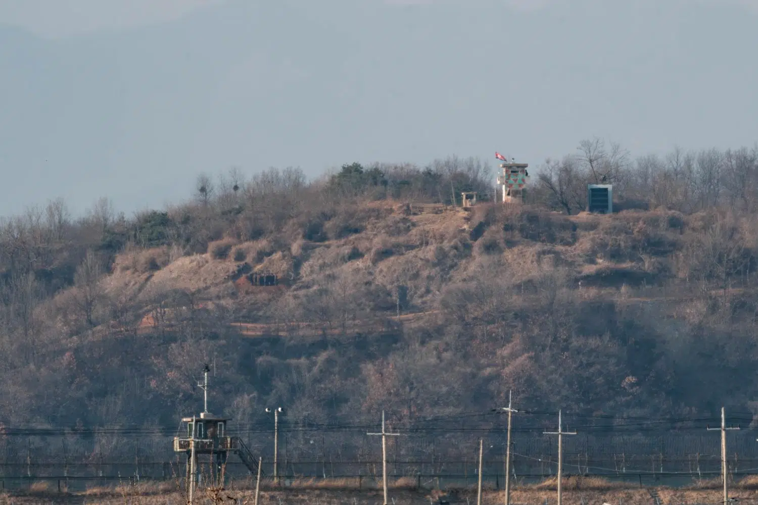
The nearest islet, Seokdo, is apparently deserted but hosts visible military structures with openings oriented southward. The second closest, Galdo (4.5 km away), is thought to be home to 122-millimeter multiple rocket launchers, surveillance assets and troops. And the entire coastline of the North Korean mainland is fortified and riddled with semi-underground batteries and other military infrastructure.

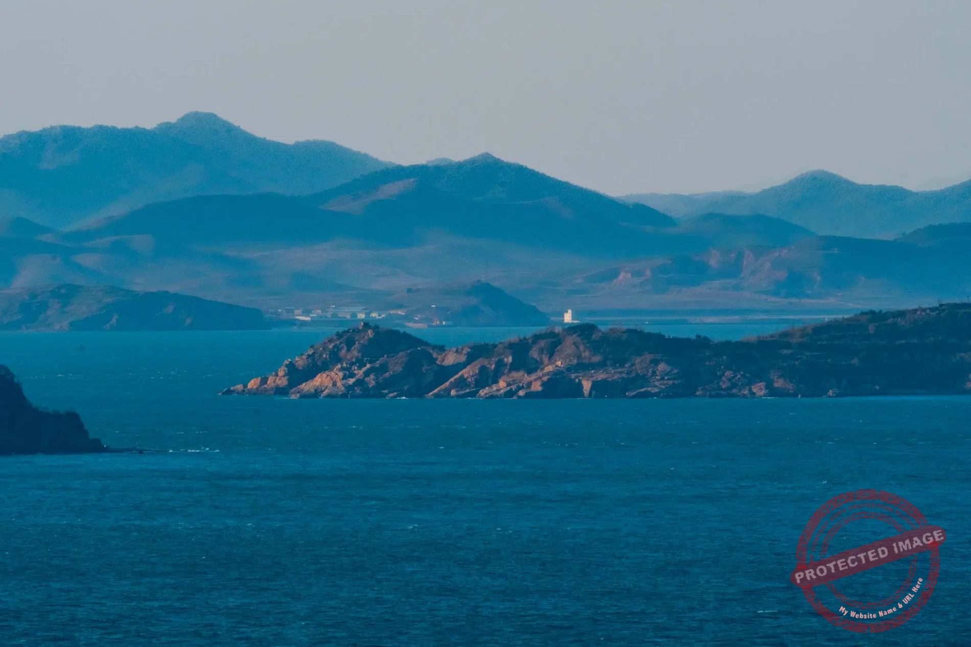
A Chinese fishing vessel cruises past the fortified North Korean islet of Gal-do, 4.5 km from the South Korean island of Yeonpyeong. The North Korean People’s Army is said to have built several bunker-style gun positions on Gal‑do along with a radar or fire control observation post (probably the construction visible on the top of the hill on the right of the picture), likely to direct coastal artillery or multiple rocket launchers towards Yeonpyeong Island. Around 100 North Korean soldiers are believed to be stationed there full-time, but you hardly see them (March 2025).
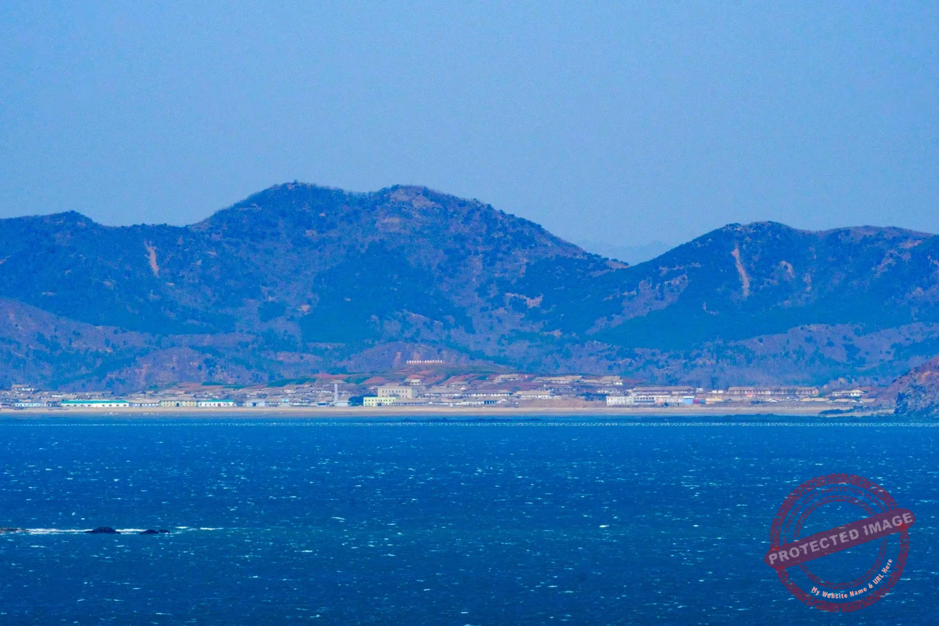
On clear days, the city of Haeju, 40 kilometers away, is visible to the naked eye. Observers can spot structures like train stations and even smoke emissions from a cement factory.
As everywhere in North Korea, every town and village along the coast has its “Tower of Immortality”, an obelisk celebrating the “eternal president” Kim Il Sung and his son, the “great leader” Kim Jong Il, and its share of giant Communist slogans that are hard to read from this distance.
The North Korean mainland and illegal fishing as seen from Yeonpyeong Island (March 2025).
This page was last updated on: September 28, 2025