Yeoncheon
연천


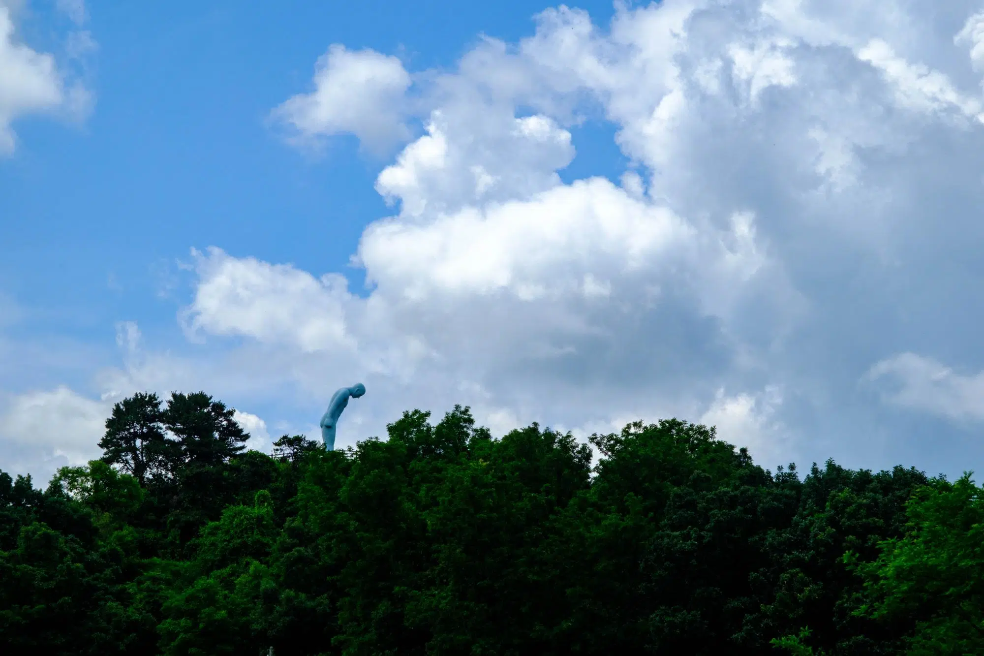
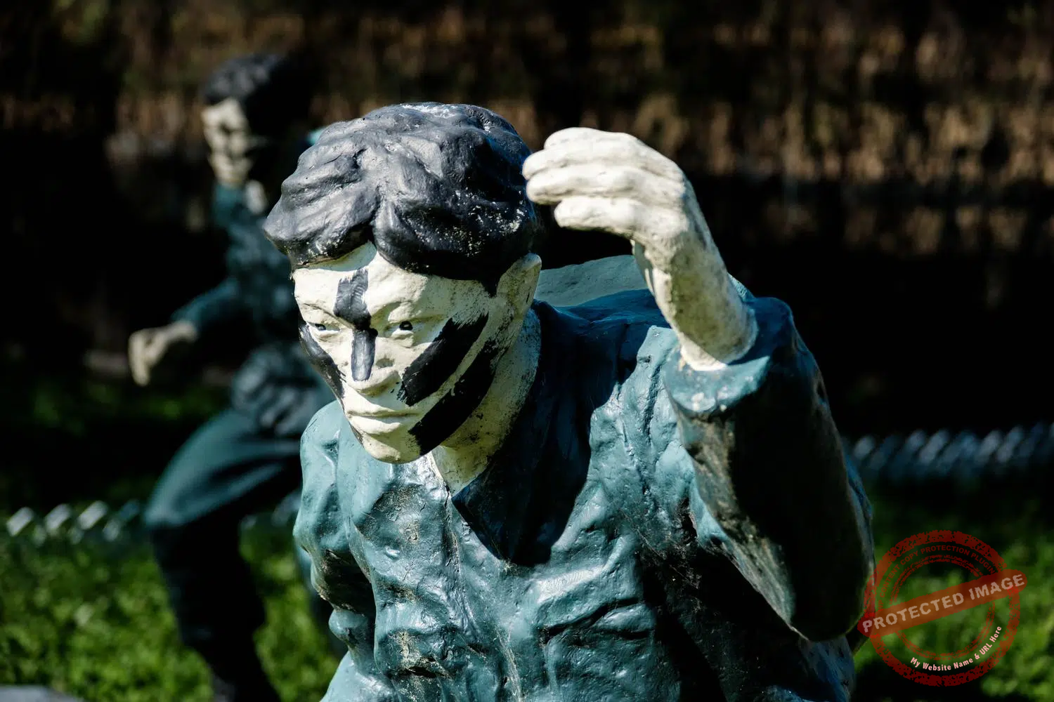
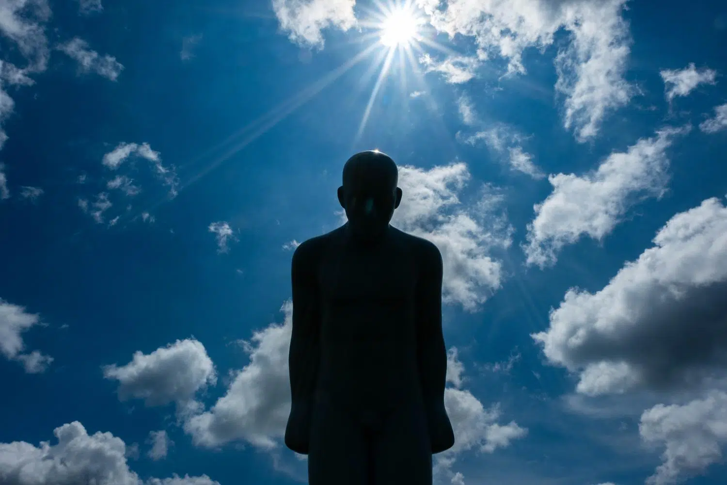
The Greetingman, a sculpture by Yoo Young-ho, bowing toward North Korea atop a hill north of Yeoncheon (June 2026).
To the northeast of Paju and its touristy DMZ sites lies a much wilder, rugged, and lesser-known borderland. The roads narrow. There are more military vehicles. The hiking trails that crisscross the mountains constantly pass by bunkers, tank emplacements, helipads, and other defense infrastructure fully prepared to withstand a North Korean attack.
This is Yeoncheon, a large county pressed against the DMZ, with a population of fewer than 41,000. According to the county’s own figures, over 92 percent of its land area falls under some kind of military restriction.
The Imjin River, which rises in the mountains of North Korea’s Kangwon Province, crosses into South Korea here. This river, the seventh longest in the Peninsula, is associated with some of the most violent episodes in the country’s history, from the Japanese invasion of 1592 to the Korean War.
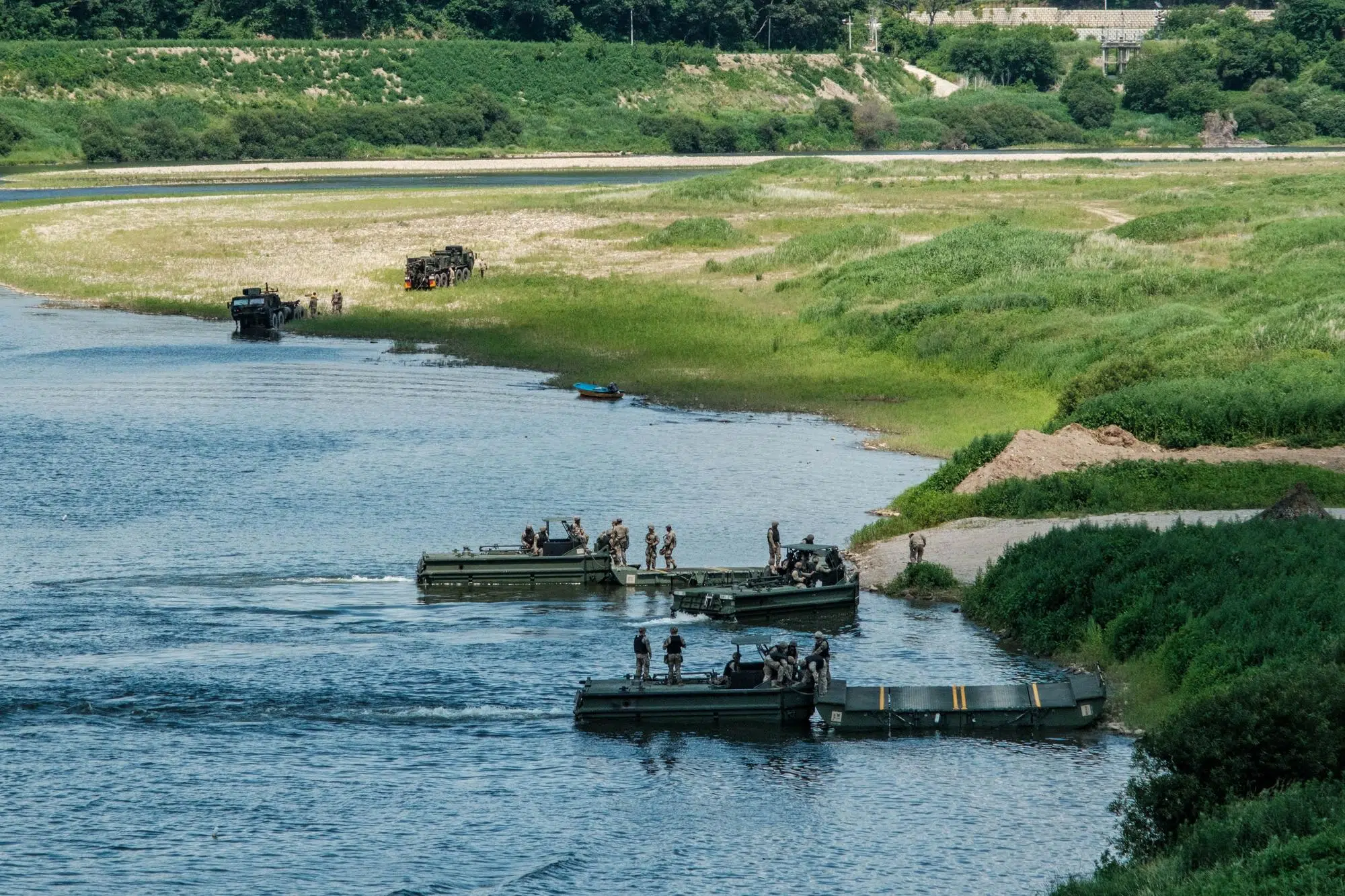
Military exercise on the Imjin River, between Yeoncheon and Paju (June 2026).
Since 1953, the border area in Yeoncheon has been the scene of a surprisingly high number of armed clashes and infiltrations, including the infamous Blue House Raid in 1968.
One of the most serious incidents happened in August 2015, when North Korea fired a rocket targeting a South Korean propaganda loudspeaker to force a halt to the broadcasts. The South immediately fired dozens of 155 mm artillery shells back into North Korean territory. No casualties were reported on either side, but residents had to evacuate to shelters and the incident escalated tensions, with North Korean leader Kim Jong Un ordering frontline units into a “semi-war state”.
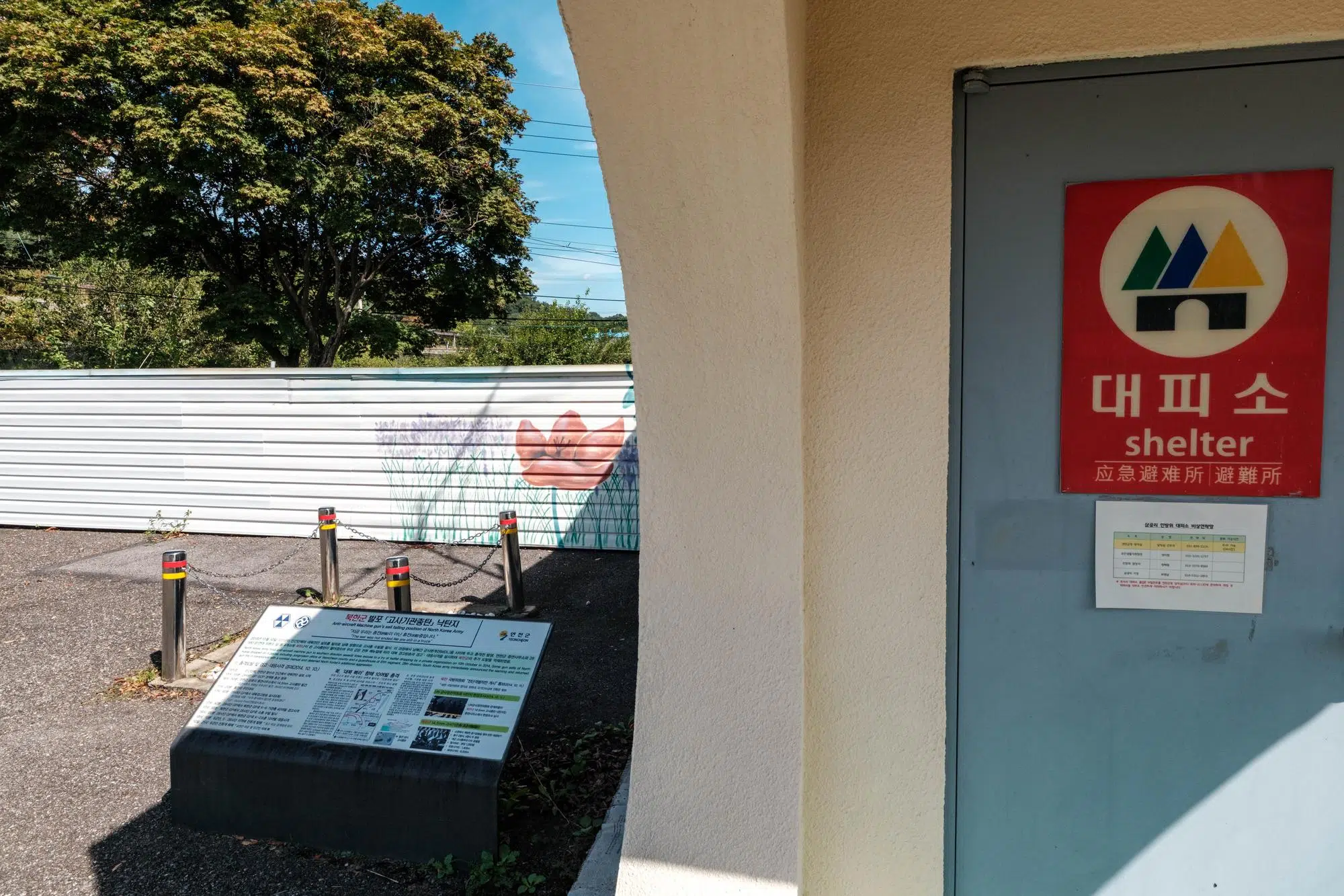
Next to a shelter near a community center in Yeoncheon, a commemorative plaque marks the spot where, in 2014, a North Korean projectile landed after being fired at South Korean balloons carrying anti-communist leaflets (September 2026).
Less than a year earlier, in October 2014, North Korean forces had fired heavy anti-aircraft machine guns at balloons launched by South Korean activist groups carrying anti-communist propaganda. Several rounds landed near a community centre in Yeoncheon, prompting a response from the South Korean military. And hardly a year goes by without North Korean soldiers crossing the demarcation line in this remote sector, usually by accident, before retreating under warning fire from the South.
Yeoncheon Station is the last stop on Seoul’s Metro Line 1. On the platform, many passengers are soldiers.
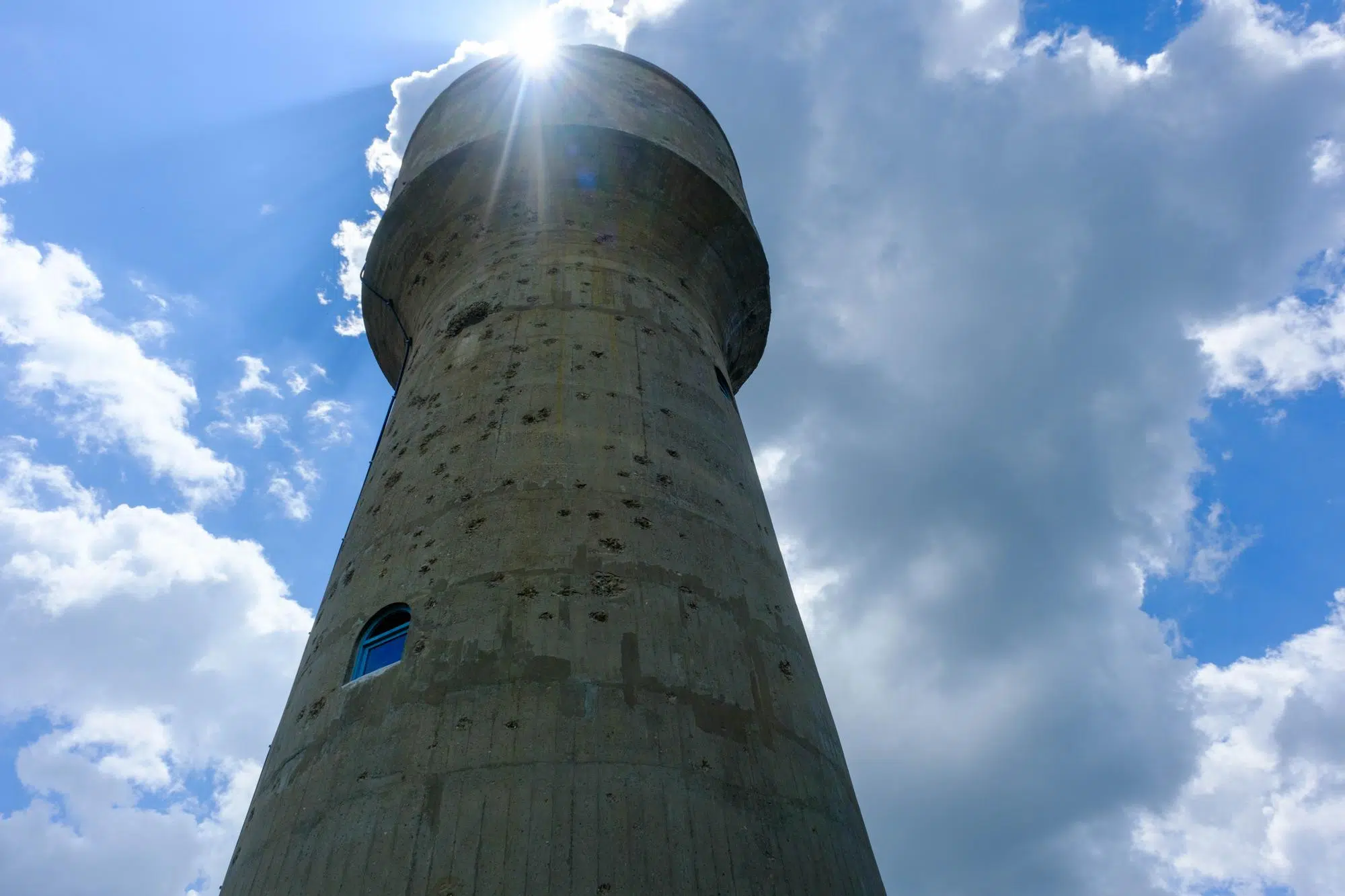
The water tower at Yeoncheon Station, riddled with bullet holes from the Korean War (June 2026).
Standing in the station forecourt are two concrete water towers, built in 1914 to supply steam locomotives running the Gyeongwon Line between Seoul and Wonsan, on the east coast. The cylindrical tower still bears the bullet marks left by UN air attacks during the Korean War. Before 1951, Yeoncheon, located above the 38th parallel, was North Korean territory. The station was used to move communist military supplies south.
In the middle of nowhere, at the summit of Oknyeobong, a 205-meter hill above the city of Yeoncheon, stands a 10-meter steel figure bowing at a 15-degree angle toward North Korea. It is the Greetingman, a sculpture by Yoo Young-ho, installed here in April 2016.
The figure is painted blue. The angle of the bow was chosen with precision: 15 degrees is the posture of someone who shows respect without losing themselves. The gesture faces North Korea, four kilometers away, with its defensive lines clearly visible.
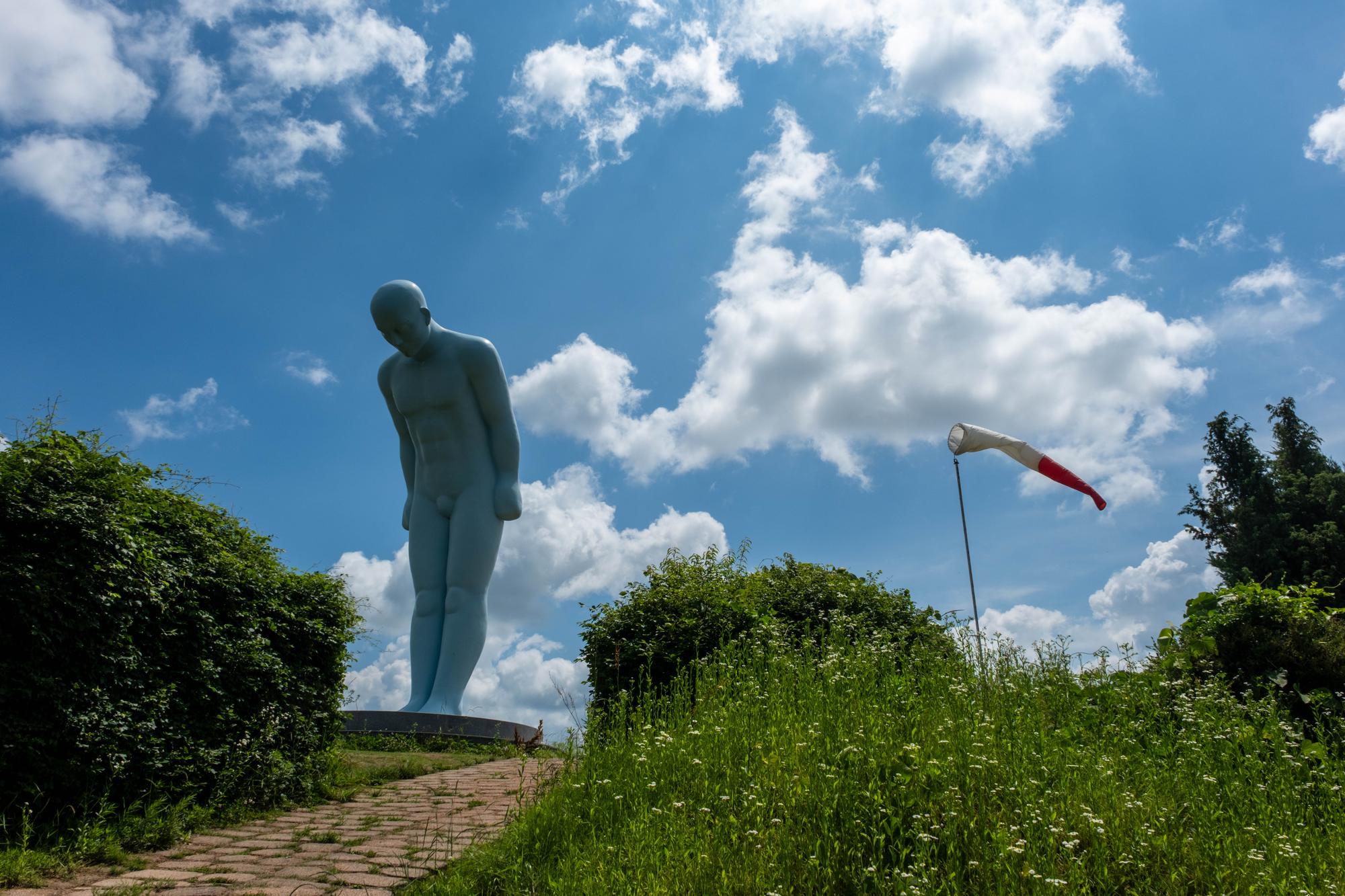
The original plan called for a mirror sculpture on the North Korean side, so that two Greeting Men would bow toward each other across the border. North Korea has never responded (June 2026).
The Greetingman arrived at Oknyeobong as part of the inauguration of the Yeongang Narutgil, a 7.7-kilometer trail along the Imjin River. To build it, Yeoncheon county persuaded the army to push the Civilian Control Line (CCL) a little further north. The summit of Oknyeobong was a military position and the site of fierce fighting during the Korean War. Today it carries a military helipad, its wind sock visible from the path below.
The original plan called for a mirror sculpture on the North Korean side, on Maryang Mountain, so that two Greeting Men would bow toward each other across the border. North Korea has never responded.
There is another Greetingman at the Yanggu Unification Hall in the Punchbowl, installed in October 2013. The Yeoncheon version is larger, at 10 meters, versus 6. Yoo Young-ho has since installed versions of the sculpture in Uruguay, Panama, Ecuador, Brazil, Vietnam, the United States, and Mexico. The Yeoncheon Greetingman remains the one facing the most immediate audience. The year of its installation, 2016, was also the year North Korea conducted two nuclear tests.
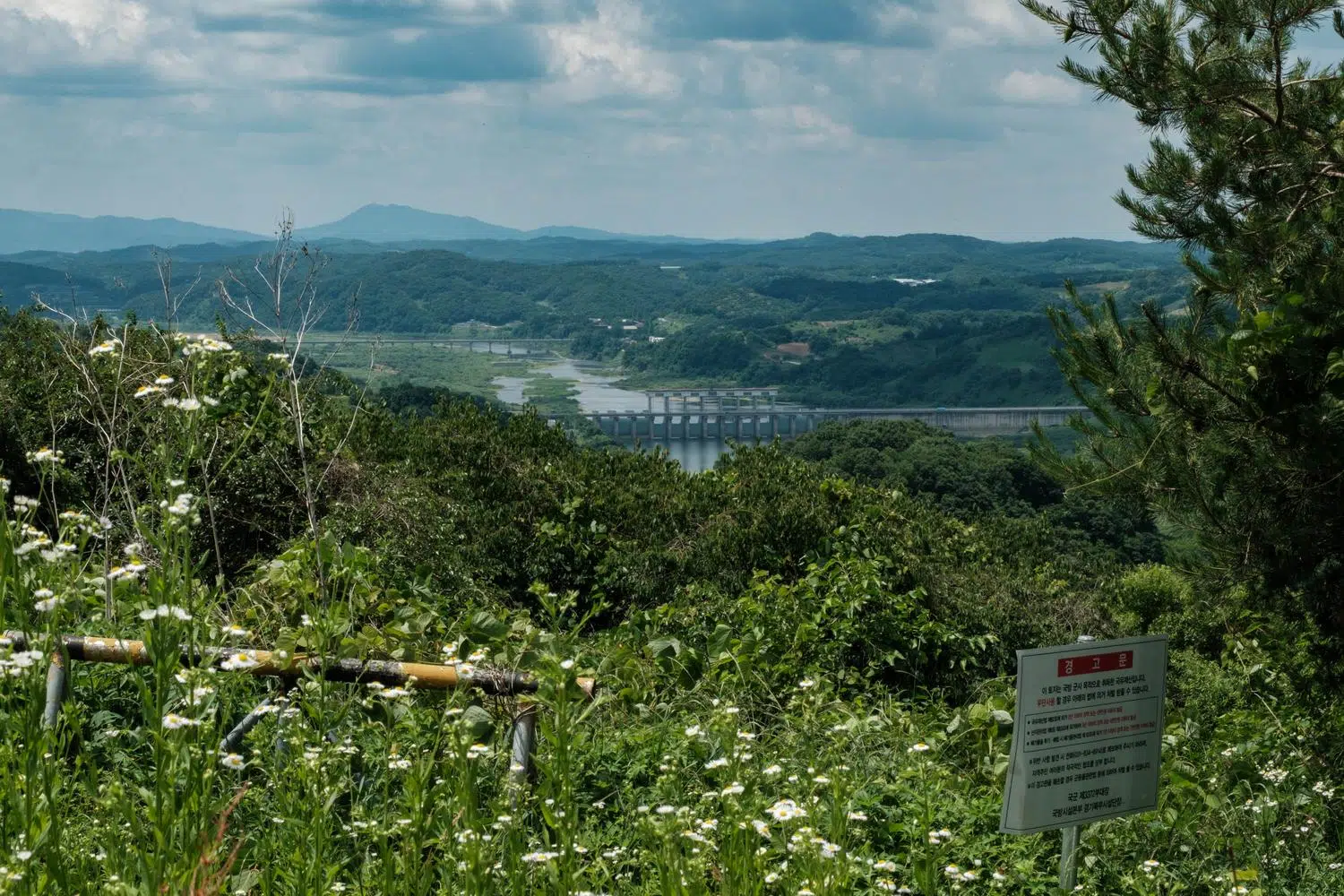
The Gunnam Dam, built on the Imjin River to contain catastrophic water releases by North Korea upstream (June 2026).
A few kilometers south, the Imjin River narrows at a point controlled by the Gunnam Dam, a flood-control reservoir completed in 2011. Its capacity is approximately 70 million cubic meters.
Although this infrastructure is reminiscent of the Peace Dam in Hwacheon, built in central Korea at the height of anti-communist hysteria to ward off an imaginary “water bomb” from the North, the Gunnam Dam is smaller and the circumstances surrounding its construction are entirely different.
The dam exists because of what happened on the morning of September 6, 2009. Without warning, North Korea opened the floodgates of the Hwanggang Dam, a huge hydroelectric facility north of the DMZ, completed in 2007, with a storage capacity estimated at between 300 and 400 million cubic meters. The Imjin River, already high from seasonal rains, surged suddenly downstream. Six South Korean civilians camping along the riverbank in Yeoncheon were killed. North Korea’s explanation cited heavy rainfall and maintenance work.
Under pressure following the deaths, Pyongyang agreed in October 2009 to provide advance notification before future releases. Compliance has been inconsistent. Unannounced releases occurred again in 2016 and 2022. Each time, South Korean authorities issued emergency alerts.
The Gunnam Dam is South Korea’s structural answer: a flood buffer between the North Korean dam upstream and the populated valley in Gyeonggi Province below.
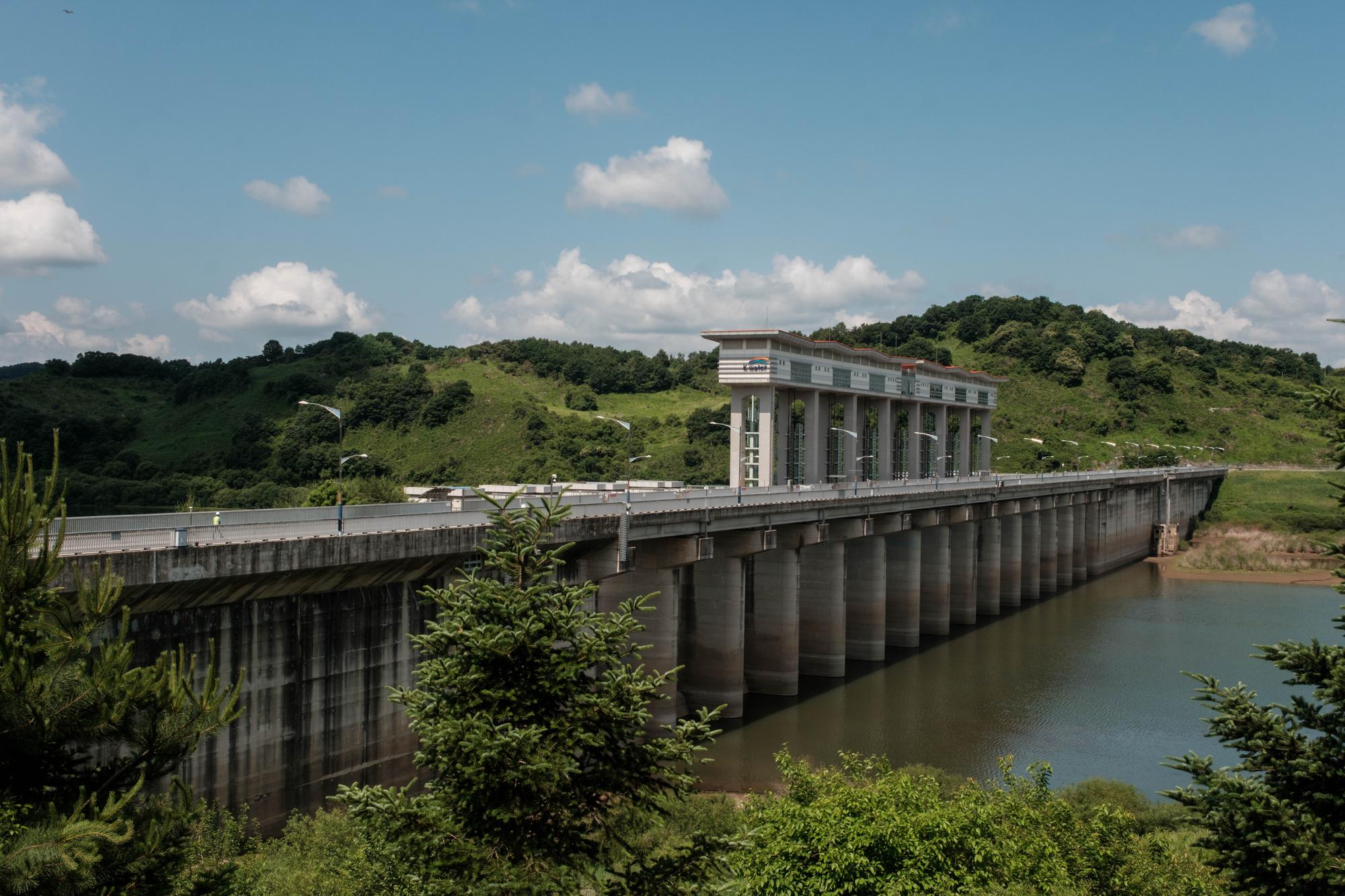
The Gunnam Dam (June 2026).
But the disproportion is stark. Gunnam holds roughly one-fifth the volume Hwanggang can release. There has been debate in South Korea about whether that constraint was political, and whether the engagement-era caution of the early 2000s limited the dam’s design, since a structure large enough to fully absorb a maximum Hwanggang release would flood North Korean territory upstream as well.
A gauging station at Pilseung Bridge, the northernmost water-monitoring point in South Korea’s river network, maintains 24-hour surveillance of water levels. It cannot observe the Hwanggang Dam directly. Since 2023, South Korea’s Ministry of Environment has increased satellite imaging of North Korean dams to at least twice daily. The images are used to estimate what cannot be measured: the water level in a dam the South cannot access, operated by a government with which Seoul has lost all contact
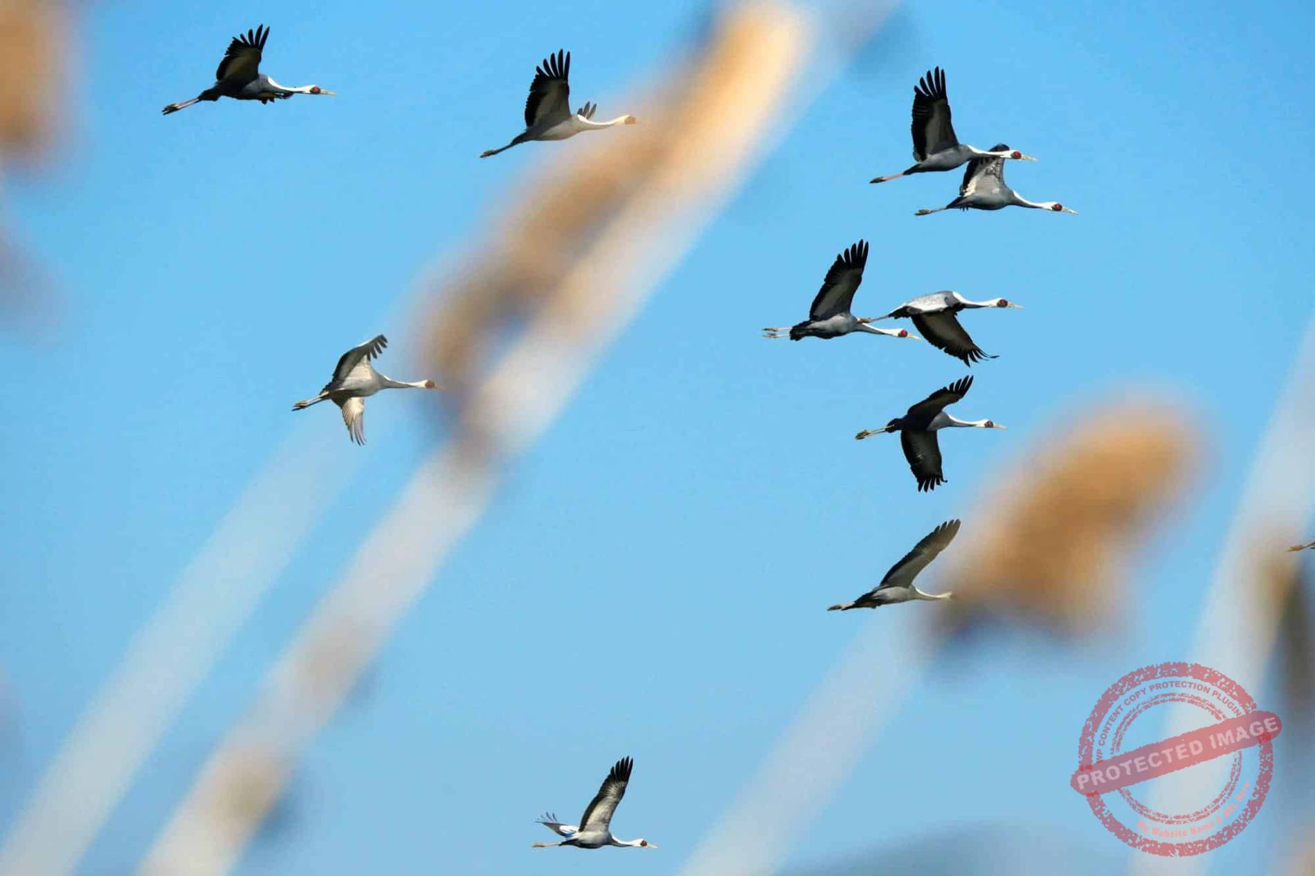
The area surrounding Gunnam Dam has been developed into a public crane park. Up to 200 white-naped and hooded cranes, indifferent to geopolitics, winter along the Imjin River here each year.
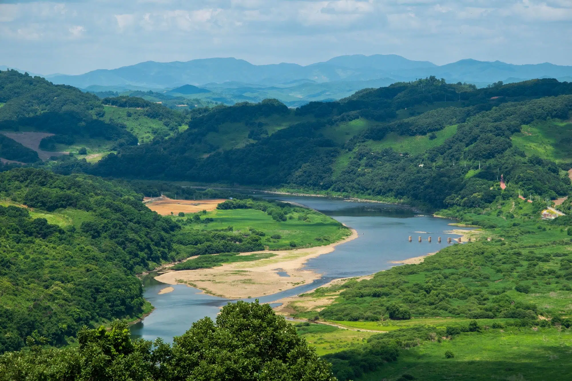
The Imjin River Valley north of Yeoncheon, with the mountains of North Korea on the horizon (June 2026).
Further into Yeoncheon’s border zone, the South Korean army has built General Outposts (GOP) along the southern edge of the DMZ and Guard Posts (GP) and Observation Posts (OP) inside it. Most occupy ridgelines. A handful are accessible to civilians under strict conditions.
Such is the case of the Seungjeon OP, located near the strange monument recreating the Blue House Raid infiltration incident, the Key Observatory, the Sangseung OP, near where the first North Korean infiltration tunnel was discovered in 1974 by a team of South Korean soldiers who saw steam rising from underground (unlike its counterparts in Paju and Cheorwon, this very narrow tunnel is not open to visitors), and the spectacular Typhoon Observatory.
To access these advanced OPs, located inside the DMZ, you need to submit a request for authorization at least one week in advance. In the case of Seungjeon, a military escort is mandatory. At the Typhoon Observatory, it is forbidden to stay for more than ten minutes, even if no one is waiting behind.
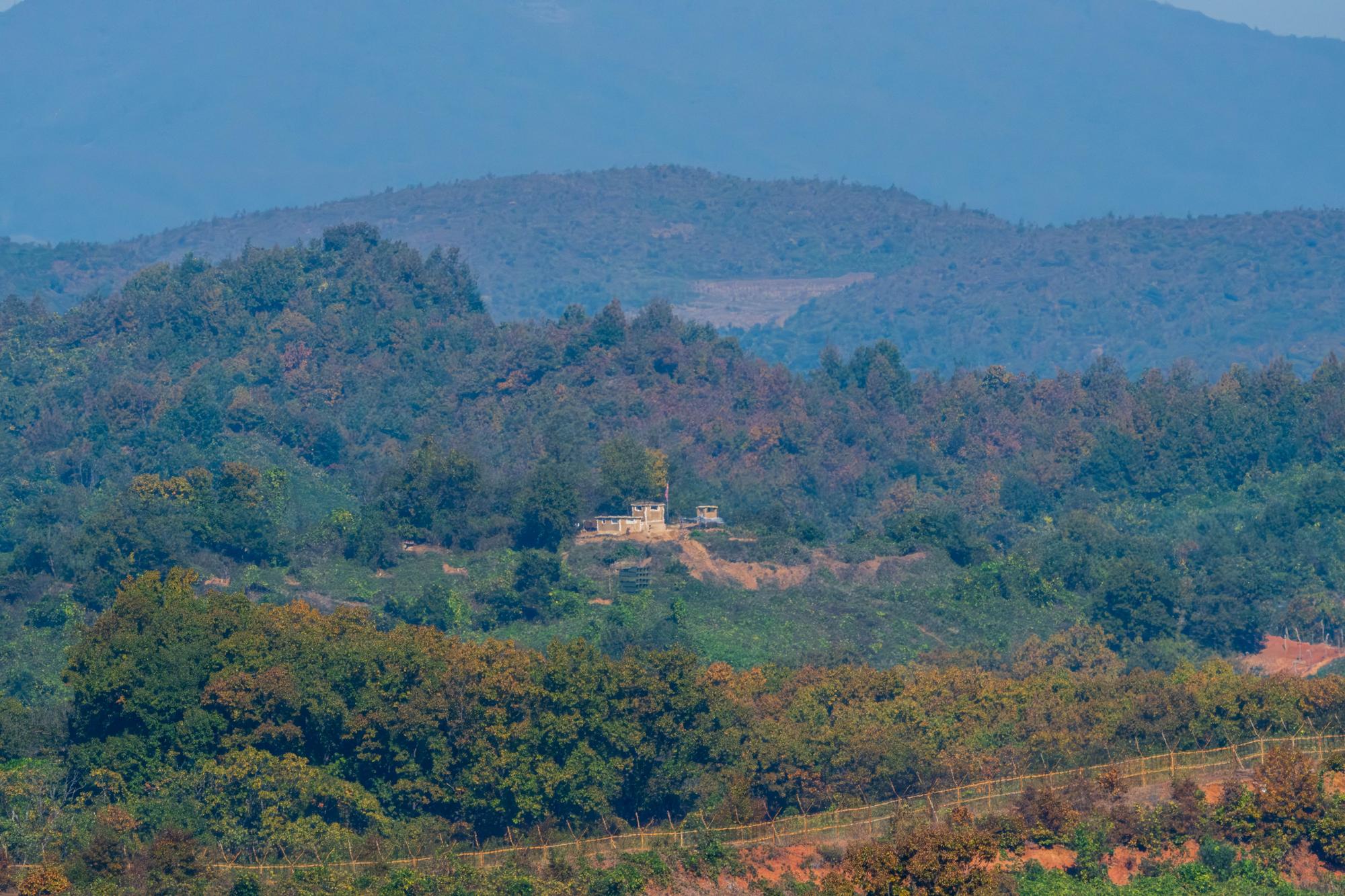
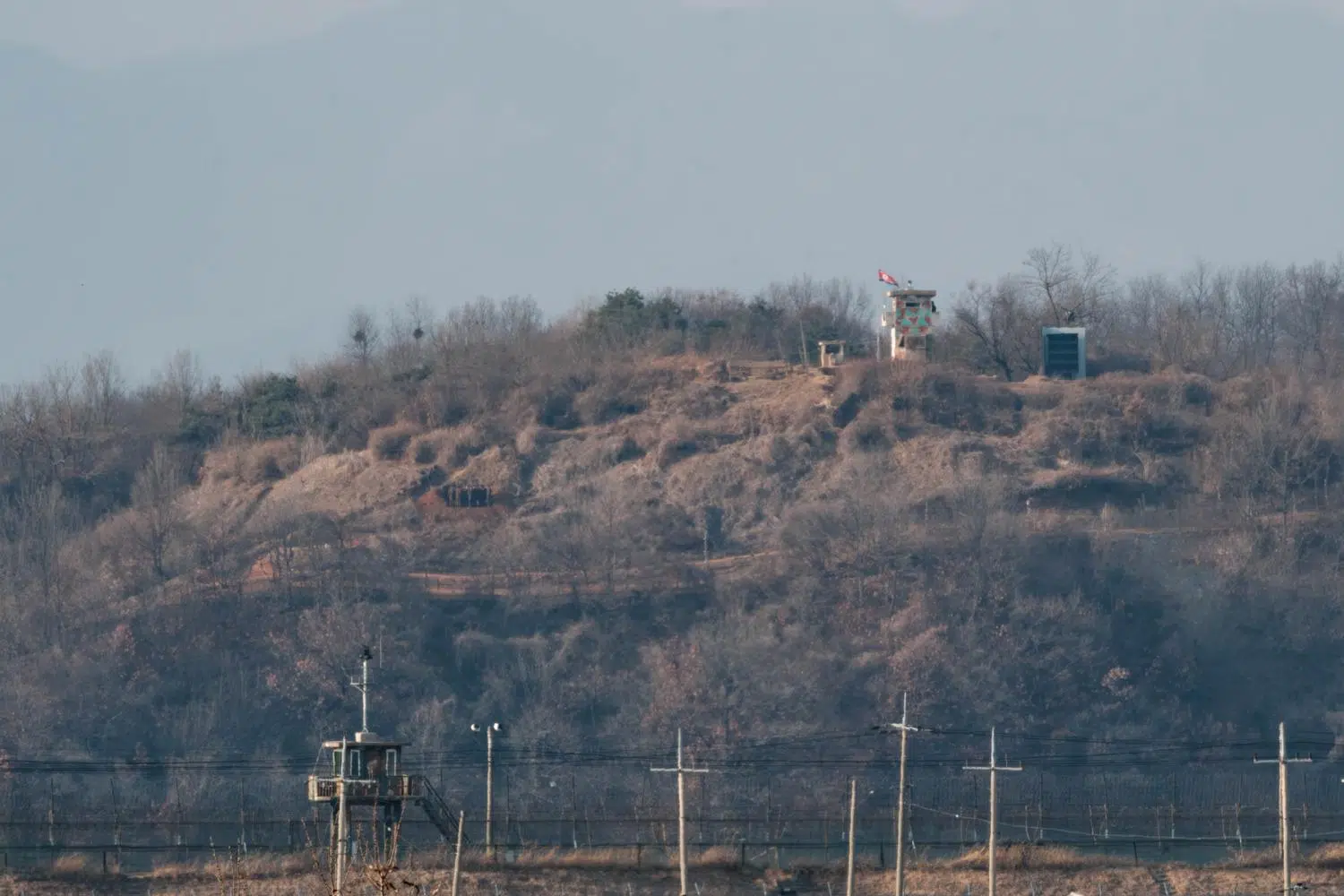
A North Korean guard post inside the DMZ, as seen from the Seungjeon OP in Yeoncheon (October 2024).
At both places, taking photos is forbidden. After some negotiation with my military minders and their commanding officer, however, I was grudgingly granted permission to quickly shoot a couple of images, but only in a northerly direction, and subject to approval once taken. It’s a far cry from the packs of tourists taking selfies at sites closer to Seoul, but each situation has its own charm. It also illustrates Korea’s ongoing tug-of-war between the desire to promote its most spectacular sites on the border and the need to preserve its national security.
The Seungjeon OP is also known as “Biryong Observatory” because of the nearby Biryong Mountain (literally meaning “Flying Dragon Mountain”). The name Seungjeon, meaning “Victory in Battle” was assigned by the South Korean Army’s 25th Infantry Division in charge of the place. The view of the mountains from the OP is magnificent. The only evidence in the landscape that we’re here on the border is a small North Korean Guard Post with a flag, a few kilometers away, and the usual rusty barbed-wire fences. The fortifications on the South Korean side are considerably more substantial, but photographing them at close range is completely out of the question.
Further east, also within the DMZ, Suribong Peak carries the Typhoon Observatory, built in 1991 by the ROK Army’s 28th Infantry Division, the “Invincible Typhoon” unit. Its primary function is to observe the movements of the North Korean army below. The vantage point couldn’t be better: a mere 800 meters beneath the observer’s feet flows the Imjin River, which marks the border, and its immense valley. In the distance, you can see North Korea’s Hwanggang Dam.
In a surrealistic blend of the martial and spiritual, the site includes facilities for Christian and Catholic worship, a Buddhist sanctum, a bell tower and a statue of the Virgin Mary, enabling soldiers and visitors to practice faith less than one kilometer from the socialist paradise.
And as is so often the case in South Korea, sinister, ultra-militarized border areas stand side by side with natural beauty.
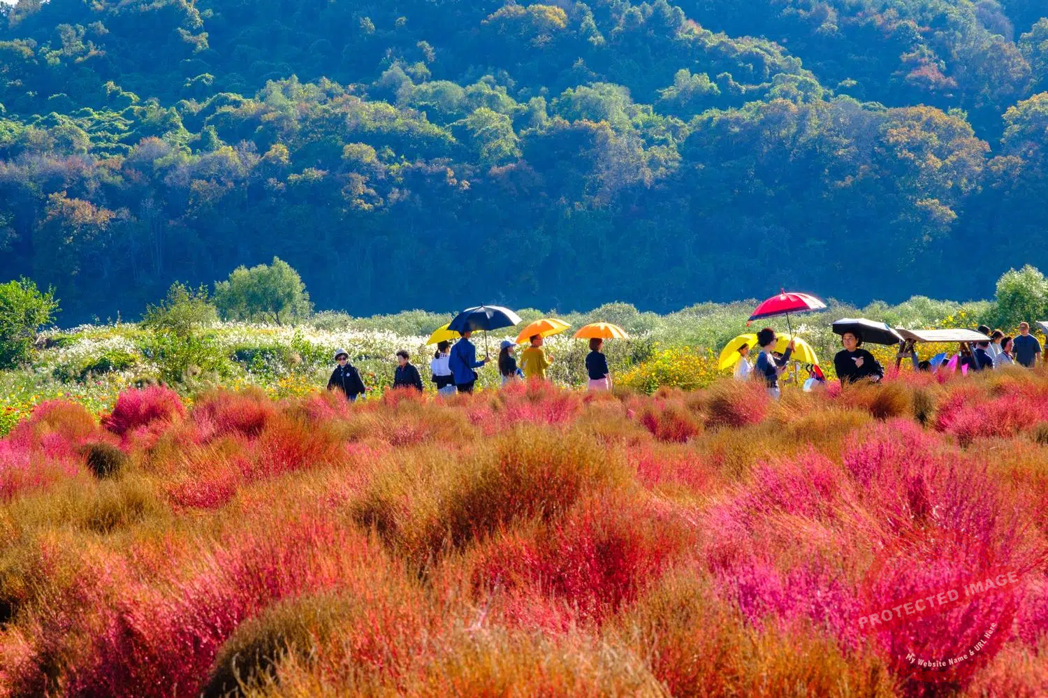
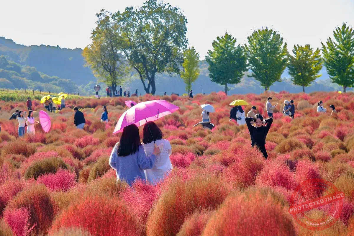
Visitors enjoy the Autumn colors at Imjin River Daepssari Park in Yeoncheon, at the edge of the Civilian Control Line (October 2024).
Coming down from the frontline ridge, past the military checkpoint, the road opens onto the Imjin River Daepssari Park, a riverside planting of approximately 20,000 Kochia scoparia (in Korean: Daepssari), a low-growing annual that turns crimson in autumn. Opened in 2024, the park draws thousands of visitors during the season. They are provided with colorful umbrellas, adding to the enchantment of the setting.
It is a sight of genuine beauty, and another demonstration of the Koreans’ ability to tone down – or hide – their K-Scar. Just north of the magnificent purple fields lies the barbed-wire fence of the Civilian Control Line.
On a much darker note, off a back road a few kilometers south of the DMZ, stands what is officially described as the United Nations Forces Cremation Facility. South Korea has classified it in 2008 as a Registered Cultural Heritage site.
The only official record says it was built in 1952 using fieldstones collected from the surrounding hills, to cremate the war dead of the United Nations Forces, and operated until just after the armistice in July 1953. Other than that, not much is known for certain about this place.
It is believed that the facility was built by British forces in response to the rapid rise in casualties during the trench and mountain pass battles that followed the stabilization of the front around the 38th parallel in the second phase of the war, particularly around the Battle of White Horse and the Iron Triangle. But there are no known official documents from the United Nations, the Commonwealth or the US military confirming this. Surviving witnesses reported that “UN soldiers killed in the fighting at the mountain passes were taken to the crematorium every day” and that “a brief funeral ceremony preceded the cremation.”
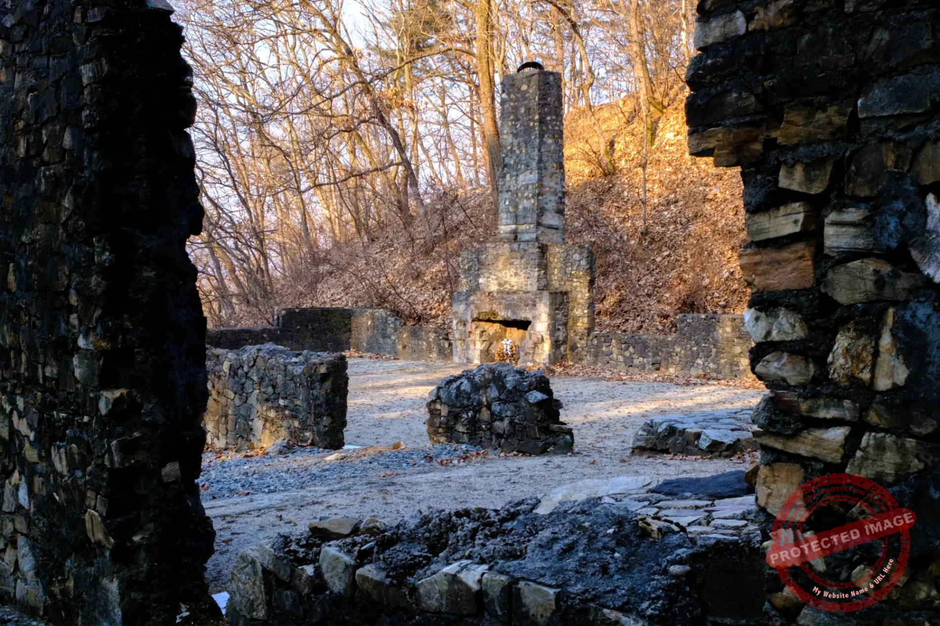
The gloomy and mysterious “United Nations Crematorium” in Yeoncheon (February 2025).
This place is undoubtedly a real crematorium. There are other ruins of this type, smaller and not officially recorded, along the former front line of the Korean War.
But how many bodies were burnt here? And which ones? Who carried out this grim task? What happened to the ashes? More than seventy years later, the questions remain open.
The archives of the US Army’s Quartermaster Museum document the Graves Registration Service system for the Korean War as a whole: the remains of American soldiers were processed and repatriated via Camp Kokura in Japan, while those of non-American allies were buried or cremated at the Tanggok Central Cemetery in Busan. But this documentation does not mention Yeoncheon, which likely served as a forward cremation site, as close as possible to the front lines, prior to any transfer to Tanggok or Kokura.
The existence of the facility was not officially confirmed until 1991, during an archaeological field survey. After being designated as a heritage site in 2008, the crematorium remained effectively unmaintained, overgrown with vegetation and lacking a proper access road, until 2013, when a budget was allocated for the purchase of the land and the installation of signage.
In 2022, a complete restoration was announced, but the project was abandoned: the county authorities concluded that it was difficult to obtain decisive historical verification documents attesting to the facility’s function.
This post was last updated on: September 13, 2026.