Jayu-ro
자유로
Every morning, commuters on the 2200 bus to Seoul scroll their phones with North Korea out the window.


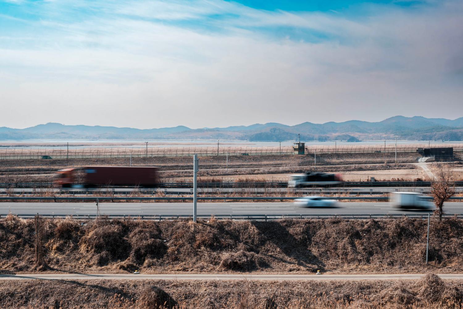
Jayu-ro, the “Freedom Road” as it passes along the Imjin River, which marks the border with North Korea at this point, in the city of Paju (February 2025).
Highway to Hell may have been a more accurate nickname. But the expression was already copyrighted by AC/DC in 1979, long before this road was built.
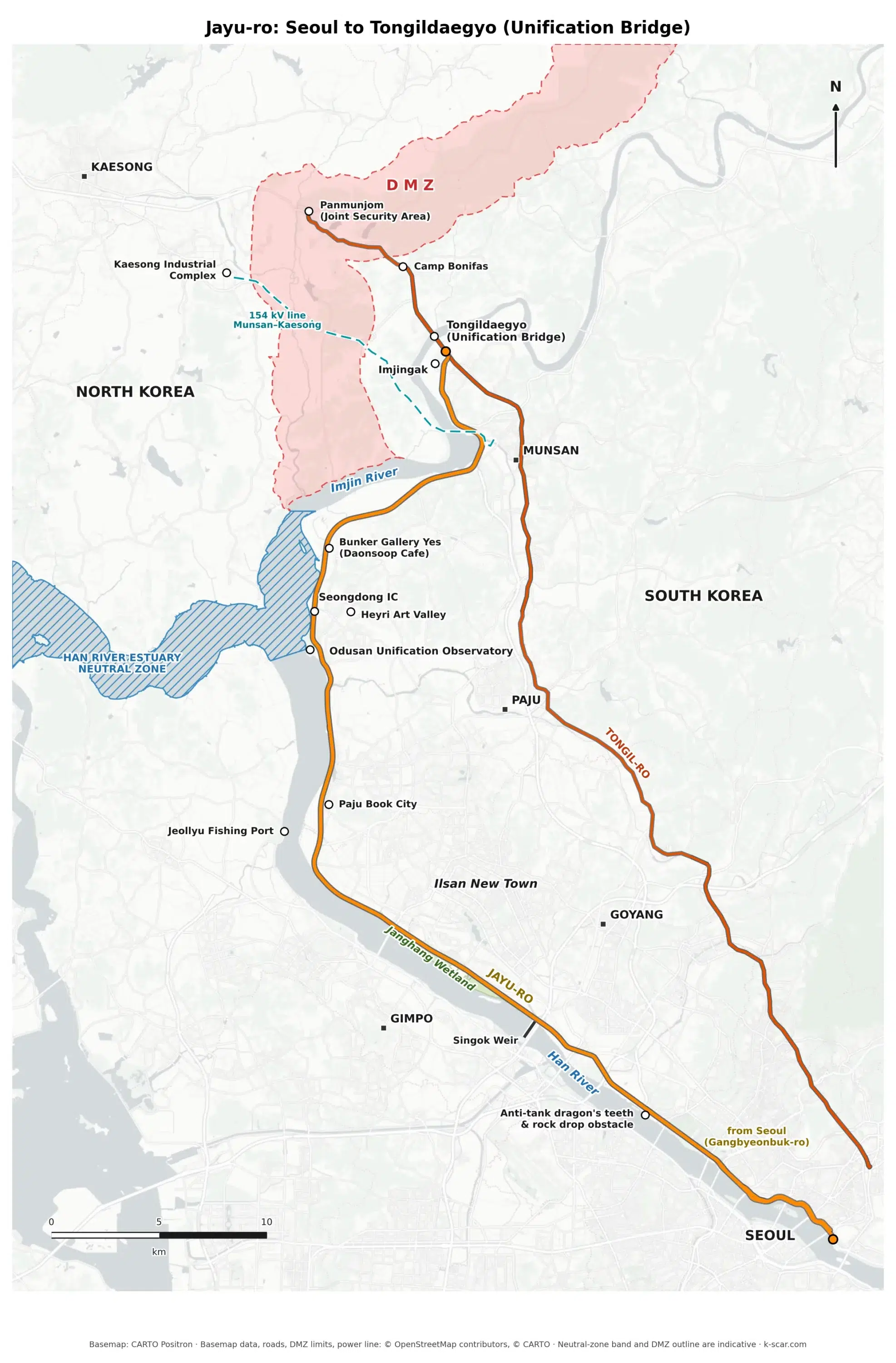
Jayu-ro, or “Freedom Road”, is the last section of the National Route 77 which starts in the big port city of Busan, in the south of South Korea.
In an ideal future, it will link Seoul to Pyongyang, China, Russia and beyond. And with it South Korea will cease to be a virtual island.
For the moment, the 49.8 km-long Jayu-ro starts in Seoul and ends past the Imjingak tourist complex at the junction with the “Unification Road” (Tongil-ro) which, after a military checkpoint, crosses the Imjin River to the Civilian Control Zone (CCZ) and to the Demilitarized Zone (DMZ) – see the glossary to understand the meaning of all these terms.
Construction of Jayu-ro was completed in 1994. The project answered three stated objectives: reinforcing the Han River embankment destroyed by a flood in 1990, building a connecting arterial road meant to anticipate a future reunification, and meeting the road demand generated by the development of the northwestern Seoul suburbs.
Given its potential role as a main artery connecting to the North, the roadbed was sized for eight to ten lanes (four or five in each direction). A width still present on most of the route today which, once you leave the Seoul metropolitan area, seems rather oversized for normal traffic.
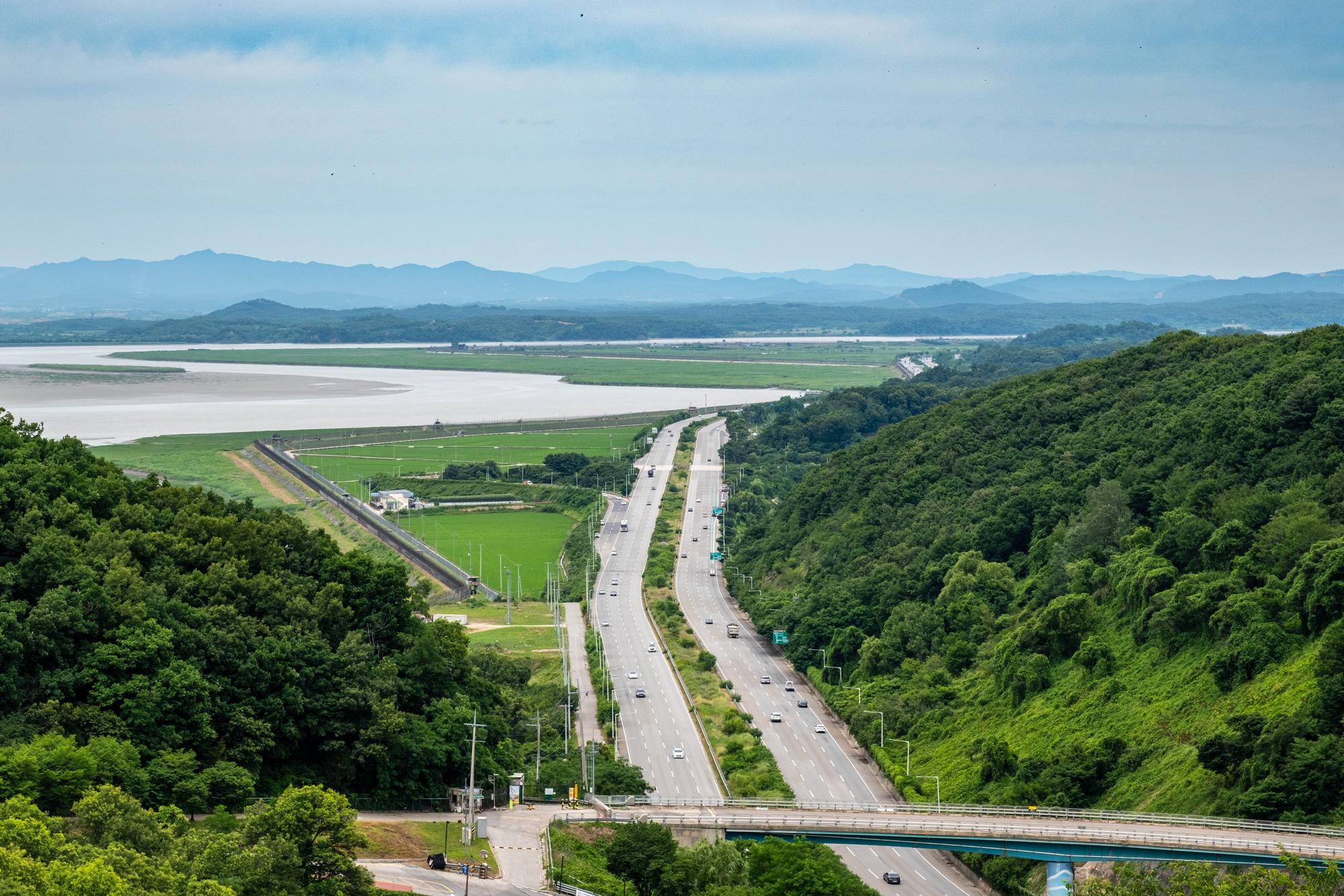
Jayu-ro, north of the Odusan Observatory. The Seongdong IC (in the center of the image) is the point on the road closest to North Korea, just 1,000 meters from the border in the middle of the Imjin River (June 2026).
For a few kilometers, in Paju City, this busy suburban motorway runs alongside the border with North Korea whose nearby villages and mountains, on the other bank of the Imjin River, suddenly seem within reach.
Here, there is no 4-km-wide DMZ to separate the combatants. North and South almost touch. The closest point on Jayu-ro to North Korea, the Seongdong Interchange (IC), is exactly 1,000 meters from the de facto border in the middle of the Imjin River. The South Korean military observation posts in the narrow restricted zone north of the road are even closer: the most forward one is just 650 meters from the enemy. The guard towers on both sides seem so close together, it’s as if the sentries could shake hands over the border if they wanted to.
This never happens, of course. But I can imagine how the soldiers must feel when they look into each other’s eyes at such close range.
The construction of the road so close to the border was not without significance.
First, the construction of this section in a restricted area relied primarily on military labor, which was less expensive. Second, the constant flow of modern cars and trucks within sight of the North Koreans had a significant psychological impact. Media reports indicate that during inter-Korean negotiations in 2004, a North Korean official remarked: “Why are there so many cars driving on Jayu-ro? Even the headlights are a burden to us,” thereby acknowledging the effectiveness of this “road propaganda.”
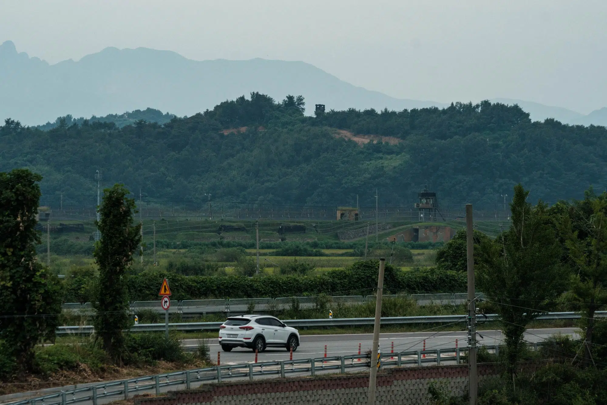
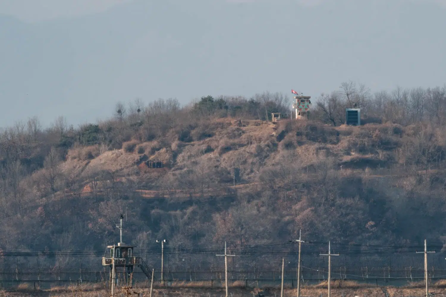
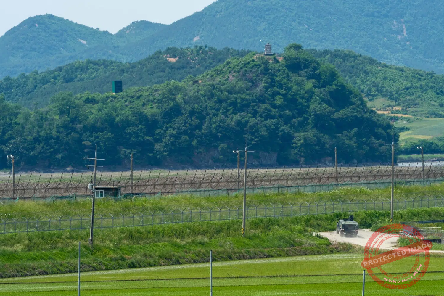
A car drives along Jayu-ro, past the South Korean border fence, while a North Korean guard post stands atop the hill inside the DMZ (September 2026).
Taking the Jayu-ro from Seoul to the North means an accelerated and extremely brief, but visual transition from the economic and cultural effervescence of the South to the rural landscapes of North Korea.
But few of the early morning commuters on the packed 2200 bus from Paju to Seoul will come out of their torpor or their cell phones to take a look at the hermit country to their right.
Until recently, signs on the highway still indicated to motorists that they were heading towards Kaesong and Pyongyang, in North Korea.
Indeed, for more than eleven years, from December 2004 to February 2016, the highway did continue to Kaesong, where the South had set up an industrial zone. But the complex has long since closed. And in late 2024, the North Koreans blew up the road just north of the border to mark the definitive breakup with the South. The Pyongyang signs on Jayu-ro have since been removed.
As soon as you leave Seoul, you realize that Jayu-ro is no ordinary highway.
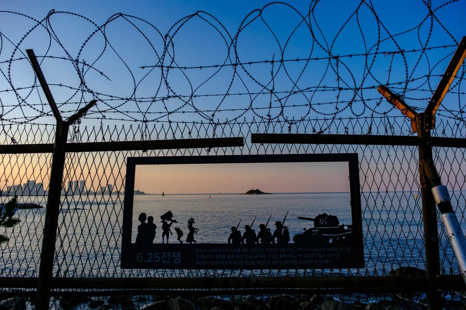
Just past the stone monument, located on the median strip of the highway and bearing the inscription: “Jayu-ro, the road toward unification”, barbed wire fences, searchlights, watchtowers, bunkers, CCTV and infrared cameras appear on the banks of the Han River, which runs alongside. Positioned in inconspicuous spots along the roadside, tanks with their guns pointed north are ready to fire on the invaders.
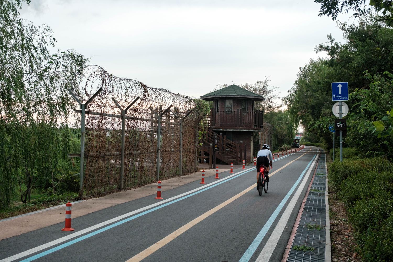
Former military infrastructure, preserved along the bike path that runs alongside Jayu-ro in the city of Goyang (August 2026).
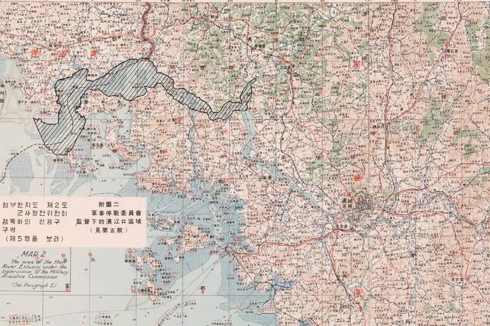
A few dozen kilometers downstream, the Han River marks the border with North Korea. The tidal estuary presents a complex network of mudflats, channels and waterways that could be exploited for covert approaches toward the capital, and it has been used as an infiltration route before by North Korean commandos. Three of them were shot dead in 1980 as they tried to enter Seoul in this way.
Hence the military’s reluctance to cede the riverbanks to the civilian authorities of the riverside cities, who are nonetheless calling for them to be turned into areas for strolling and relaxation. Since the 2010s, however, the city of Goyang has reclaimed part of its riverbanks and built promenades, a golf course, and bike paths there, while preserving some of the old military infrastructure, such as bunkers, watchtowers, and sections of barbed-wire fencing. Many areas along the riverbank, which are still mined (and, moreover, infested with venomous snakes), remain off-limits.
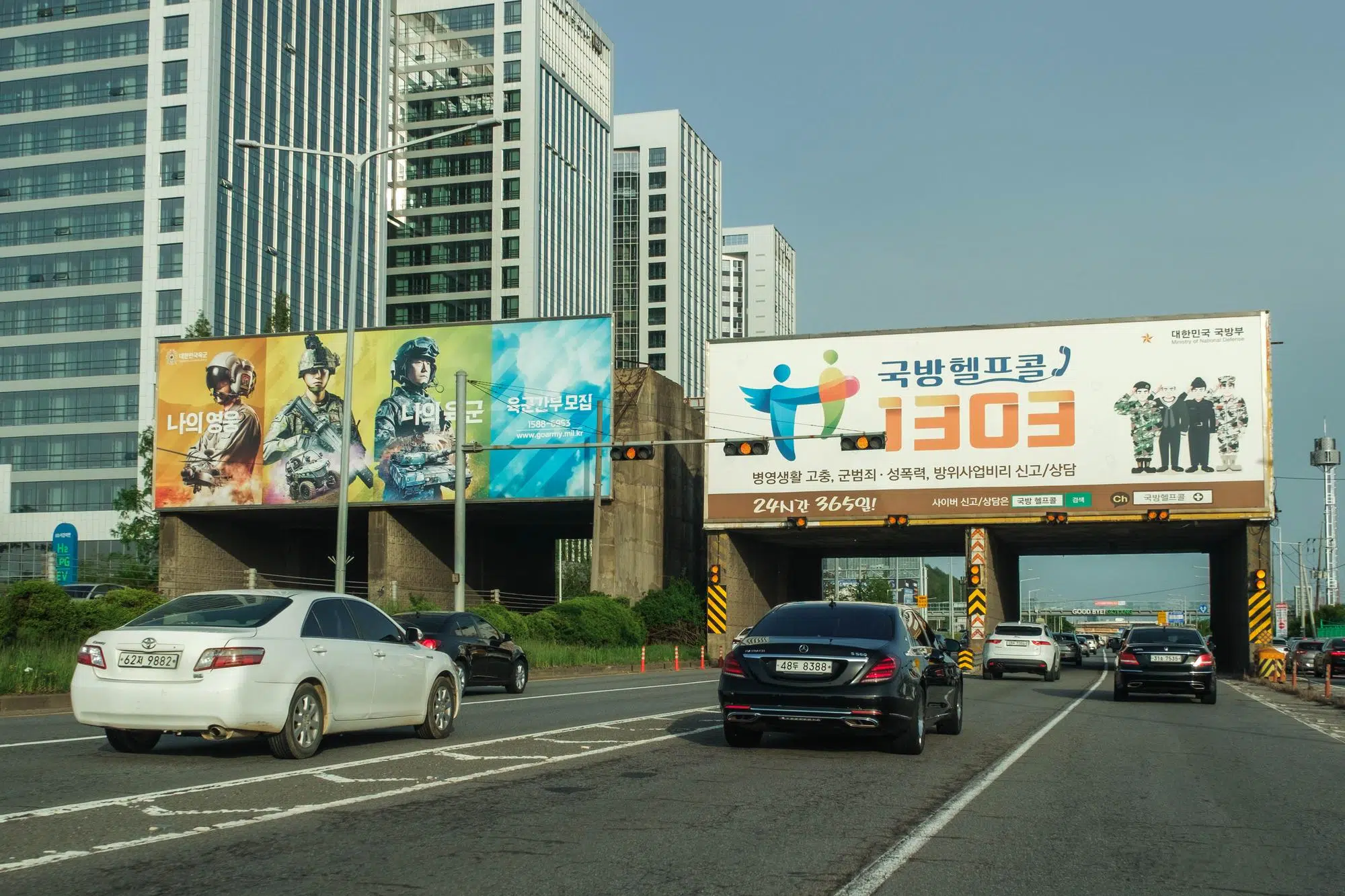
The Goyang “rock drop” anti-tank obstacle on Jayu-ro also serves as an advertising medium. The block on the left encourages young people to join the army. The one on the right encourages victims of bullying, sexual violence and corruption in the armed forces to call a hotline (May 2025).
Right at the northern exit of Seoul, the road is overhung by a huge anti-tank obstacle called “rock drop”: concrete blocks weighing several dozen tons resting on pillars packed with explosives that can be detonated in the event of an enemy invasion, blocking the way for armored vehicles. Incidentally, these facilities also serve as an advertising medium for the South Korean military.
Just to the south of the “rock drop”, between the road and the riverbank, a bike path crosses several rows of old “dragon’s teeth,” another type of anti-tank device. The site, which was previously a restricted military zone, was developed into a recreational area and opened in 2023 under the name “Yongchi Park” (yongchi means “dragon’s teeth” in Korean).
Rather than removing the concrete heavy blocks, the City of Goyang deliberately preserved them as a tangible reminder of Korea’s division and military history and designed the park around them, adding walking paths and a viewing platform on the Han River.
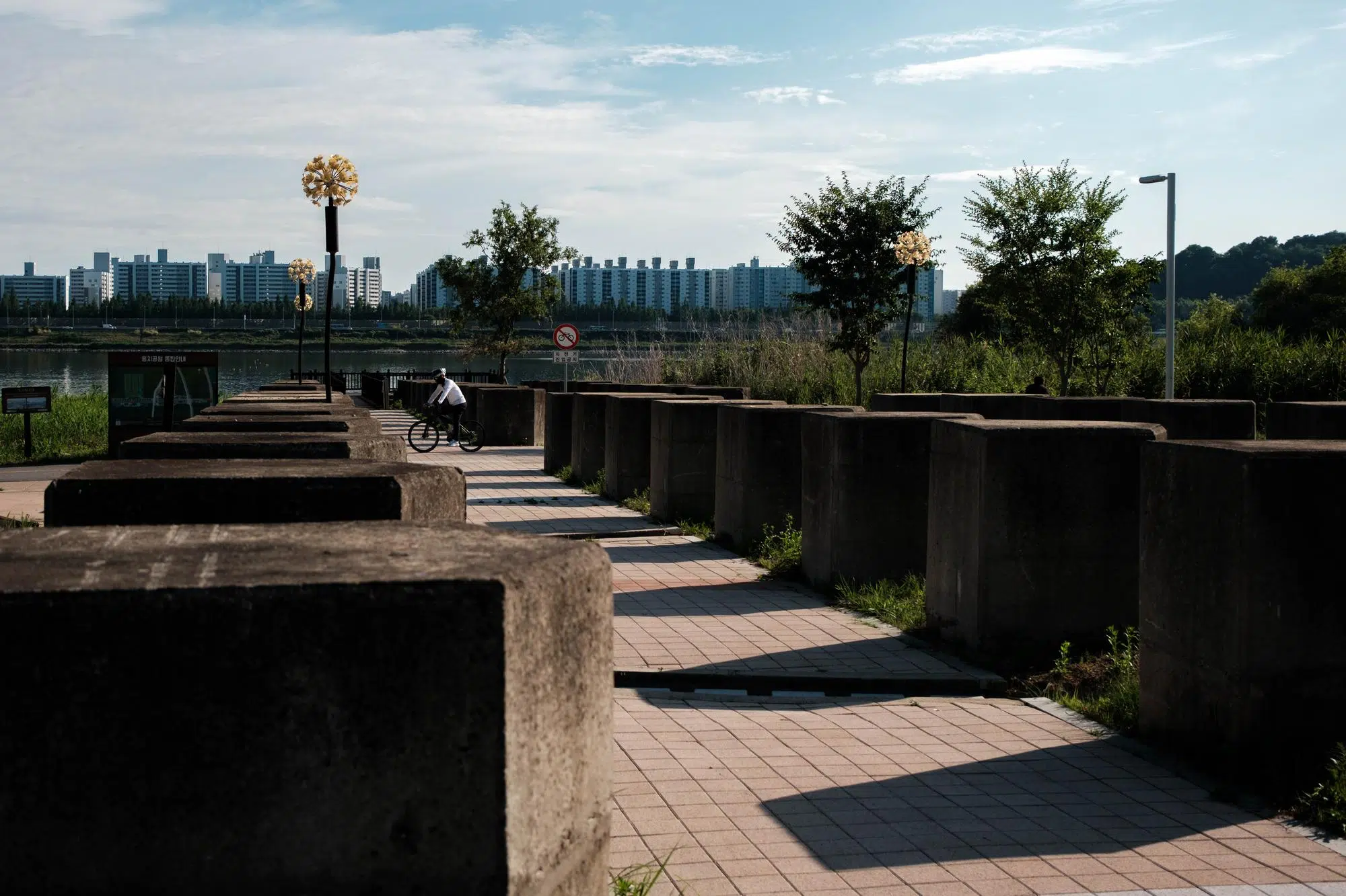
Rows of old “dragon’s teeth” obstacles in a park between Jayu-ro and the Han River in Goyang (June 2026).
Rock drops and dragon’s teeth obstacles can be found all over South Korea’s border regions. The fear of tanks is a legacy of the trauma caused when hundreds of North Korean Soviet-made T-34s rolled into the South at the start of the Korean War in 1950, destroying everything in their path (for their part, the North Koreans, traumatized by the rains of American bombs that reduced most of their cities to rubble, are obsessed with building air-raid shelters and digging tunnels).
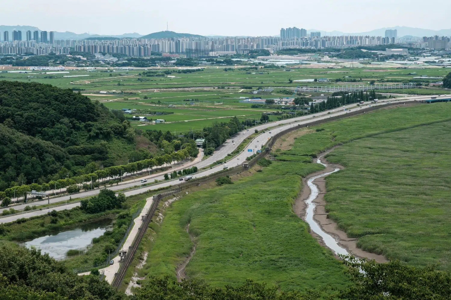
Jayu-ro as it passes through Paju, with fences lining a swamp along the Han River. Fortifications to prevent infiltration by combat swimmers or submersibles via the river, which further north marks the border with North Korea, extend along both banks almost to the gates of Seoul (June 2026).
A little further north of the anti-tank obstacles, the highway passes by the Singok Weir, completed in 1988, which spans the Han River between Goyang and Gimpo.
Unlike a conventional dam, it is a submerged structure. Its main purpose (which is disputed by environmental organizations) is to regulate the river and prevent saltwater from flowing upstream during spring tides. Another purpose, stated by the government at the time of its completion, is to prevent North Korean semi-submersibles to infiltrate the capital.
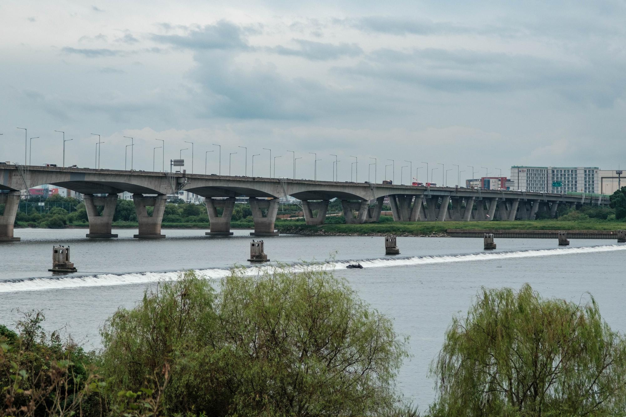
The Singok underwater weir, built on the Han River to prevent tides from the Yellow Sea and North Korean semi-submersibles from reaching Seoul (August 2026).
For nearly eight kilometers, the road then runs alongside the Janghang Wetland, a 600 meters wide Ramsar-listed site sandwiched between Jayu-ro and the Han River.
It is an intertidal zone with willow forests and salt marshes. It is also a military area that was off-limits for decades which, much like in the DMZ, has allowed a rich variety of wildlife to thrive. Here, right in the middle of the Seoul metropolitan area, you can find mainland leopard cats, Korean water deer (the males of which have long canines resembling those of vampires), raccoons, and numerous species of birds, fish, and crustaceans.
Access to the wetland remains restricted to the public, but former military watchtowers on its edge have been converted into an interpretation center and a bird observatory, right next to Jayu-ro and its constant traffic noise. Local farmers, who have been cultivating rice in the wetland for a long time, keep doing so and have signed contracts with the authorities to collaborate on conservation efforts such as providing food and resting places for migratory birds.
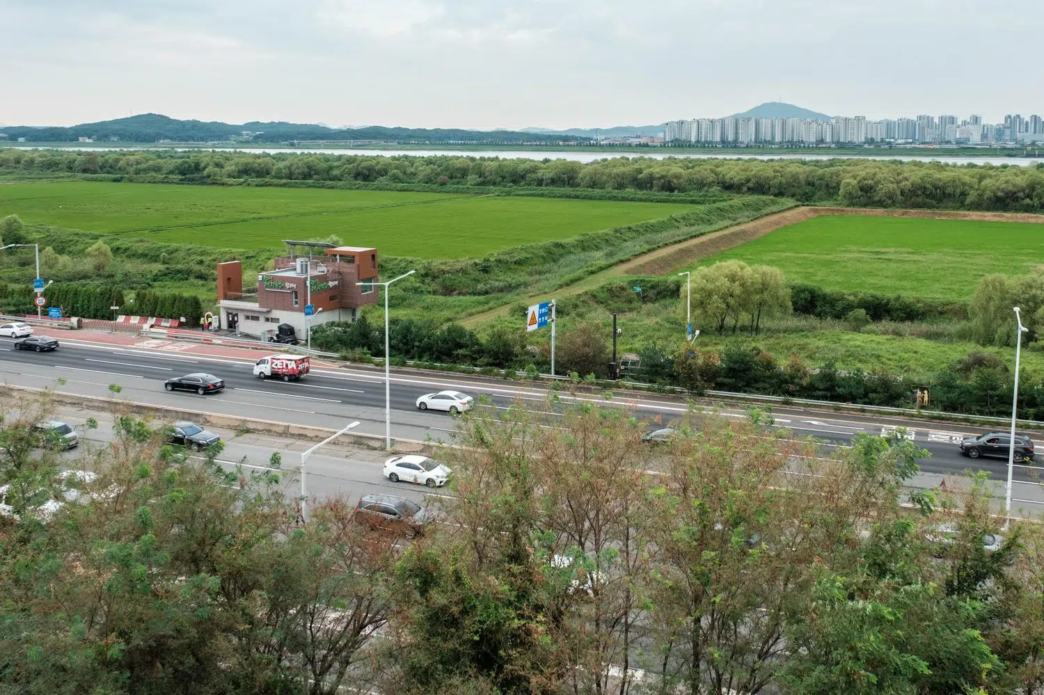
Jayu-ro runs alongside the Janghang Wetland, which has become a haven for flora and fauna thanks to its status as off-limits military land for decades. A former watchtower has been converted into a bird-watching facility (August 2026).
But the wetland is regularly affected by anti-personnel landmines of North Korean origin: planted along the DMZ, they are dislodged by floods and by the strong tidal range (about 9 meters) of the Yellow Sea, then drift down the Han River to Janghang. These devices (M14 plastic mines and wooden box mines) are difficult to find with metal detectors. Between July 2020 and November 2021, three mine explosions were recorded in and around Janghang, injuring two environmental cleanup workers (one of whom lost a foot) and one soldier. This ongoing risk has prevented the removal of accumulated waste at the site.
Further downstream, the road runs alongside other remarkable wetlands, protected from human activity by heavy anti-infiltration fortifications.
On a completely different note, between Seoul and Paju, the road runs past Ilsan New Town, built in the 1990s according to directives by the military to transform it, if necessary, into a hellish scene of street combats. So much so that in military circles, the town has been nicknamed ‘Ilsangrad’, in reference to the Battle of Stalingrad during World War II, which epitomises the horrors of urban warfare.
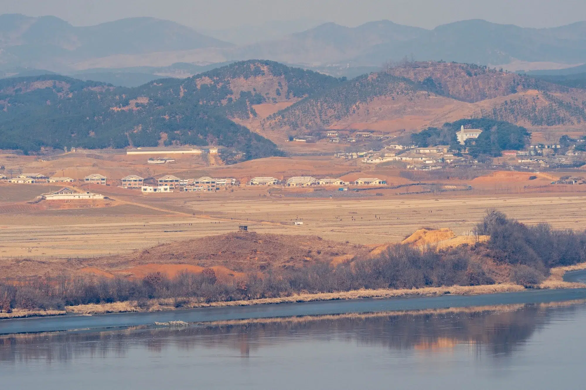
Farm work in North Korea, as seen from the South Korean side of the Imjin River (February 2025).
The most interesting part of Jayu-ro begins at the Odusan Observatory, which can be seen at the top of a hill on the left when coming from Seoul.
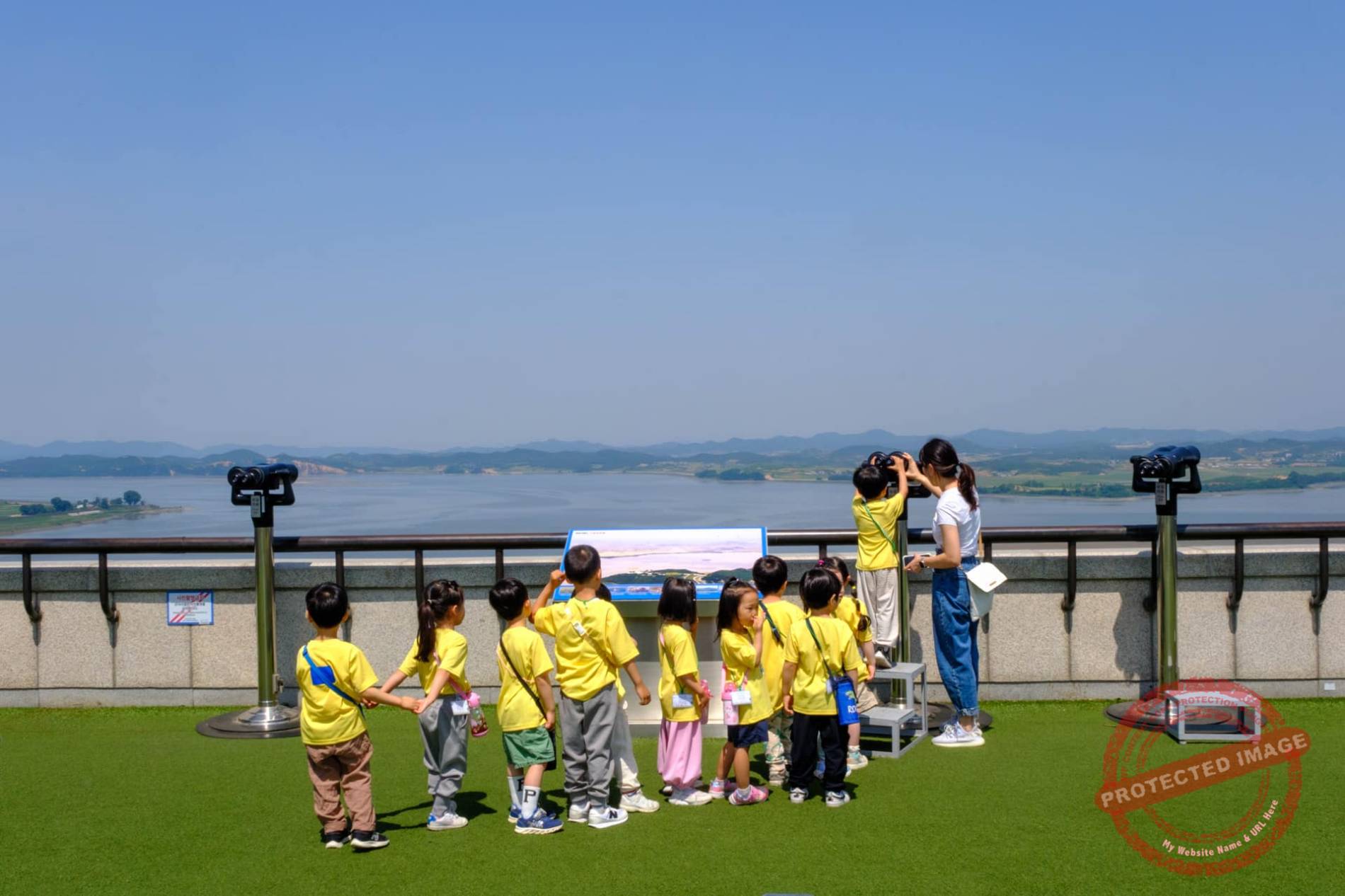
For several kilometers, the motorway runs alongside the Imjin River, which at this point marks the border. North Korean mountains, villages and watchtowers are clearly visible 2.5 kilometers away or less.
Here, the Jayu-ro marks the boundary of the Civilian Control Zone. Don’t think about getting out of your car, or venturing through one of the tunnels under the road. With the exception of the military and a few farmers authorized to cultivate fields near the border, anyone sneaking into this restricted and heavily monitored area runs a serious risk of being shot without warning.
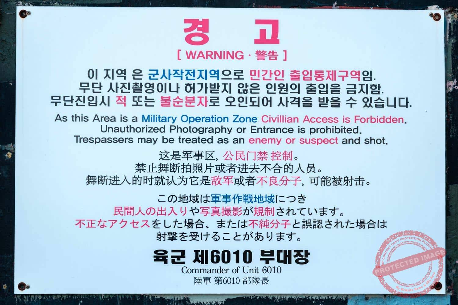
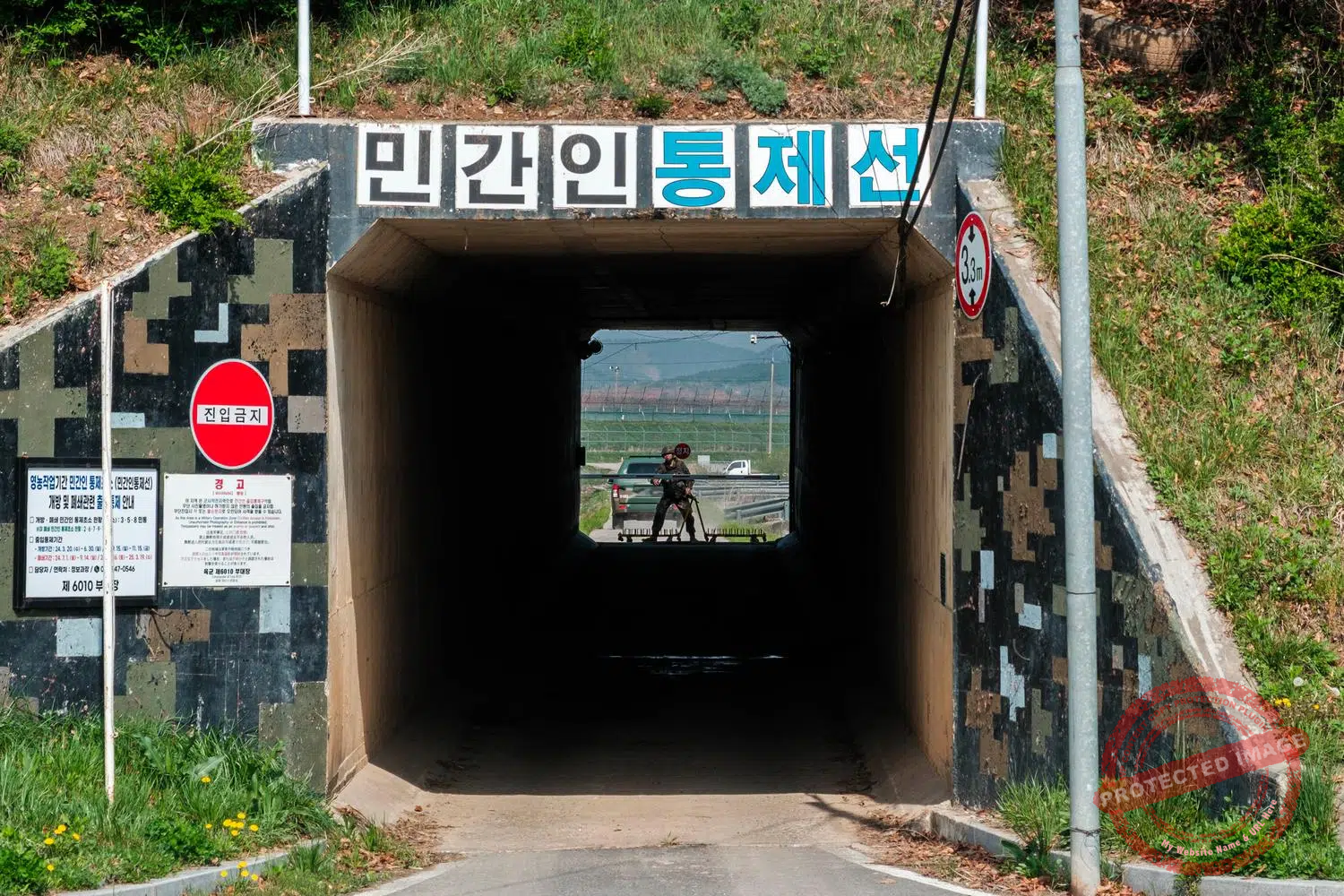
A tunnel under Jayu-ro marks the entrance of the Civilian Control Zone (April 2025).
The best place to safely watch the border and North Korea from the other side of Jayu-ro is the Daon Forest Cafe set up just off the highway since 2022.
The two-storey building boasts a spacious terrace and a comfortable lounge from which to take a long look at the landscape on a sofa while sipping a home-made beer or devouring a hearty brunch.
From this vantage point, the watchtowers of the North seem insanely close to those of the South, and the sunsets over the North Korean mountains are magnificent.
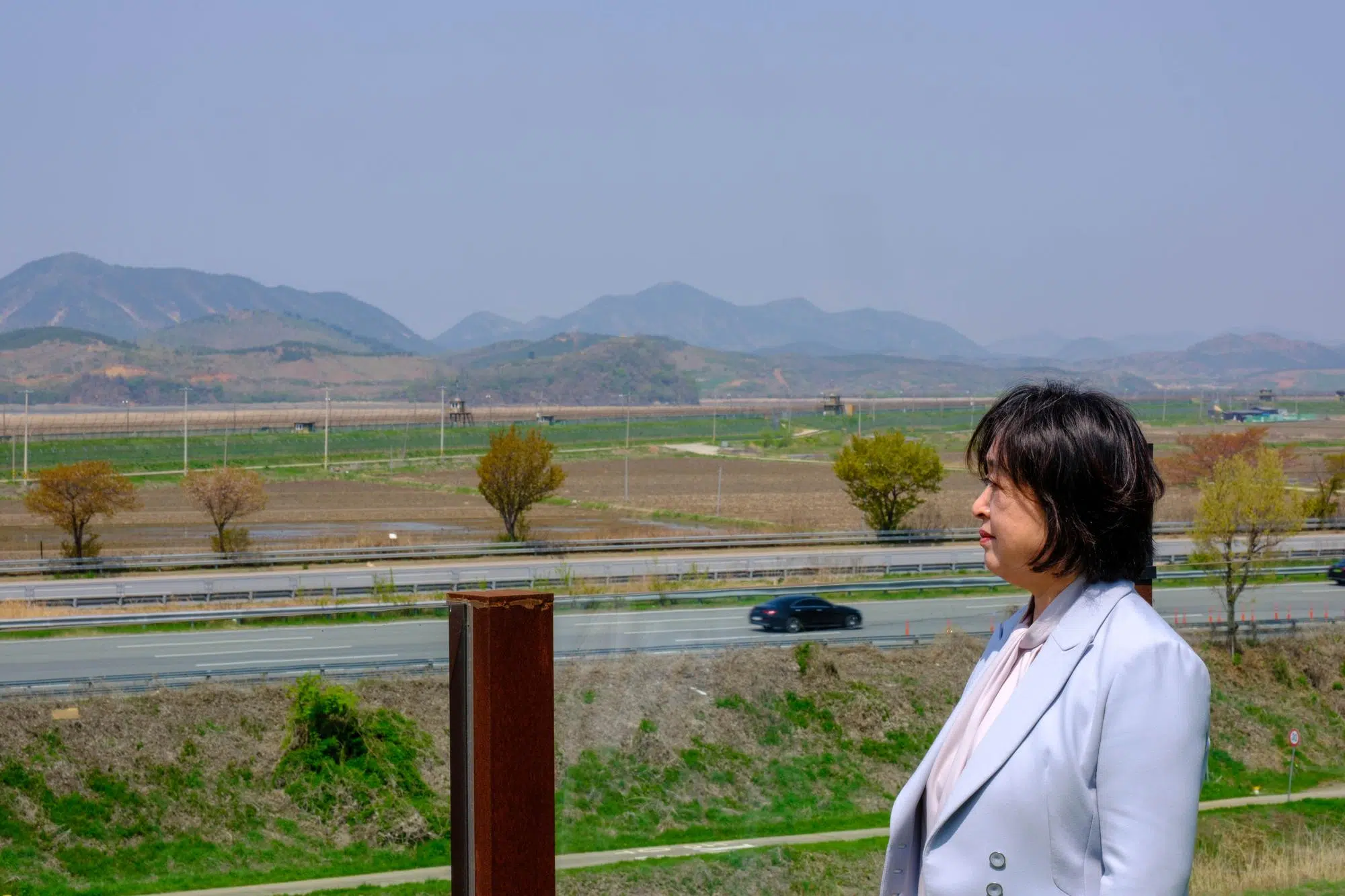
Lee Ho-sook, owner of the Daon Forest Café and daughter of North Korean refugees, looks towards the border from the cafe’s terrace (April 2025).
The café was founded by Lee Ho-sook and her husband, both children of North Korean refugees.
“Our parents wanted to return to the land of their birth, but they died before realizing this dream. So we chose a place close by, to think of them more often”, Ms Lee explained when I returned to the place in April 2025 with my AFP colleagues to report on her cafe.
The cafe also attracts North Koreans who have defected to the South. During family holidays such as Seollal (Lunar New Year) and Chuseok in the autumn, they can look across to their homeland from its terrace.
The Bunker Art Gallery
On the other side of the border, North Korean farmers go about their business, burning rice fields at the end of winter in a polluting agricultural practice eradicated in the South. The pungent smoke billows across the border and envelops the cafe, but some customers, indifferent like many South Koreans to their northern neighbor, are unaware of the cause.
“It looks so calm and peaceful right now, but many visitors don’t know that the North is just across the road, so when they find out, they’re surprised”, Mrs Lee said. “Most people forget that the country is divided and this reality is normalized.”
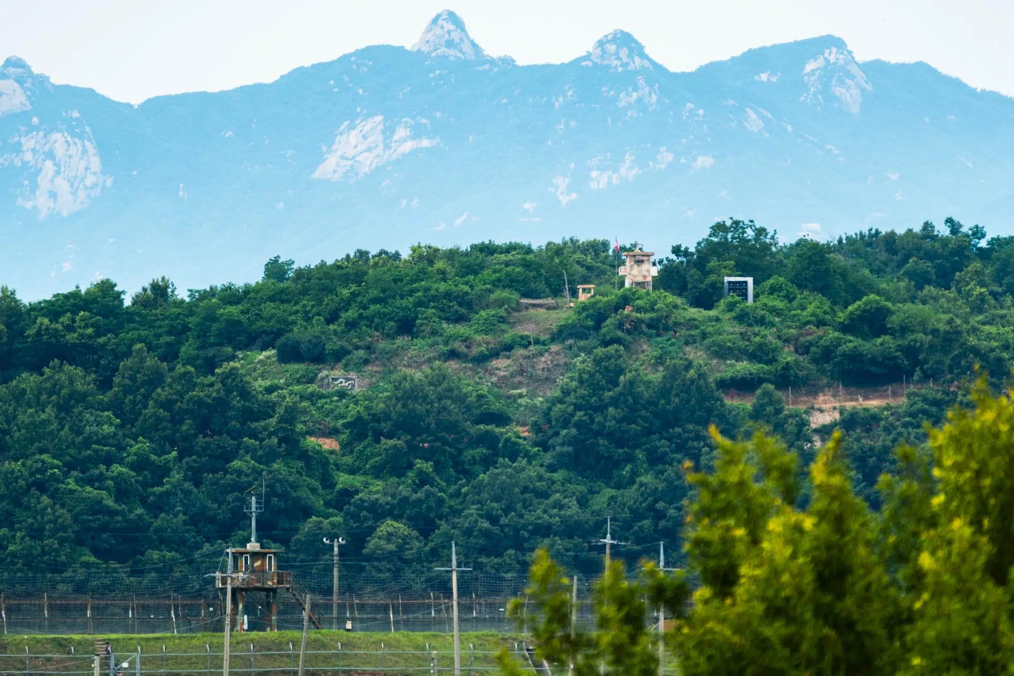
Seen from Jayu-ro, a North Korean guard post in the DMZ overlooks a South Korean watchtower across the border (June 2026).
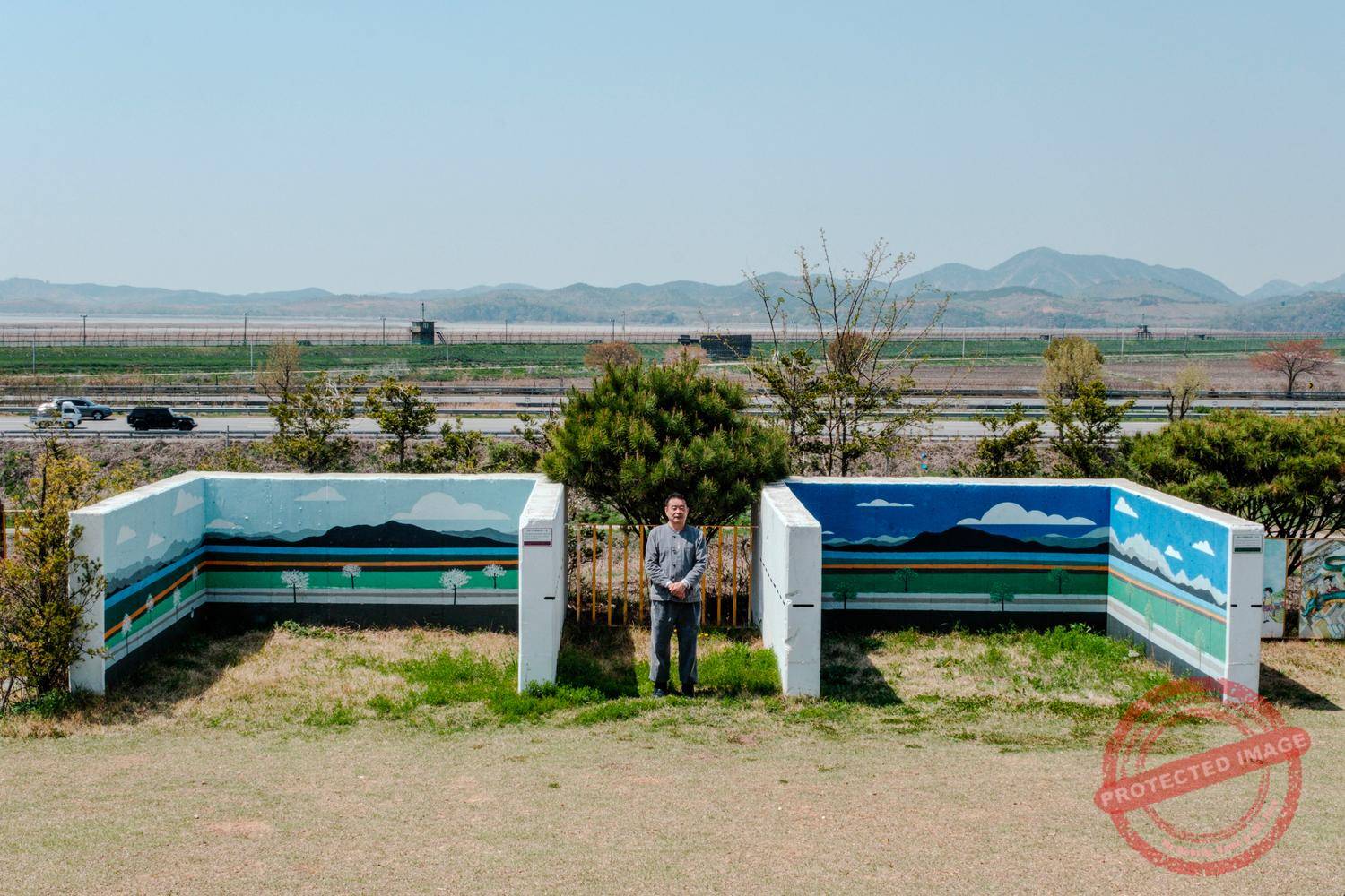
To obtain a building permit in this area so close to the North, the café owners had to agree to build a bunker, as well as four fortified tank positions on their land around the cafe, to be used by the South Korean army in the event of an enemy attack.
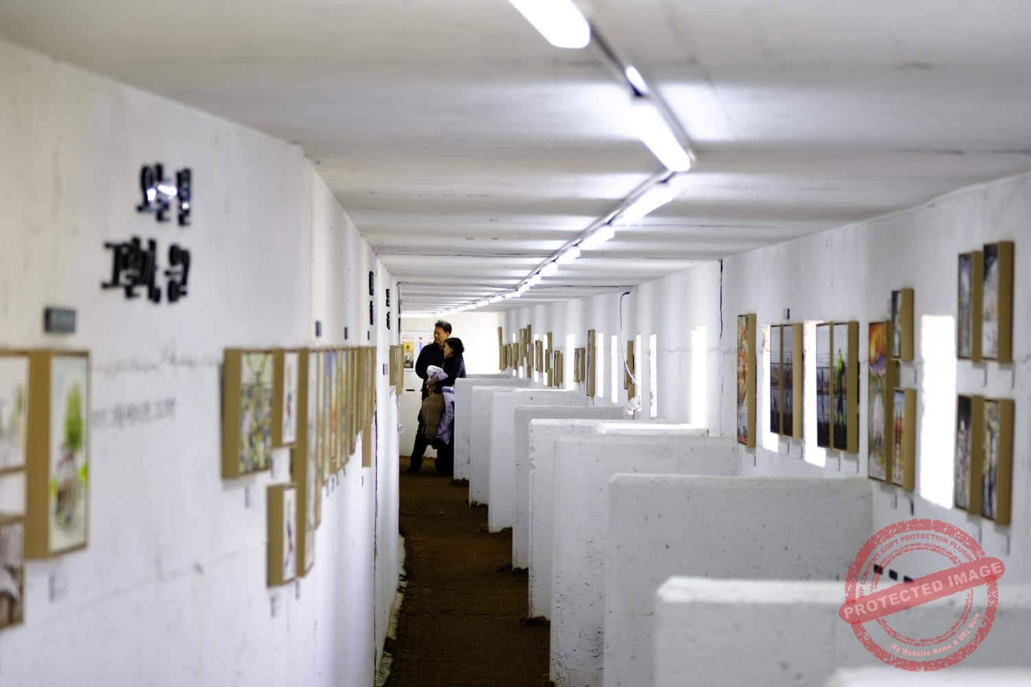
This 70-meter-long bunker lies beneath a vast lawn and includes 25 loopholes facing north, from which soldiers can fire on any invaders.
The facilities are requisitioned once a year for military exercises. The rest of the time, Kim Dae-nyeon, an artist from the border city of Paju where the café is located and a former secretary general of the South Korean National Electoral Commission, exhibits his drawings there.
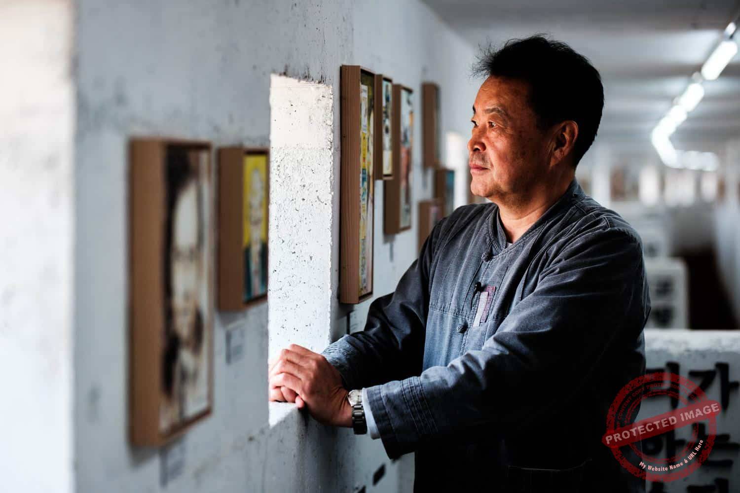
Artist Kim Dae-nyeon, alias Danny Kim, poses inside his bunker gallery in Paju (April 2025).
His 40-year career in the service of democracy, he says, has profoundly influenced his art.
“I hope North Korea will also adopt democracy and freedom one day. My convictions about peace and freedom have continued first through my public career, and now in my artistic work,” he said.
Many of his drawings deal with the division of Korea and the hopes of reunification.
One of them depicts an imaginary bridge spanning the Imjin River. In others, comic-book superheroes like Spiderman or the Incredible Hulk attacking border fences. Another shows weasels demonstrating, noise-cancelling headphones on, against noise pollution from the North.
Mr Kim also painted the four tank fortified positions in the colors of the four seasons.
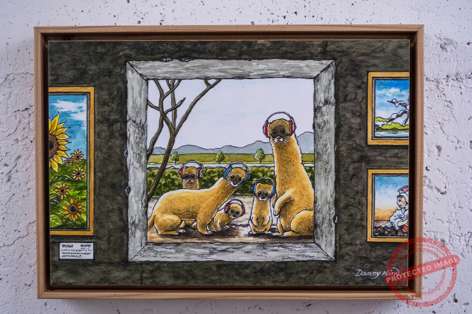
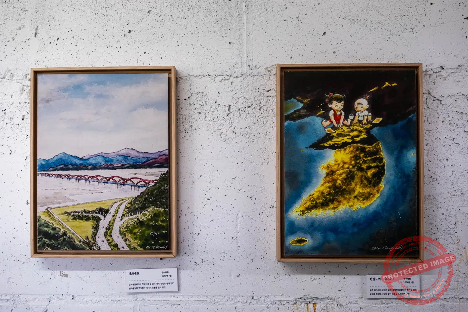
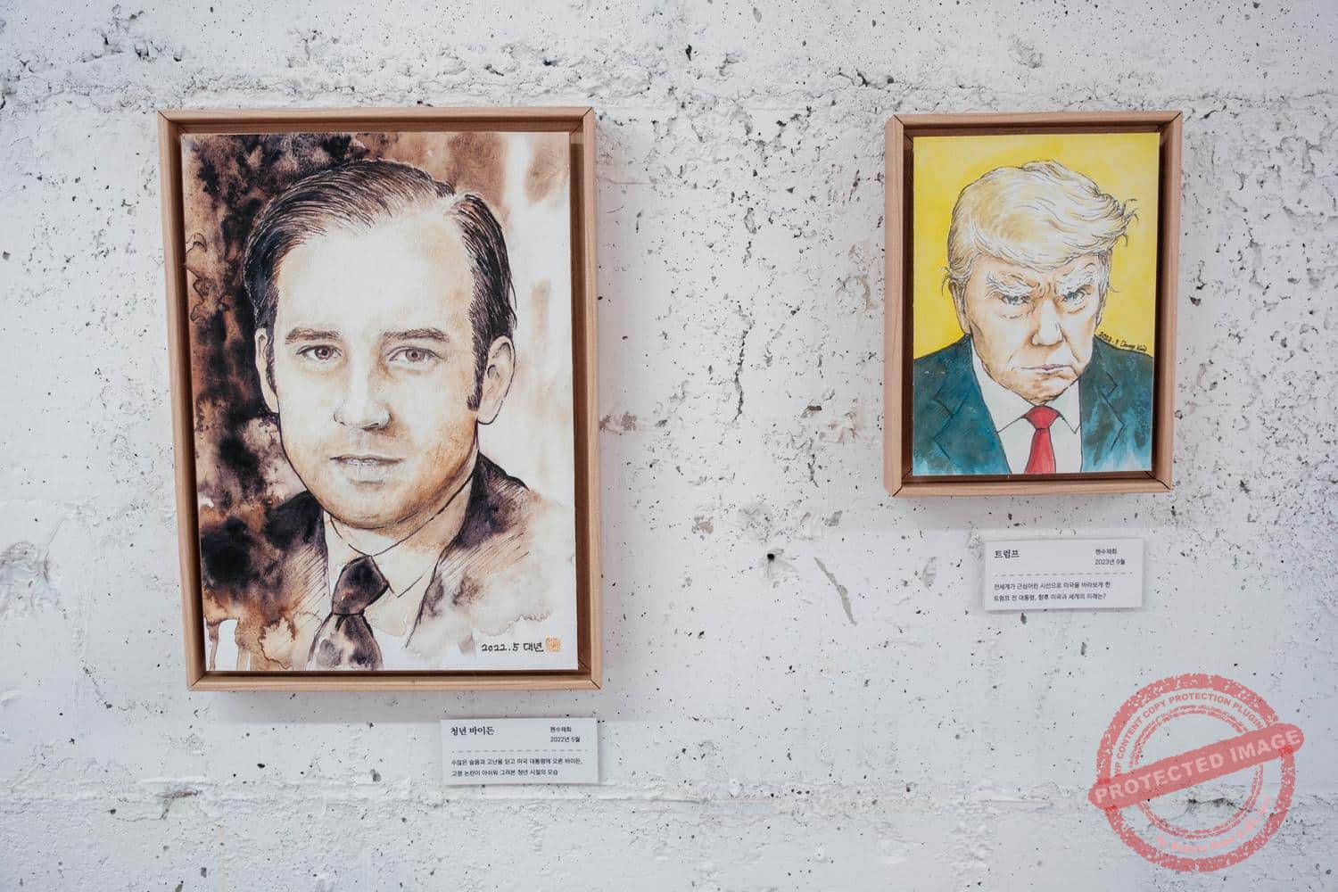
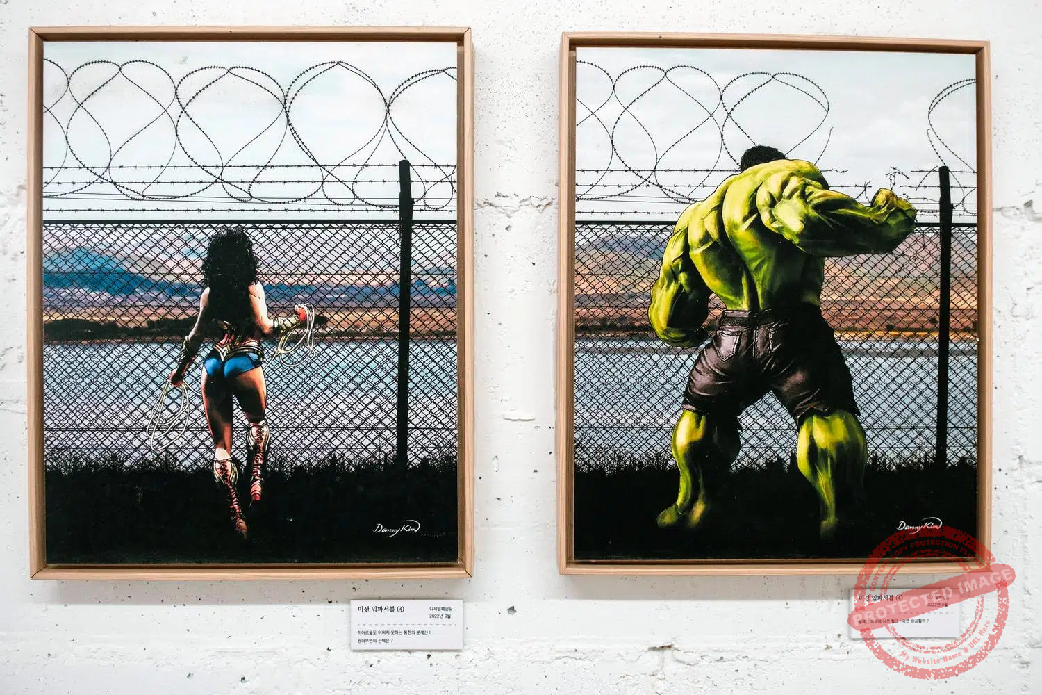
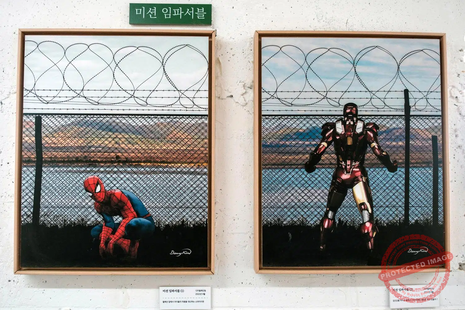
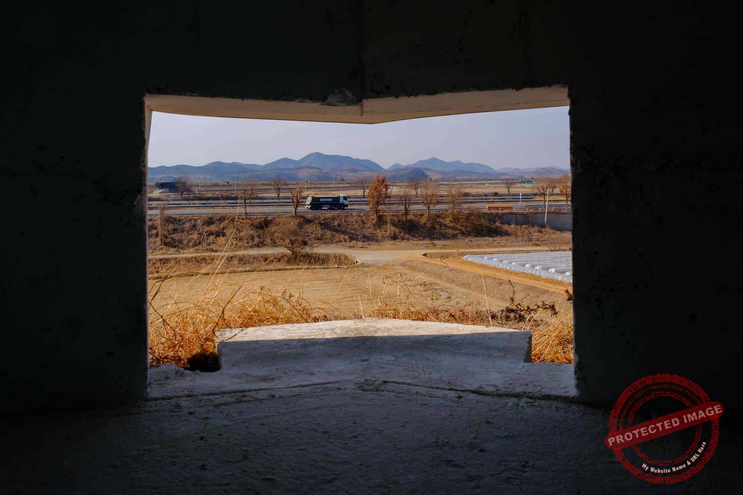
He has named his gallery “Bunker Gallery Yes!”, as his main theme is “응” (pronounced “eung”), which means ‘yes’ in Korean”.
“It’s a word that symbolizes empathy, harmony and reconciliation”, he said. ”This character also symbolizes North and South Korea, separated but hoping to reunite. The horizontal line can represent the Imjin River or the ceasefire line – the point at which union can occur, like sunset over the West Sea”.
“When life gets tough, I come here and look at North Korea”, Mr Kim said. “Our compatriots there live in far worse conditions. When I look north, I feel grateful to be here, free and I regain the confidence to go on living. I hope that the whole world will become aware of this suffering, and that there will never be another war here. And until the day peace really comes, I’ll keep on painting”.
Power line to nowhere
Further north on Jayu-ro, near Munsan, a 154 kv high-voltage power line runs over the highway and the Imjin River.
The unremarkable transmission towers are easy to miss, even though the direction of the high-voltage line –from south to north– is striking in this border region. It is hard to imagine that they are the remnant of one of the more improbable industrial experiments in inter-Korean history.
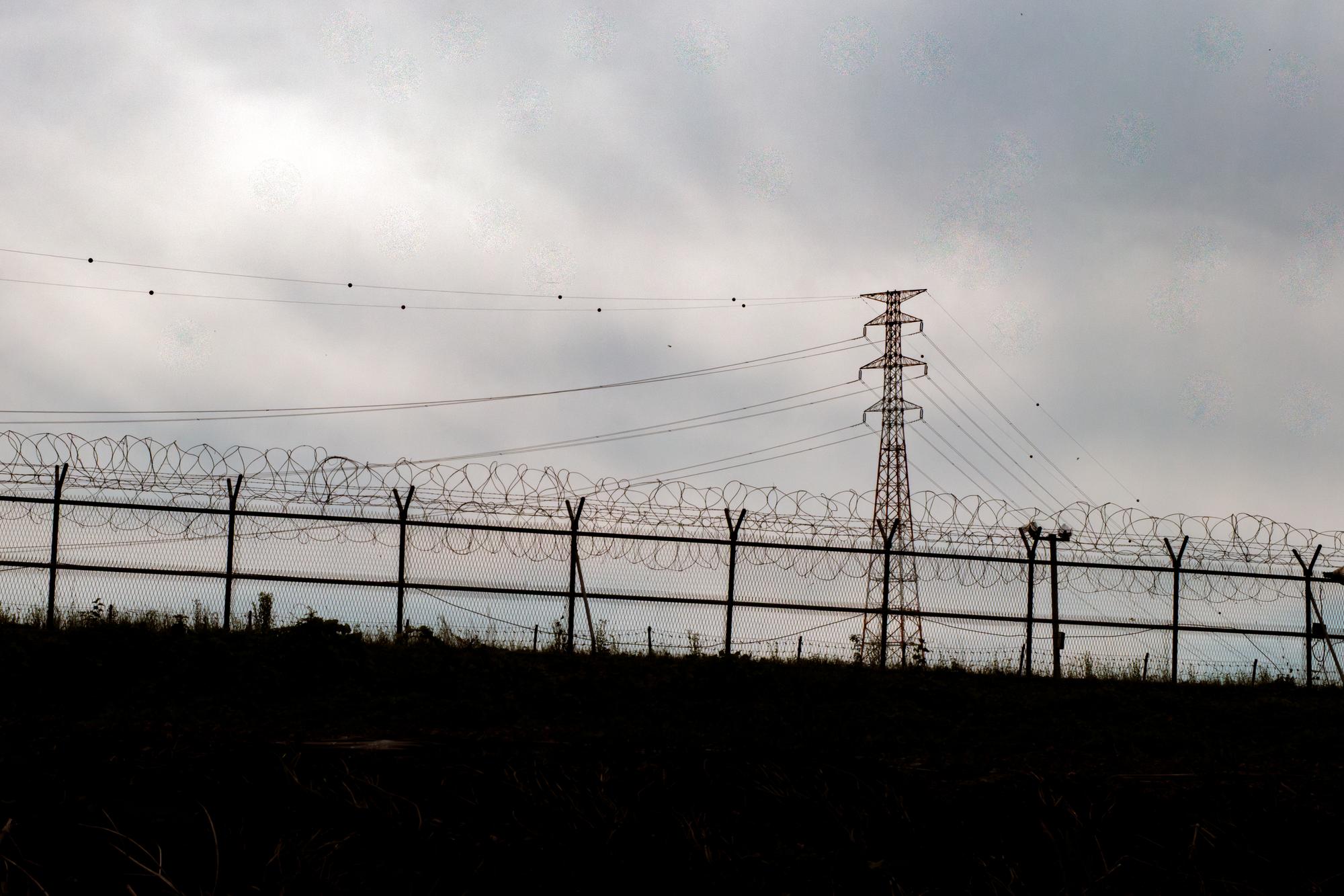
The high-voltage electric line that once supplied South Korean power to the North (June 2026).
In January 2007, Korea Electric Power Corporation (KEPCO) installed 48 high-voltage transmission towers along a 16-kilometer corridor following the old Gyeongui road, including 15 towers on the North Korean side of the Military Demarcation Line. The purpose was to carry electricity from the Munsan substation in Paju to the “Peace Substation” at the Kaesong Industrial Complex, in North Korea, which employed thousands of North Korean workers for some 120 South Korean companies (the site of this complex is visible from the Dora Observatory in the DMZ).
The arrangement did not last. Power supply was first suspended in February 2016, when Seoul shut down the complex entirely following a North Korean nuclear test.
It briefly resumed in 2018, when the inter-Korean liaison office in Kaesong reopened, only to stop again in June 2020 after North Korea blew up that same liaison office. The wires have carried nothing since.
Then, starting November 24, 2024, North Korean soldiers were spotted cutting the high-voltage cables on their side of the DMZ. They began with the lines connecting the first tower north of the border, piling the severed wires on the ground. Although Pyongyang has never officially stated the reason for this dismantling, it is easy to deduce that the aim was to recover the copper from the electrical wires, a scarce commodity in North Korea, which cannot easily import it due to international sanctions.
By early December, four of the 15 towers on the North Korean side had collapsed, apparently because removing the tensioned cables had compromised their structural integrity. South Korea’s government released surveillance footage showing a North Korean worker, high up on a transmission tower and apparently wearing no safety harness or helmet, falling several stories during the dismantling work. His fate was not confirmed.
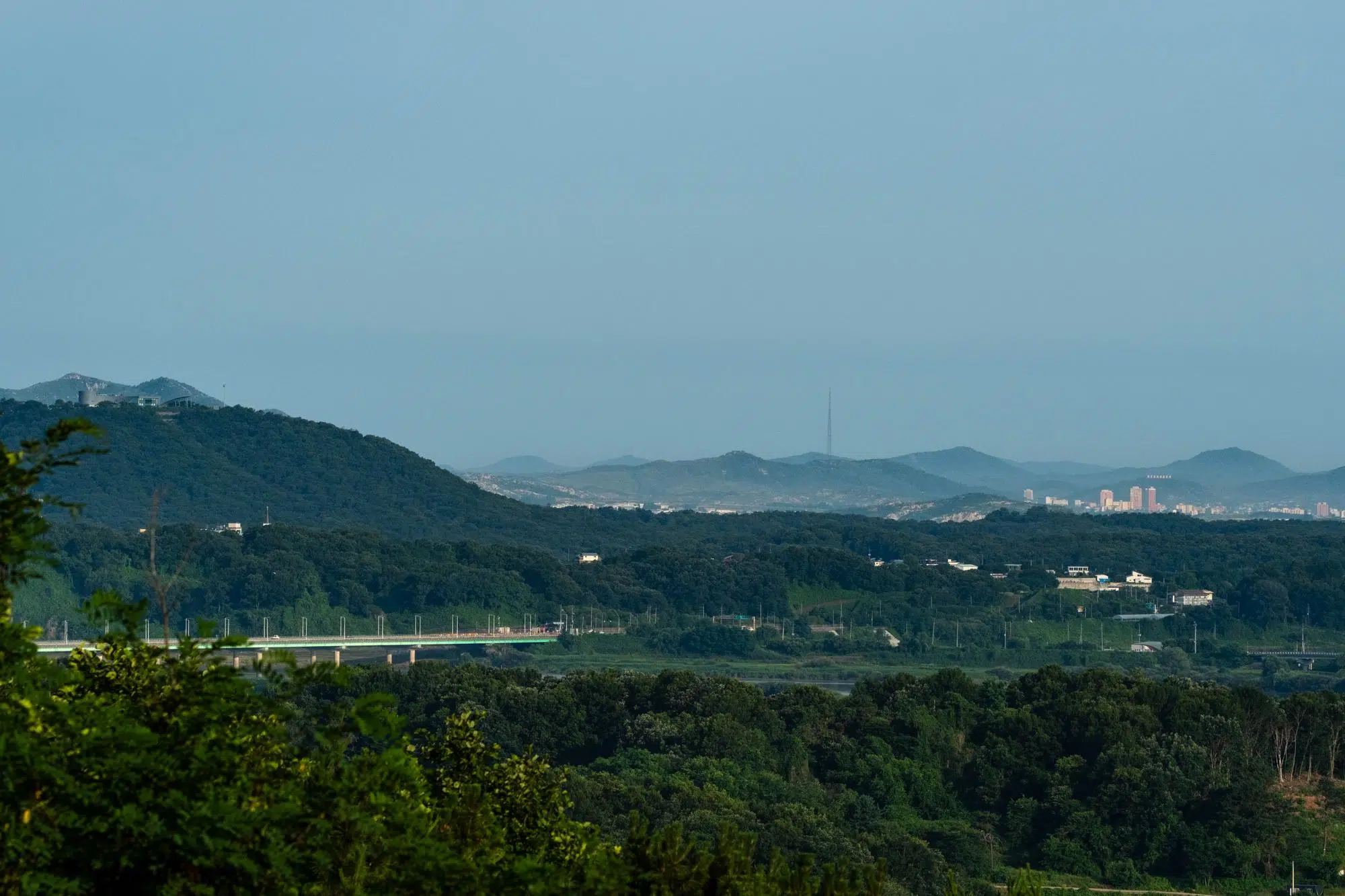
Jayu-ro ends at the Tongildaegyo, or Unification Bridge (bottom left), which spans the Imjin River. At this point, the highway joins Tongil-ro, or Unification Road, that continues towards the DMZ and used to link up with a South Korean-built industrial complex in the major North Korean city of Kaesong (top right), but is now cut off at the border (June 2026).
During the harsh Korean winter, the busy motorway ending at the border with the other world is prone to sudden fog banks and black ice patches, making it one of the deadliest roads in South Korea. This was all it took for it to become the focus of a creepy urban legend.
In this Korean variation of the “vanishing hitchhiker” tale, a woman wearing sunglasses can sometimes be seen along the side of Jayu-ro. Those who get closer to this ghostly hitchhiker soon realize that she’s actually not wearing dark glasses, but has completely empty eyeballs.
The ghost turns out to be quite harmless, as she simply asks motorists to drop her off at a cemetery, where she evaporates.
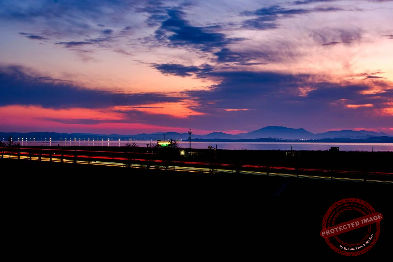
Jayu-ro by night (February 2025).
Noise Wars
A North Korean watchtower and a giant loudspeaker overlook the South Korean fortifications along the Imjin River, as seen from the Daon Forest Cafe in Paju (June 2025).
For decades, the two Koreas have waged intermittent ‘loudspeaker duels’: a ritual of psychological warfare where news bulletins, patriotic music, propaganda messages and, more recently, mixes of terrifying noise ride the wind over the DMZ, the Hangang Estuary and the Imjin River. The city of Paju, and more specifically the neighbourhoods bordering Jayu-ro, is one of the areas most affected by these gruelling ‘noise wars’ when they occur.
The peculiarity of these wars is that it was always South Korea that started them.
South Korea began its fixed-line broadcasts in 1963, and the North soon countered with its own systems. Content ranged from international news to K-pop hooks, interspersed with appeals to defect and denunciations of the other side’s regime.
For long stretches, the two Koreas have agreed to pause the noise. A 2004 understanding effectively silenced the speakers—until crises reopened the switch boxes.
The latest escalation in sound tensions – and undoubtedly the most bizarre ever heard at the border – began under right-wing President Yoon Suk Yeol, a hardliner against Pyongyang.
In 2024, in retaliation for South Korean activists sending balloons loaded with propaganda into its territory, North Korea sent hundreds of balloons loaded with trash to the south, some of which even ended up in the grounds of the presidential compound in Seoul. The south responded by bringing the loudspeakers back into service at the border for the first time in years. As before, the audio programme included news bulletins, K-pop for young people and traditional Korean ballads for their elders.
This time, North Korea’s response took on a completely new form.
Instead of shouting slogans against the ‘puppet regime in the South’ or calling on South Korean soldiers to defect to the socialist paradise, the North’s giant loudspeakers began blasting out a deafening soundtrack worthy of a horror film every night, mixing wolf howls, death rattles, the crackle of automatic weapons, explosions, haunting laughter and screams, and sinister music.
Often exceeding 80 decibels in the South – the equivalent of a vacuum cleaner running at full power – the North Korean noises rattled the windows of houses in Paju and on the border island of Ganghwa, putting a strain on residents’ nerves and sleep.
Upon taking office in June 2025, South Korea’s new liberal president Lee Jae-myung ordered his country’s loudspeakers to be silenced. The very next day, North Korea did the same, and the noise nightmare ended overnight.
While the South Korean army has since dismantled its giant loudspeakers at the border, North Korea has left its own in place, perhaps anticipating a new wave of sound attacks when the political winds change again in Seoul.
This page was last updated on: September 13, 2026.