Cheorwon
철원

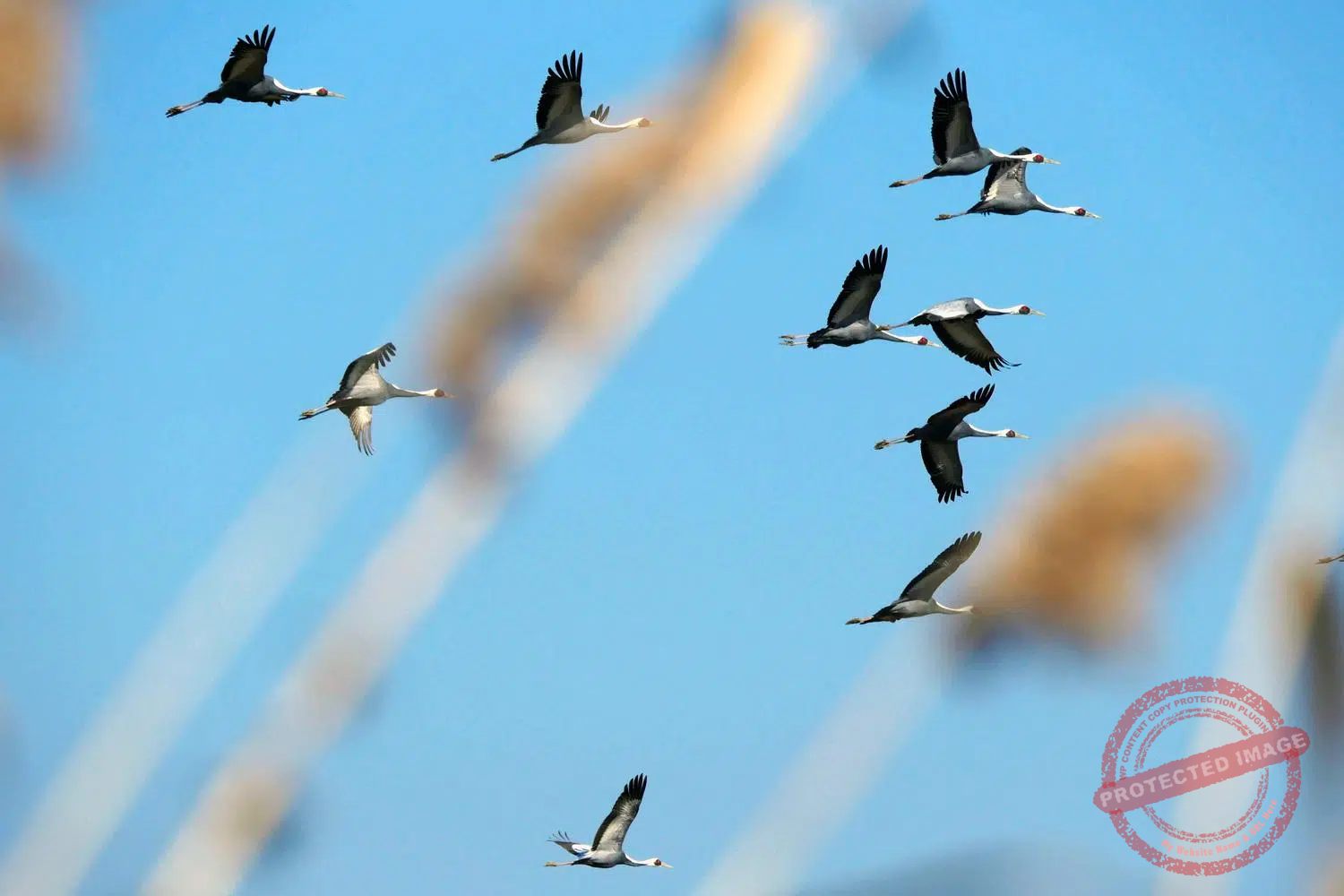
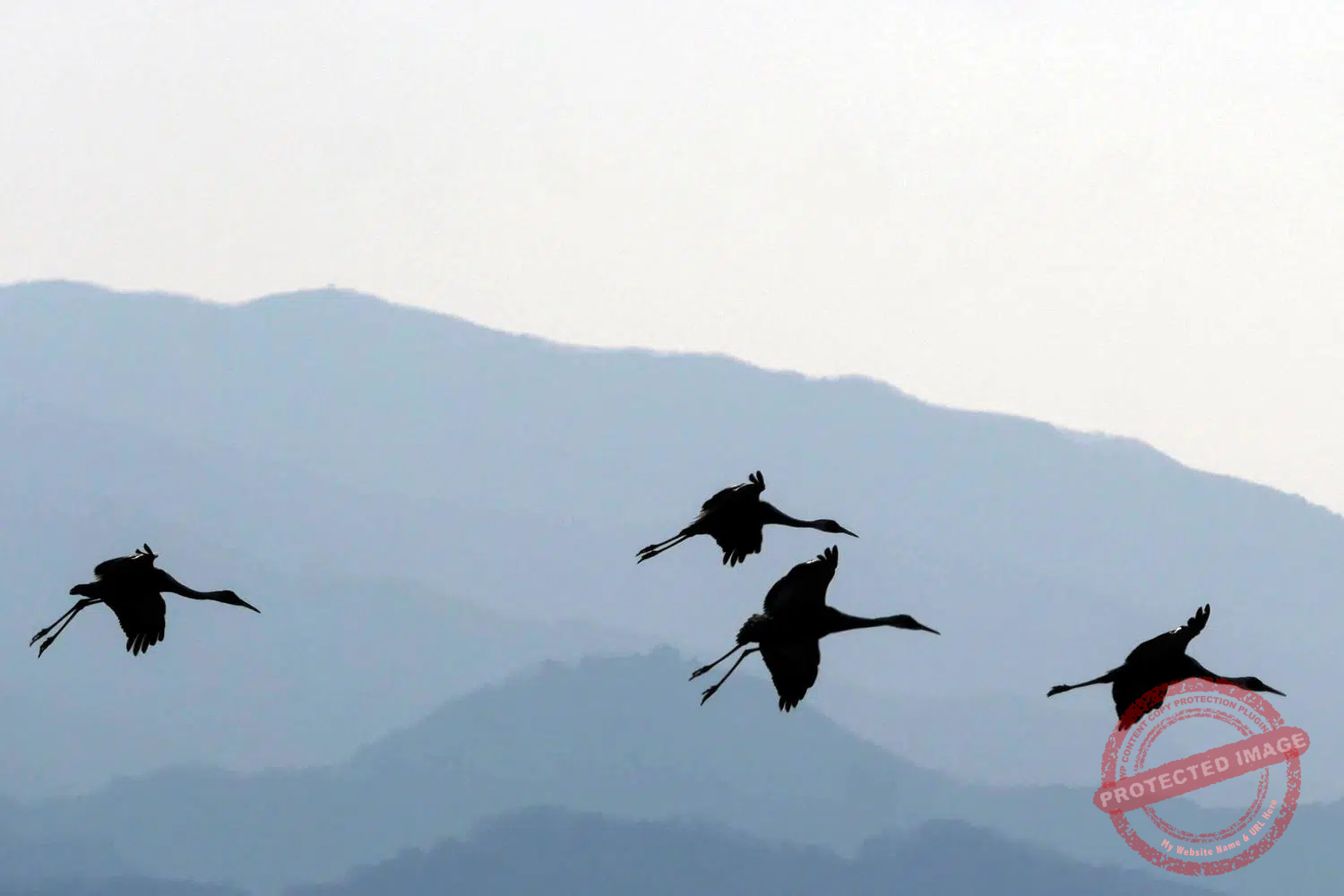
Korean cranes – also called Red-crowned cranes – fly over the Civilian Control Zone in Cheorwon (January 2024).
My intention in coming to Cheorwon, in the center of the Korean peninsula, was to get another glimpse of North Korea over the DMZ. That part of the trip was satisfied, and I got my fill of Korean People’s Army watchtowers and North Korean villages in the distance.
But the surprise came in the form of cranes.
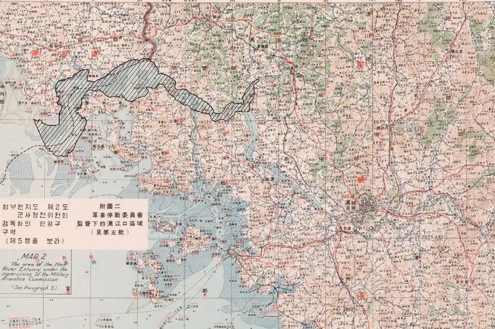
Thousands of them, all the way from Russia’s Far East, Mongolia or Manchuria to spend the winter in the Civilian Control Zone (CCZ), located just before the DMZ and the military demarcation line between the two Koreas, a strip of heavily mined land where all human activity is severely restricted.
A veritable kingdom of cranes. A surreal natural spectacle amidst barbed wire, minefields and military vehicles.
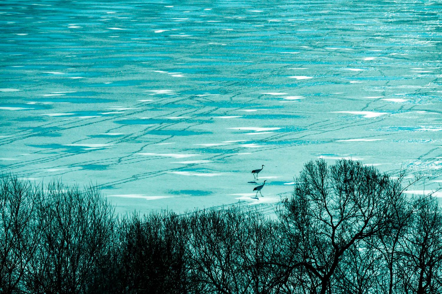
The huge red-crowned Cranes – also called Korean Cranes or Manchurian Cranes – and the White-naped Cranes that spend the winter in the wetlands and rice paddies of Cheorwon are both endangered species. They are highly symbolic in East Asian cultures, associated with longevity, peace and fidelity.
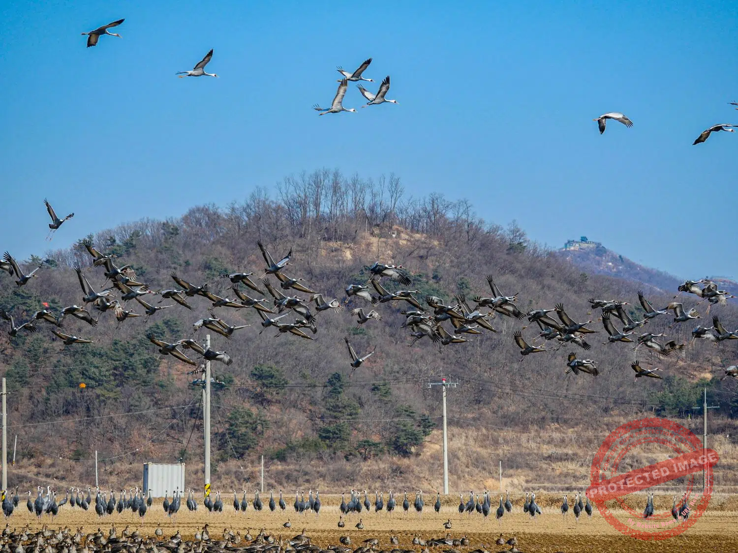
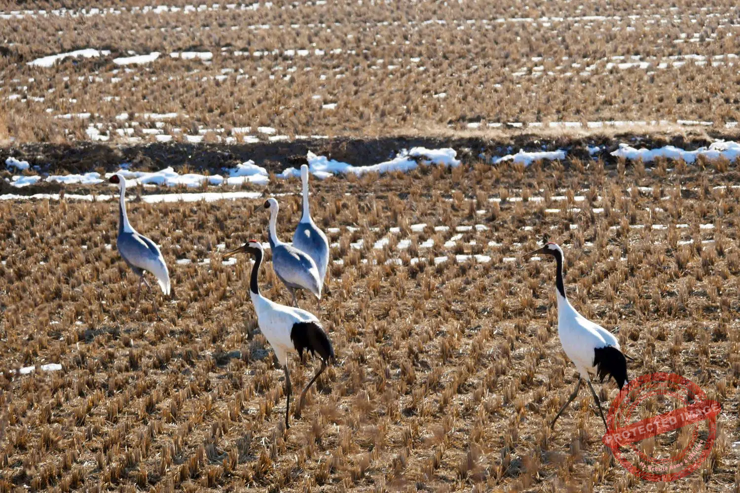
Red-crowned Cranes and White-naped Cranes inside the Civilian Control Zone in Cheorwon (January 2024).
The DMZ, where no-one is allowed except soldiers from both sides, and the adjacent Civilian Control Zone have been migratory birds sanctuaries since 1953.
Cheorwon is probably one of the best places to observe this phenomenon. Where cranes, vultures, eagle-owls, ducks and other birds have taken advantage of the geopolitical situation to take up residence in and around the DMZ, where no one would disturb them.

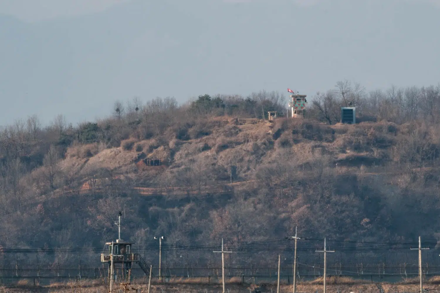
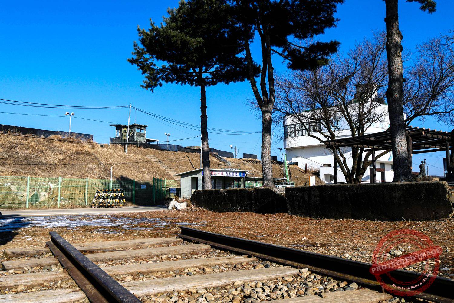
North Korean watchtowers and soldiers seen from the Cheorwon Peace Observatory (June 2025).
During the Korean War (1950–1953), Cheorwon emerged as one of the most strategically significant and fiercely contested areas on the peninsula.
Since 1945, Cheorwon had been part of North Korea, falling just north of the 38th parallel. However, as battle lines shifted throughout the conflict, it became a key objective for United Nations and South Korean forces aiming to penetrate deep into enemy territory.
Cheorwon formed one corner of the “Iron Triangle”, alongside Pyeonggang and Gimhwa. This triangle was the centerpiece of Korea: a flat basin, surrounded by high peaks, through which an important road and rail network linked the north and south of the Peninsula. Whoever controlled the Iron Triangle would become master of the whole country.
No one was going to let that happen.
The White Horse Hill Battle Memorial in Cheorwon (January 2024).
Controlling the heights overlooking the plain, and thus having a commanding view of approaching enemy forces, became a top priority for both North and South.
By late 1951, as the war devolved into a bloody stalemate, Cheorwon and its surrounding hills became emblematic of the attritional phase of the conflict.
Battles in the area were not necessarily about capturing territory, but about wearing down the enemy and securing favorable positions for eventual armistice negotiations. In the end, there were thousands of deaths, but no decisive conquests on either side.
One of the most famous engagements in the region was the Battle of White Horse Hill in October 1952.
Over 9 days, South Korean troops —with UN support—repelled repeated Chinese assaults in a brutal, close-quarters fight. The hill changed hands 24 times during that short period. It is calculated that the Chinese fired 55,000 shells and the South Korean forces 185,000 during the battle. In addition, the US Air Force dropped more than 3,000 bombs of all kinds on the hill, including napalm.
After this deluge of fire, the hill, previously known as Hill 395, took on a shape reminiscent of a skeletal white horse, hence its name.
About 15,000 soldiers of both sides died here. Ultimately, the South Korean forces took control of the hill. The front was later stabilized a few kilometers north, and those positions stand as the military demarcation line between the two Koreas until nowadays.
Today, the Cheorwon basin is still considered a potential invasion corridor from the north. Hence the imposing fortifications south of the DMZ, and the numerous anti-tank obstacles lining the roads throughout the region.

An anti-tank obstacle – camouflaged with flowers and touristic slogans – on a road near Cheorwon (May 2025).
North Korea’s interest in the Cheorwon area long after the war was confirmed by the discovery of the “Second Tunnel of Aggression”.
As its name suggests, this tunnel was dug by North Korea to invade the South and was the second to be discovered out of a total of four. It is one of the two that are open to civilian visitors (the other one is in Paju, even closer to Seoul).
On November 20, 1973 around 7:20 AM, during the least vigilant early morning watchkeeping, two South Korean soldiers on the frontline heard unexplained explosions underground and immeately reported the incident to their division commander. The latter ordered the immediate installation of listening and recording equipment in the suspect area.

Inside the “Second Tunnel of Agression” in Cheorwon (January 2024).
Over the next two weeks, a total of 571 explosions of unknown origin were recorded. It became clear that the North Koreans were digging something right under the feet of the South’s soldiers. But catching the enemy red-handed was still going to take some time.
The operation to get hold of the infiltration tunnel was dubbed “Operation Eagle” and mobilized hundreds of soldiers, military and civil engineers as well as experts of all kinds. Stumbling upon a narrow gallery dozens of meters deep, covering an area of several square kilometers, made finding a needle in a haystack seem like child’s play.
In the early hours of March 24, 1975, 16 months after the first alert and after digging a 108 meter-deep hole during 24 days, the construction machinery of Hyundai Engineering & Construction finally broke through the North Korean tunnel.
It happened to be 3.5 kilometers-long, to measure nearly two by two meters in size and to penetrate South Korean territory for 1.1 kilometer, at a depth of between 50 and 60 metres. The use of this tunnel for a surprise attack would have allowed for 30,000 soldiers to pass through per hour into the South.

An exhausted tourist emerges from the “Second Infiltration Tunnel”, having run for hundreds of meters, bent in half in a narrow, suffocating hole, banged his head against the low ceiling at least 200 times and climbed hundreds of steps to return to the world of the living. His tour guide, who had remained on the surface during his ordeal, shouts at him not to forget to hand in his helmet before leaving (June 2025).
But before being decommissioned, this infiltration route first had to be explored.
On April 8, eight South Korean soldiers were killed by a booby trap laid by the North Koreans inside the tunnel they were inspecting. A monument erected at the entrance to the tunnel today commemorates their sacrifice.
Only a 500 meters-long section is open to the public. If you fancy the experience, you’ll have to descend an interminable staircase and head down to the end, regularly banging your head against the granite ceiling (helmets are provided). The experience is not recommended for claustrophobics or people in poor physical condition.
North Korean leader Kim Il Sung is said to have ordered the completion of the tunnels in 1971. “One tunnel can be more powerful and effective than ten atomic bombs put together and the tunnels are the most ideal means of penetrating the South’s fortified front line”, he reportedly claimed.
Based on intelligence and on defectors accounts, it is estimated that there are around twenty more North Korean infiltration tunnels that have never been discovered, and are virtually impossible to detect. The role they would actually play in an invasion of the South remains a mystery.
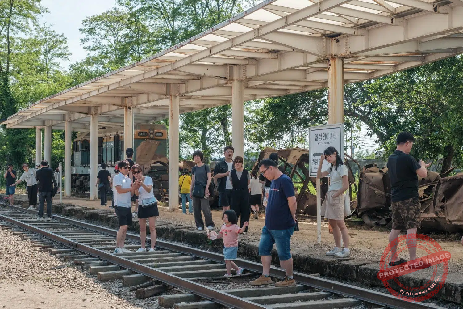
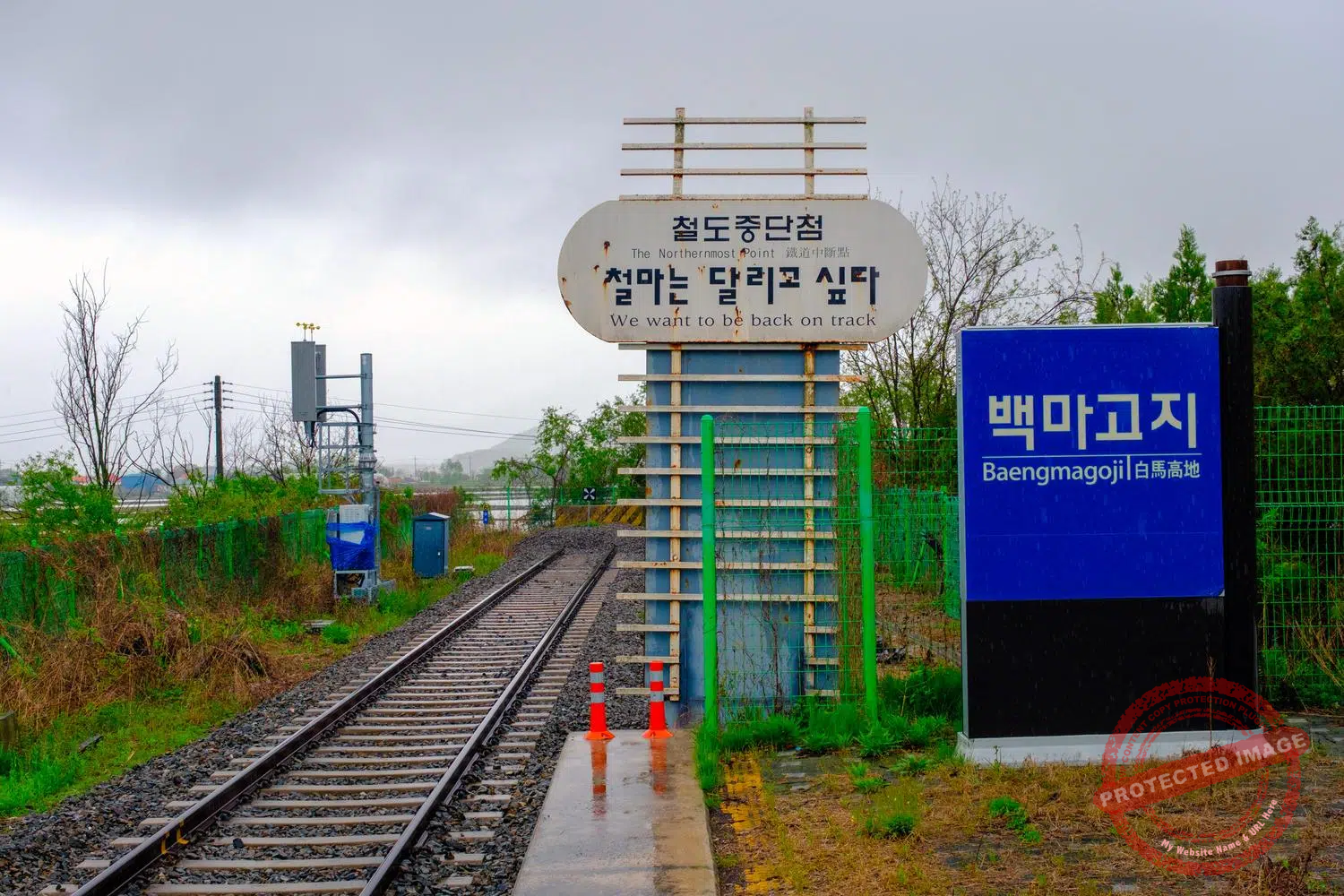
End of the line. The former Gyeongwon railroad between Seoul and Wonsan, a major port city now in North Korea, has been cut off for over 75 years. The last station of the line in South Korean territory, Woljeong-ri, was rebuilt in recent years as a tourist spot at the very edge of the DMZ, but receives no trains. Visitors taking part of the official Cheorwon DMZ Tour escorted by the army can take selfies on the tracks and in front of the wreck of a locomotive bombed during the Korean War. The “real”, active terminus of the Gyeongwong railway line is Baengmagoji Station, also in Cheorwon but outside the Civilian Control Zone. “We want to be back on track”, says a sign at the end of the platform.

Another powerful symbol of Korea’s separation is the Seungilgyo bridge in Cheorwon. Construction began in 1948 under the North Korean Communist regime, which controlled the region at the time, was interrupted during the Korean War and completed in 1958 by South Korea. The northern portion of the bridge (right of the picture), built by the communists, and the southern portion (left), built by the South Korean authorities, are differently constructed, to the point that the discrepancy is externally visible. Since the construction of a much more modern road bridge (in the background) in 1999, the Seungilgyo bridge can only be crossed by bicycles and pedestrians but remains a listed historic monument. The Hantan River, which runs beneath and has its source in North Korea, is popular with rafters and anglers (June 2025).
This page was last updated on: September 28, 2025.