Gyodong Island
교동도

A Black-faced spoonbill fishes in a flooded rice paddy adjacent to the border fence in Gyodong Island. The hills in the background are in North Korea (May 2025).
Gyodong Island lies somewhere halfway between the wild, remote five West Sea Islands and South Korea’s hyperurbanized mainland.
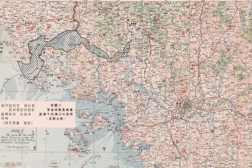
It is the last large South Korean island at the mouth of the Han River (or the first, depending on which way you’re going). The so-called “Neutral Zone of the Han River Estuary” which, under the 1953 armistice agreement, was supposed to be open to civilian shipping for both Koreas, ends at the small island of Maldo, a restricted military territory 7 kilometers south of Gyodong.
During the Korean War (1950–1953), Gyodong Island became a haven for refugees fleeing the advancing North Korean army. When the armistice was signed, the front line, formed by the estuary, became the inter-Korean border. And the two banks, between which there had once been constant exchanges, became separated forever.

The border fence that surrounds Gyodong Island (May 2025).
Many residents of Gyodong today are descendants of people who escaped from nearby Hwanghae Province in the North, right across the river. As a result, the island’s local dialect, cuisine and family names often reflect North Korean roots, even though over the decades this identity has become diluted with the influx of people from other regions of South Korea.
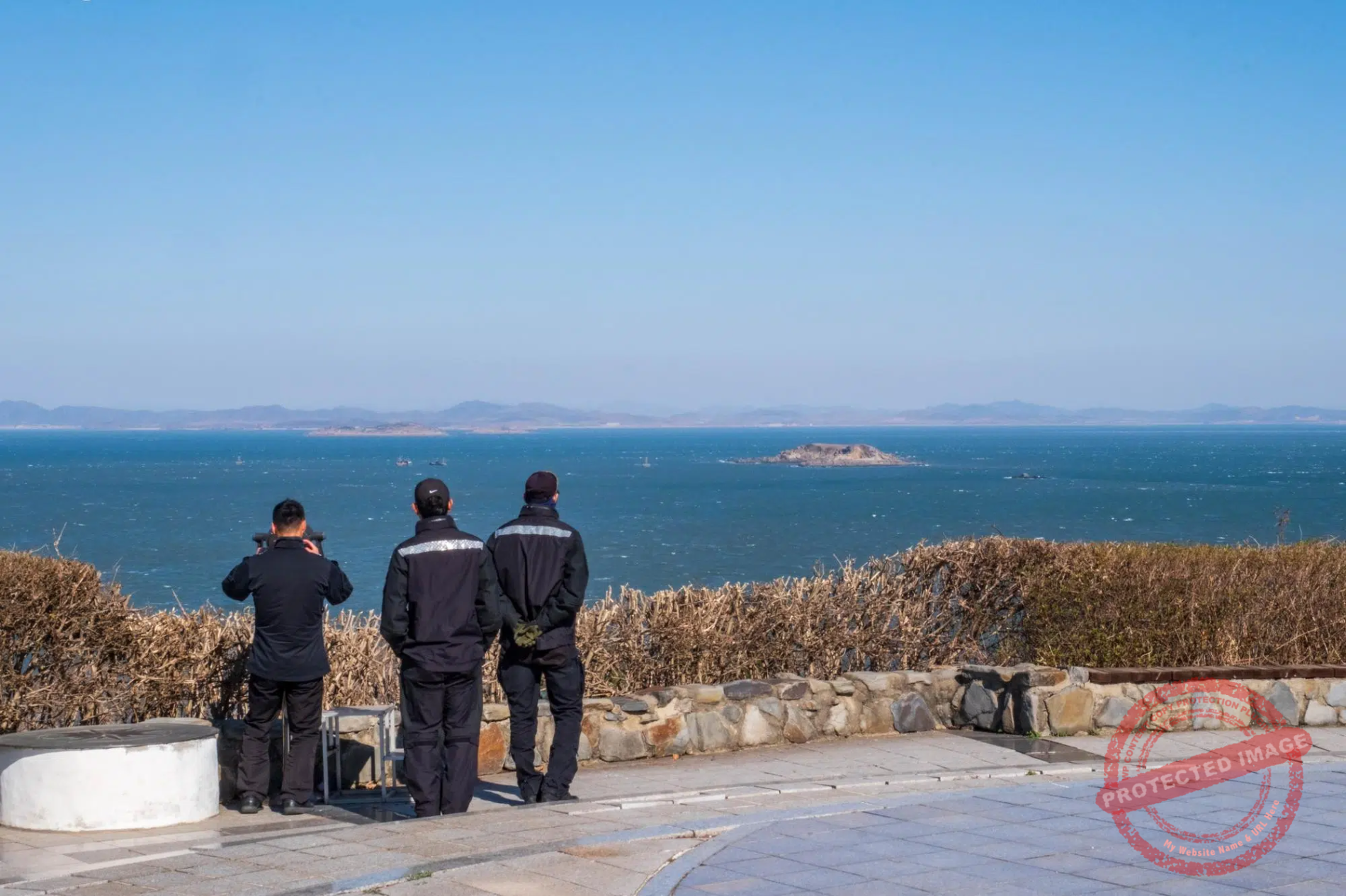
Stranded for decades just a stone’s throw from their former homes and families, the refugees set up a small open-air observatory at the northern tip of the island, from which they could see their homeland and pray for their parents and ancestors who remained on the other side, only 2.6 kilometers away.

A couple from Gyodong Island pay their respects in front of the Manghyangdae altar during the Chuseok mid-autumn holidays for their ancestors who remained in North Korea, on the other side of the Han River Estuary (October 2025).
Manghyangdae, which can be translated as “the Homesick’s Hill”, continues to fulfil its original function more than 75 years after the Korean partition.
During the family festivals of Chuseok, in mid-autumn, and Seollal, the lunar new year, the small altar erected for this purpose is visited by many islanders whose parents or grandparents remained on the other side of the estuary at the end of the war, in most cases without anyone knowing their fate.
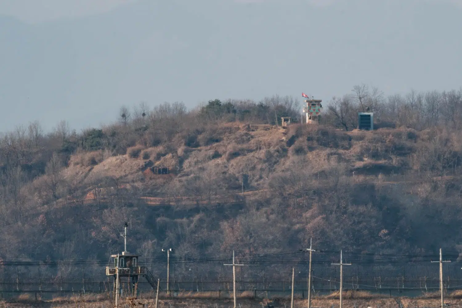
According to Korean tradition, visitors place offerings—fruit, dried fish, or alcohol—in front of the altar and bow down to the ground several times. Others simply take a look, through one of the telescopes set up nearby, at the North Korean county of Yeonbaek where the giant slogan “Long live socialism” sits atop a hill. On a clear day, you can see people riding bicycles or working in the fields. Most buildings appear to be fairly modern in construction.
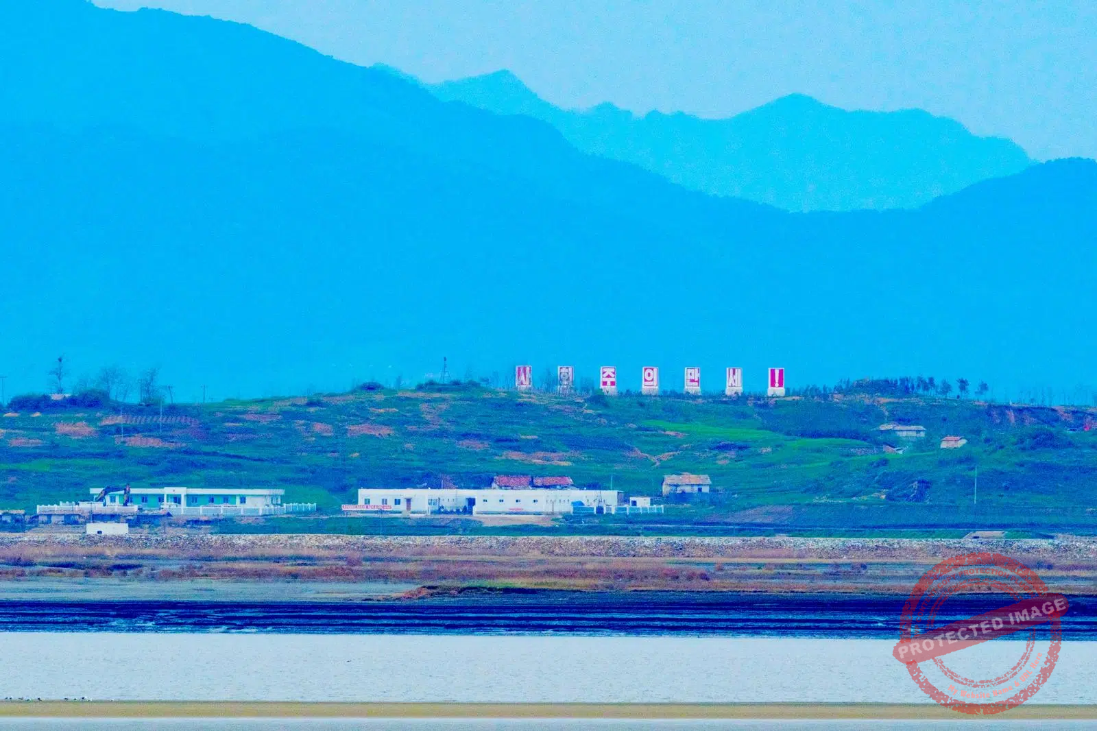
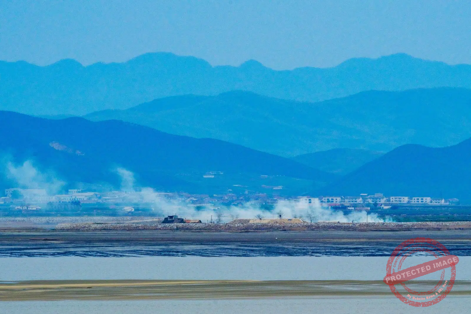
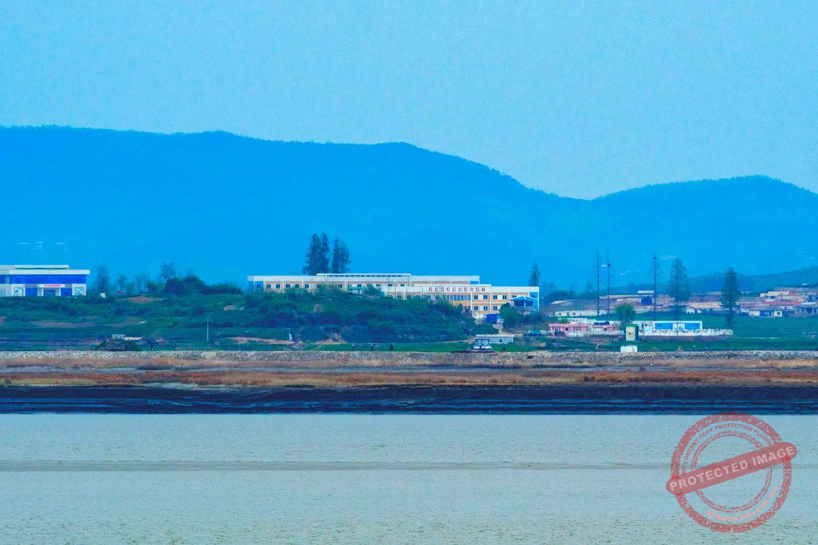
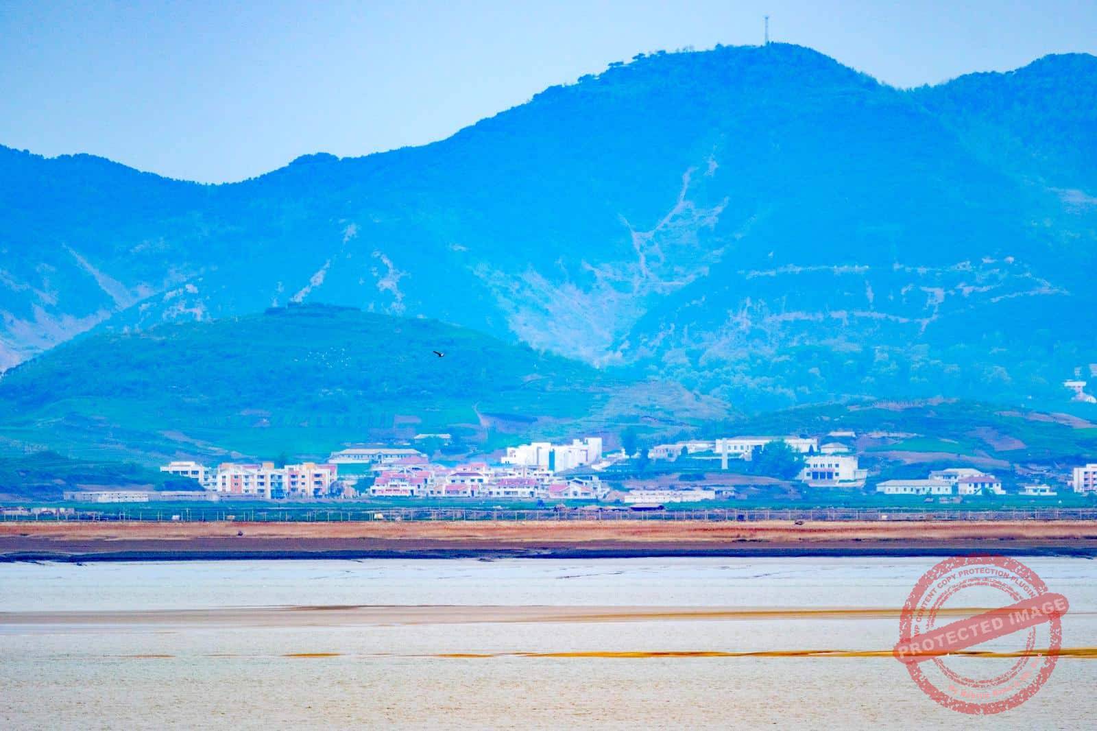
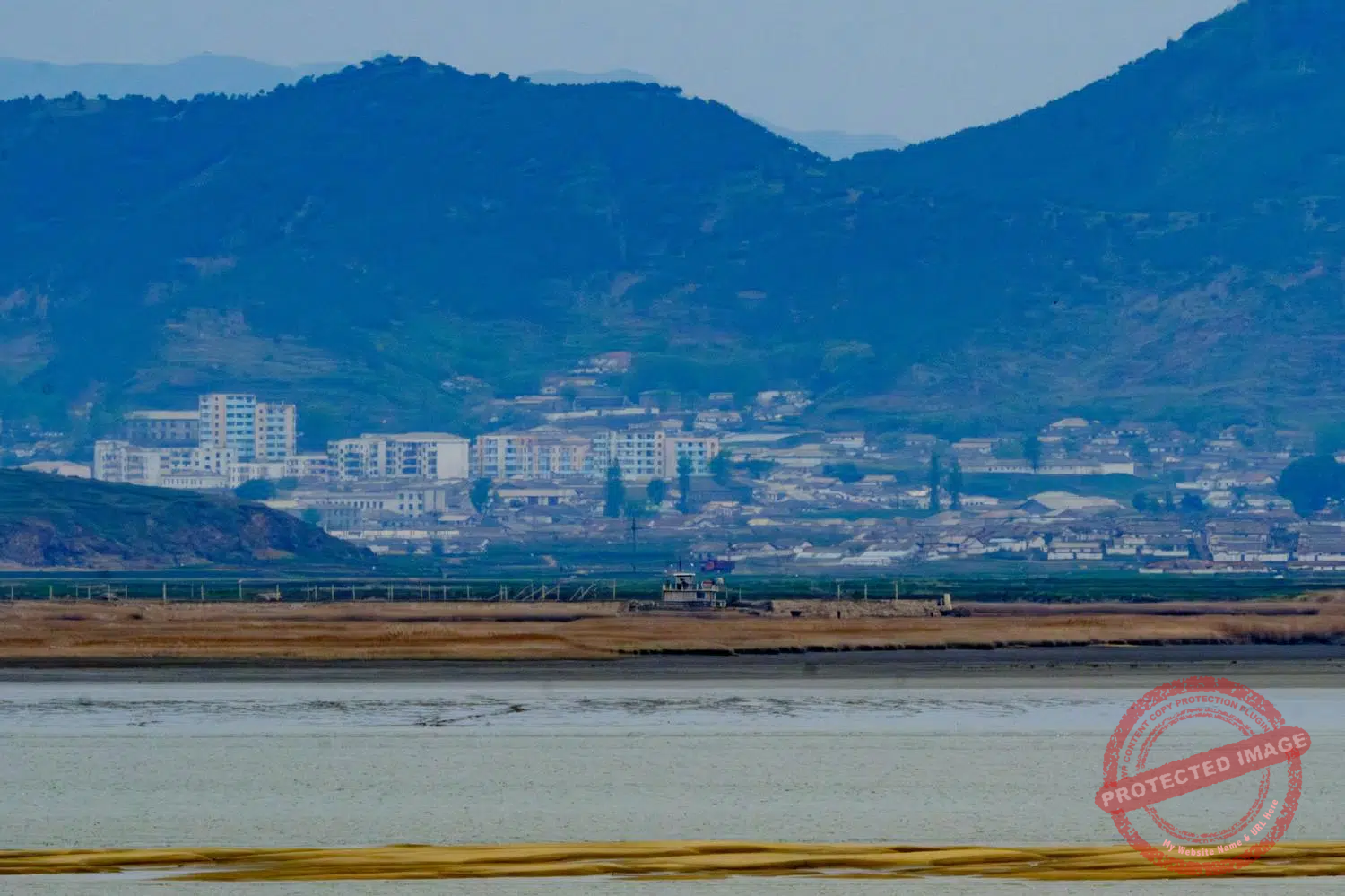
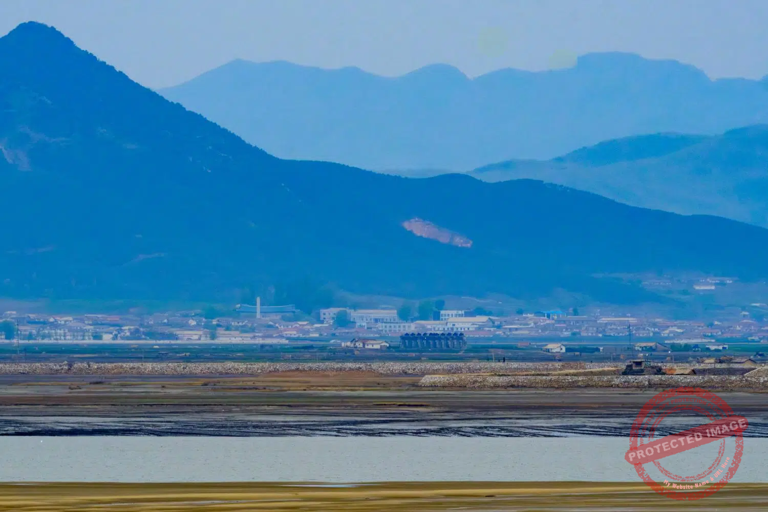
The North Korean bank of the Han River Estuary, seen from the Manghyangdae Observatory in Gyodong Island. The slogan on the top of the hill says: “Long Live Socialism!” (May 2025).
Until the late 1960s, before the entire inter-Korean border was heavily fortified and made impassable, the islanders could go out to sea on the northern side of Gyodong for fishing. There are even stories of Gyodong residents who continued to visit their relatives in the North regularly by clandestinely crossing the Han River estuary – which at low tide can practically be done on foot. These old tales from grandma are impossible to verify. But they don’t seem completely implausible.
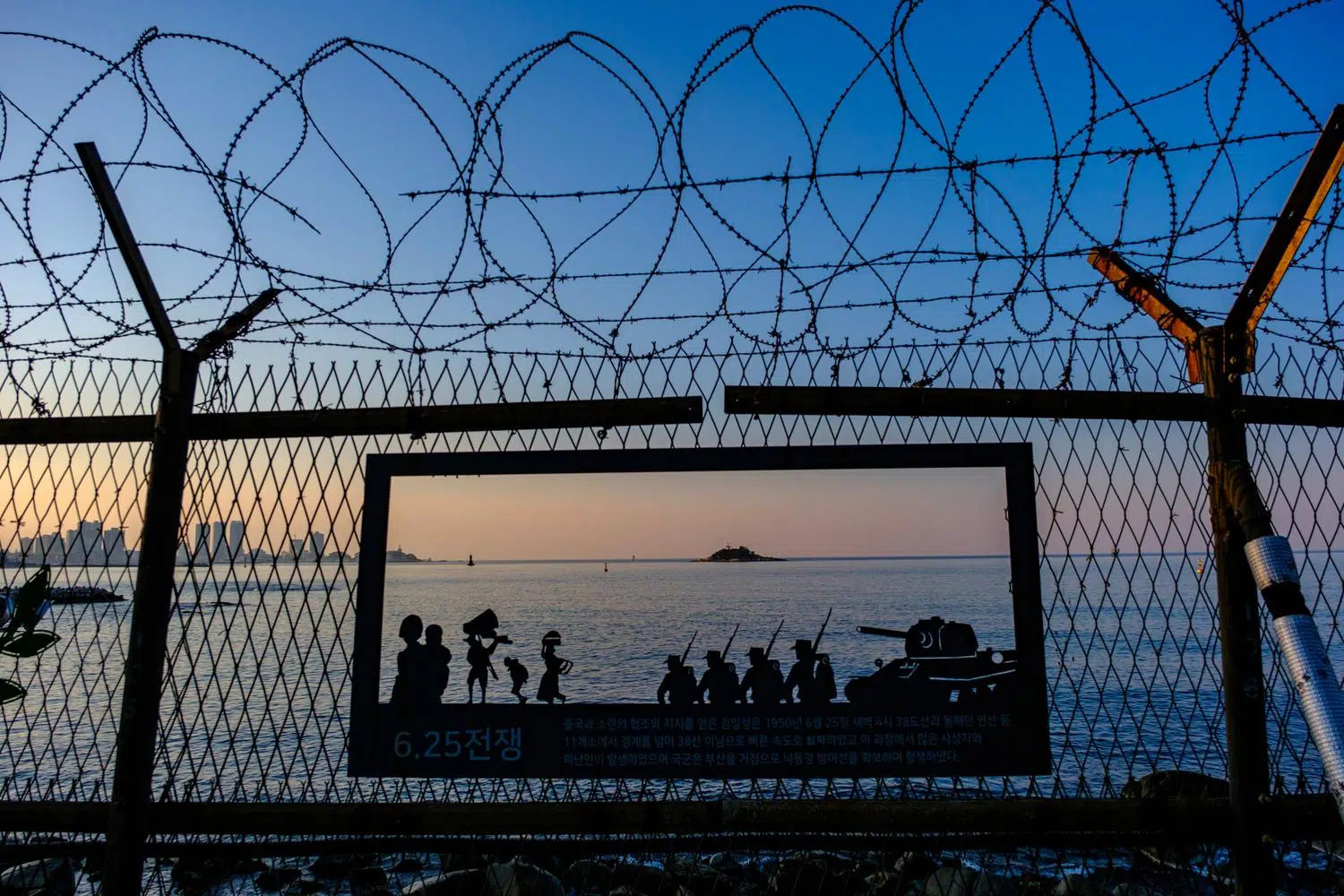
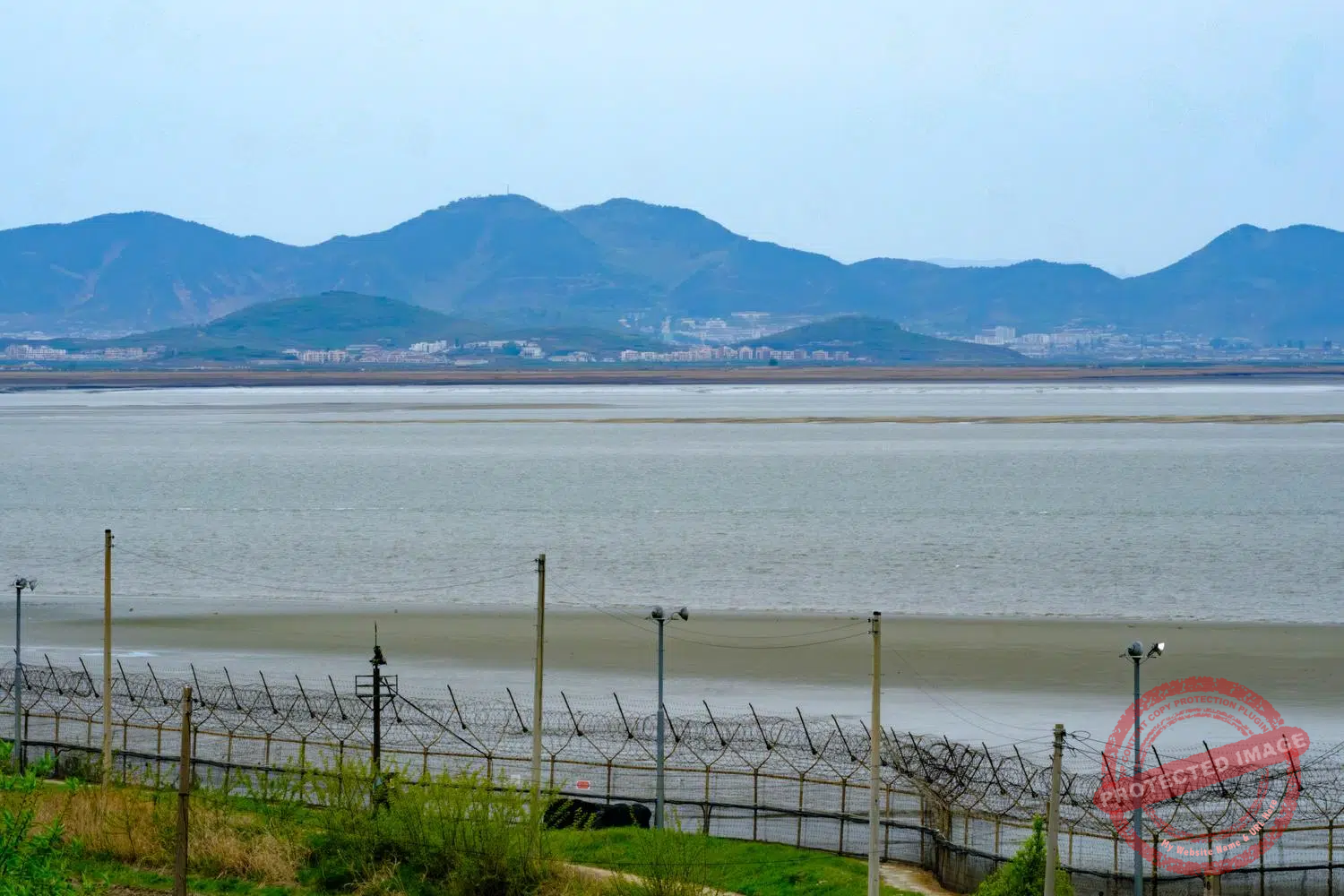
Nowadays, any crossing of the estuary is impossible without risking almost certain death or arrest. But, as in the Yellow Sea islands, the thick fortifications surrounding Gyodong Island almost entirely are equipped with intercoms at regular intervals, enabling any North Korean defectors to call the South Korean army for help once they’ve swum ashore. The island is located within the Civilian Control Zone, which means that you have to pass through a military checkpoint before crossing the bridge that leads to it.

A family looks at North Korea from the Manghyangdae, literaly the “Homesick’s Hill”, in Gyodong Island (May 2025).
The island is within range of North Korean artillery, and although it has been spared the kinds of direct confrontations seen on Yeonpyeong (which was shelled by North Korea in 2010), the threat remains. As in all areas of South Korea close to the border, air-raid warning loudspeakers, shelters, civil defense drills and military installations are a fact of life.
Many in Gyodong look on with envy at the birds, so numerous in this seaside region, which can land on the barbed wire fences and cross the border freely without being shot at or considered defectors.

A magpie’s nest atop a pole equipped with warning loudspeakers on Gyodong Island (May 2025).
There are the blacked-faced spoonbills, with their amusing spoon-shaped beaks. There are the herons and the whooping cranes that can be seen by the dozens fishing in the rice fields. There are magpies, crows and other common birds for whom Gyodong’s defensive infrastructure, such as the air raid warning loudspeakers, provide perfect nesting places.
Above all, there are the swallows. They’re plentiful here. Many of the houses have swallow nests under the eaves. A museum has even been dedicated to them. These migratory birds that return each spring are cherished by the refugees and their descendants as guests and messengers from their lost hometowns in the North.

Isolated, deserted by its youngest inhabitants, and underdeveloped, Gyodong Island seemed destined for decline until 2014, when a suspension bridge connecting it to the South Korean mainland was inaugurated, placing it overnight just an hour and a half’s drive from Seoul. Seven years later, another revitalization project involved building a huge observatory and a skywalk on top of Hwagaesan, the highest hill on the island.
A bike path has been built around the island, along the grim border fences, and tens of thousands of sunflowers planted on the island’s west coast, in the shadow of the North Korean mountains, attract just as many visitors at the end of summer. To complete the transformation of Gyodong into a tourist destination, a scene from the hit series “Squid Game” was filmed at a local school.
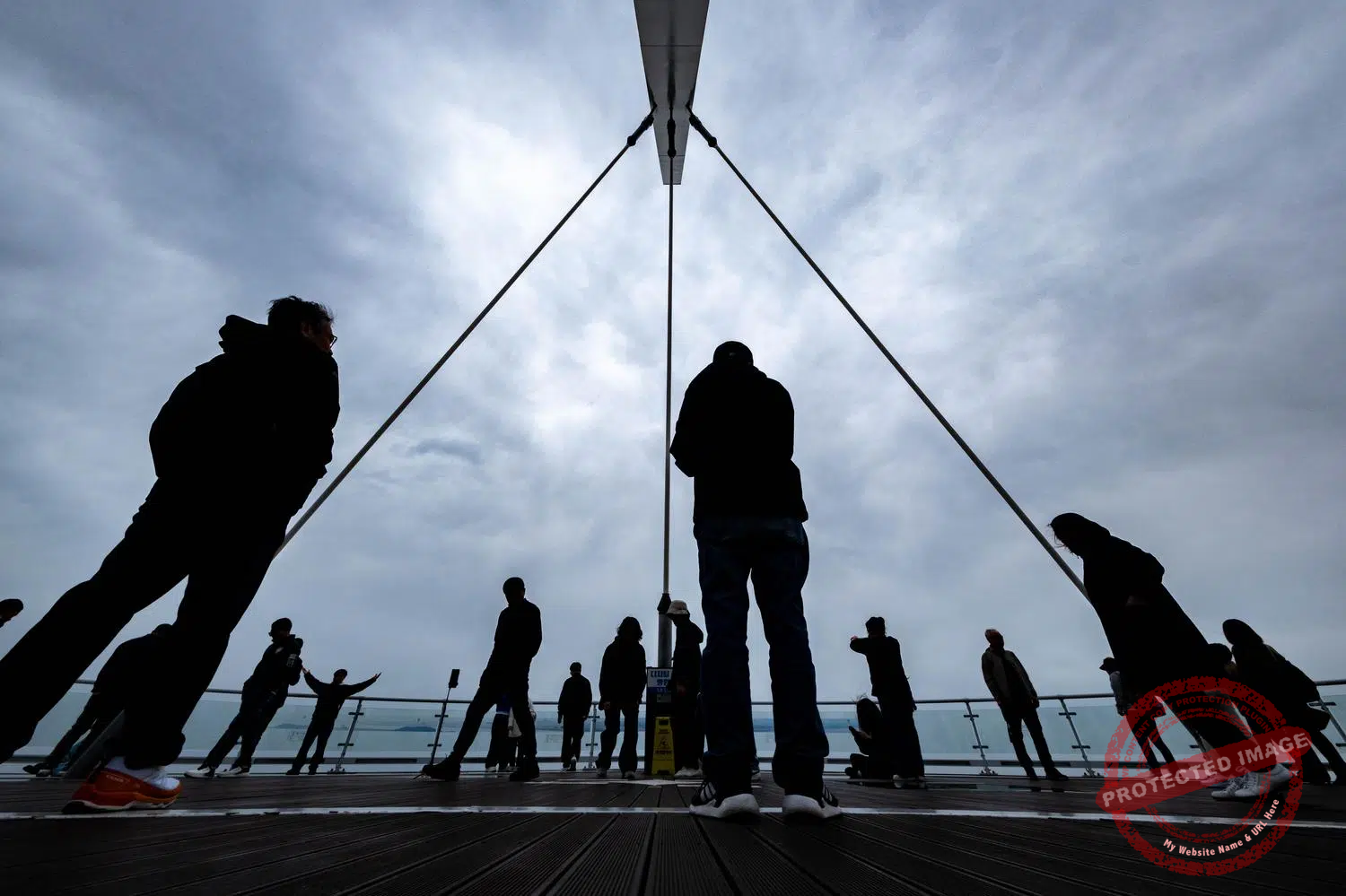
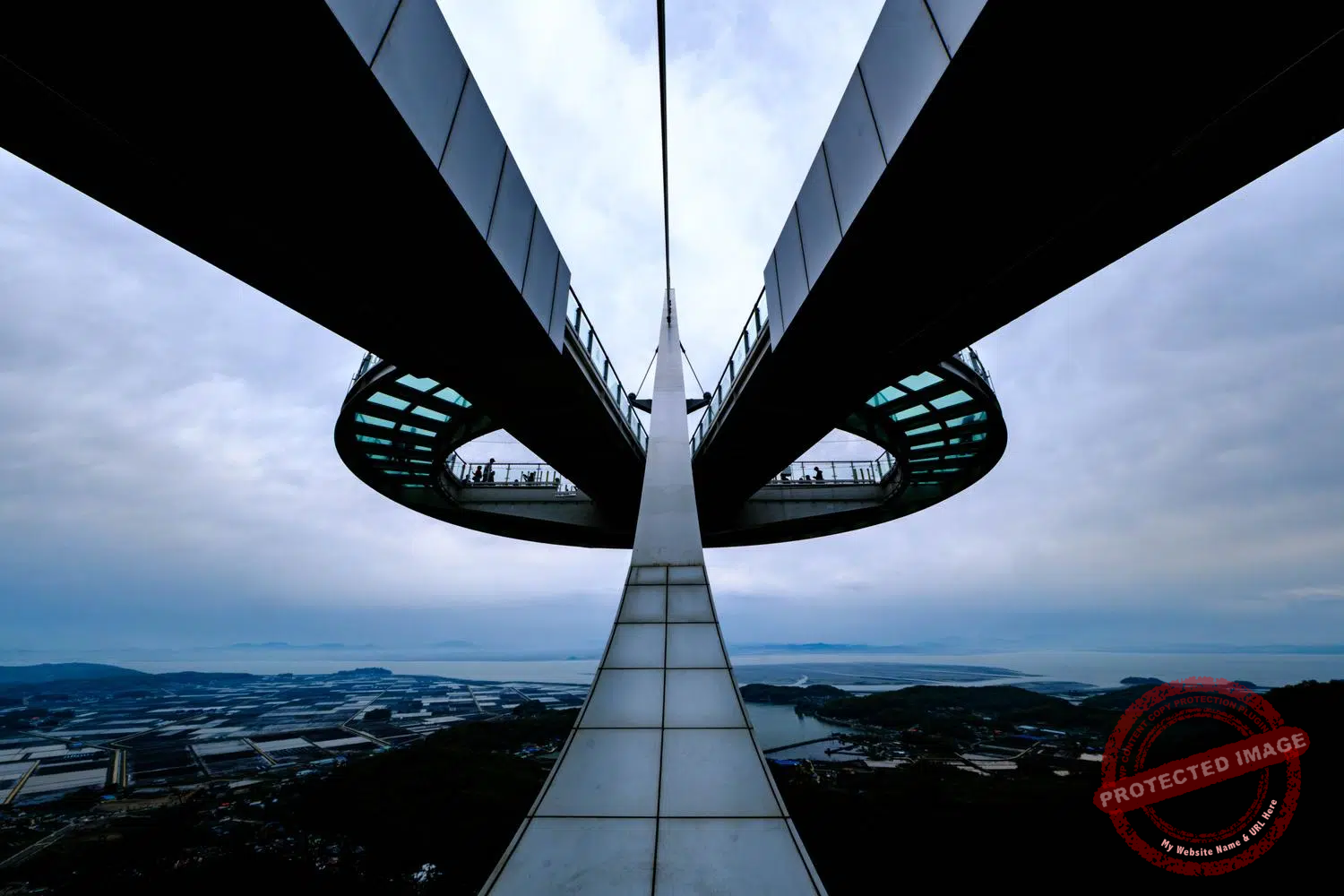
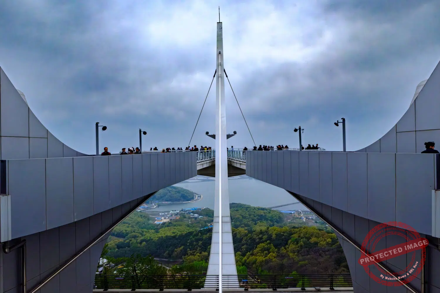
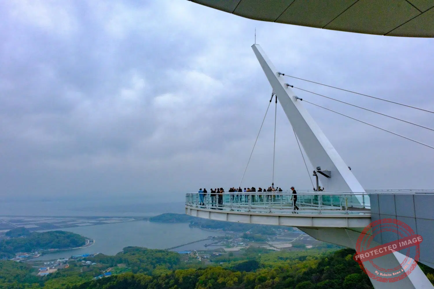
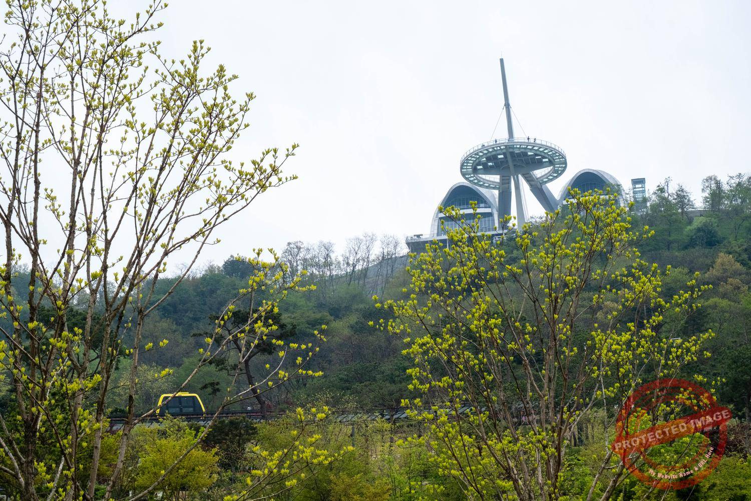
The futuristic Hwagaesan Observatory, built on the top of Gyodong Island’s highest hill (May 2025).
Due to its prolonged isolation, Gyodong hasn’t developed as fast as neighboring regions. It remains a genuine rural island, dotted with farms and rice paddies and with no hotel infrastructure. Many people come here to see what a South Korean village looked like decades ago. Some houses here date back to well before the Korean War.
The Gyodong Daeryong Market also offers a glimpse into Korea’s past, with its retro atmosphere reminiscent of the 1960s or 1970s. Established by North Korean refugees, it was created to replicate the Yeonbaek Market on the other side of the Estuary. It has long since been overrun by the more touristy stalls and cafés, but a few original fruit and vegetable vendors remain.

Mandu for sale at Daeryong Market. On Gyodong Island, these traditional steamed dumplings are closer in size to those eaten in North Korea than those, much smaller, made in the rest of South Korea (October 2025).

Crowds flock to Daeryong Market on Gyodong Island during the Chuseok mid-autumn holiday (October 2025).

Tourists visit a field of sunflowers in western Gyodong Island. The mountains in the background are in North Korea (September 2025).

Sunset over the rice fields and the border fences of Gyodong Island (May 2025).
This post was last updated on : October 8, 2025