Yeoncheon
연천

The gloomy and mysterious “United Nations Crematorium” in Yeoncheon (February 2025).
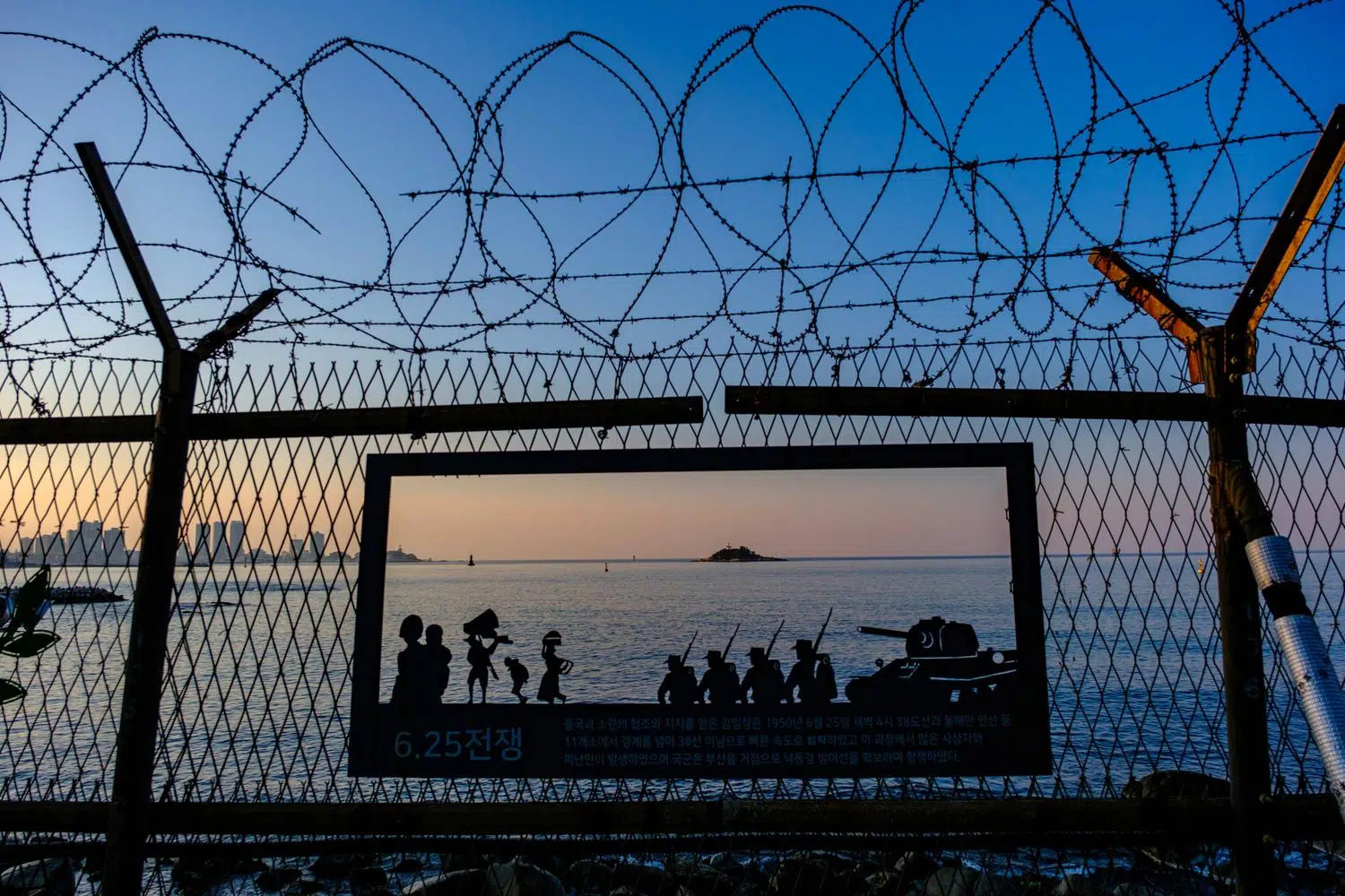
To the east of the Joint Security Area and the DMZ’s popular tourist sites in Paju begins a much lesser-known mountainous border region that stretches to the east coast of the Peninsula.
A few kilometers south of the DMZ, in Yeoncheon County, lies the gloomy and mysterious “United Nations Crematorium,” a designated historic site even though no one knows for sure what it is, or even if it really belonged to the United Nations.
The only official information available says that it was built in 1952, using stones collected from the surrounding area, in order to cremate the fallen United Nations Force’s soldiers during the Korean War, and that it continued to operate until right after the armistice in 1953.
Even though this is an officialy “Registered Cultural Heritage” site by the South Korean government, there is no record of the United Nations cremating its fallen soldiers, whose remains are buried at the National Cemetery in Seoul and other places for South Koreans, and at the United Nations Cemetery in Busan for foreigners.
This place is undoubtedly a real crematorium. There are other ruins of this type, smaller and not officially recorded, along the former front line of the Korean War.
But how many bodies were burnt here? And which ones? Who carried out this grim task? What happened to the ashes?
So many unanswered questions, more than 70 years later.

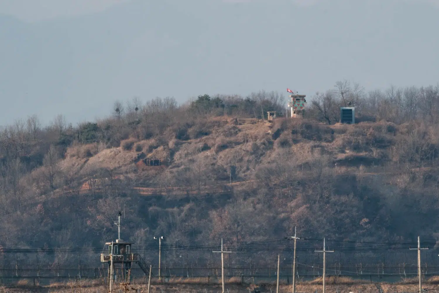
A North Korean guard post inside the DMZ, as seen from the Seungjeong observation post in Yeoncheon (October 2024).
As everywhere along the border, the South Korean army has built in the area many General Outposts (GOPs) on the southern edge of the DMZ as the first line of defense in the event of invasion. Most of them are located atop spectacular peaks and ridges, but photographing them is out of the question.
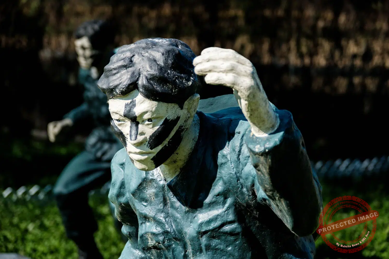
However, some observation posts (OPs) belonging to these units are open to the public, under strict conditions. Such is the case of the Seungjeon OP, located near the strange monument recreating the January 21st incident, the Key Observatory, the Sangseung OP, near where the first North Korean infiltration tunnel was discovered in 1974 by a team of South Korean soldiers who saw steam rising from underground, and the spectacular Typhoon Observatory.
To access these advanced Observation Posts, you need to submit a request for authorization at least one week in advance. In the case of Seungjeon, a military escort is mandatory. At the Typhoon Observatory, it is forbidden to stay for more than ten minutes, even if no one is waiting behind.
In both places, taking photos is forbidden. After some negotiation with my military minders and their commanding officer, however, I was grudgingly granted permission to quickly shoot a couple of images, but only in a northerly direction, and subject to approval once taken. It’s a far cry from the packs of tourists taking selfies at sites closer to Seoul, but each situation has its own charm. It also illustrates Korea’s ongoing tug-of-war between the desire to promote its most spectacular sites on the border and the need to preserve its national security.
The view of the mountains from the Seungjeon observation post is magnificent, but lacks a little geopolitical interest. The only evidence in the landscape that we’re here on the border is a small North Korean Guard Post with a flag, a few kilometers away, and the usual rusty barbed-wire fences. The fortifications on the South Korean side are much more stunning, but photographing them is a very big No No.
The Seungjeon OP is also known as “Biryong Observatory” because of the nearby Biryong Mountain (literally meaning “Flying Dragon Mountain”). The name Seungjeon, meaning “Victory in Battle” was assigned by the South Korean Army’s 25th Infantry Division in charge of the place.

A little further east, nestled atop Suribong Peak, the highest point of Bikkisan Mountain, the fantastic Typhoon Observatory was constructed in 1991 by the South Korean “Invincible Typhoon” unit (the probably self-assigned nickname of the 28th Infantry Division).
It stands a mere 800 meters from the Military Demarcation Line (MDL), materialized here by the Imjin River. In a surrealistic blend of the martial and spiritual, the site includes facilities for Christian and Catholic worship, a Buddhist sanctum, a bell tower and a statue of the Virgin Mary, enabling soldiers and visitors to practice faith less than one kilometer from the socialist paradise.
The primary function of the Typhoon Observatory is to observe the movements of the North Korean army below. The vantage point couldn’t be better: beneath the observer’s feet flows the Imjin River, which marks the border, and its immense valley. In the distance, you can see North Korea’s Hwaggang Dam, a frequent cause of tension between North and South as the Imjin River, on which it is built, rises in the North but then passes into South Korean territory.
Completed in 2007, this dam’s primary functions are power generation and irrigation. But in 2009, an unannounced release from the dam resulted in a sudden surge downstream, killing six South Korean campers who had pitched their tents by the river. North Korea responded by claiming it was due to maintenance and heavy rains. Since then, further unexpected releases have led South Korea to ban all swimming, camping, fishing and other activities in and near the Imjin River.
In 2012, South Korea completed construction of the Sohwa Dam downstream, the main purpose of which is to contain any dangerous, unexpected releases by the North. An episode reminiscent of the Peace Dam in central Korea. Or how hydrography, geography and other natural sciences can become vicious strategic weapons in a country that has been divided in a totally artificial way for over 70 years.
And as is so often the case in South Korea, sinister, ultra-militarized border areas stand side by side with natural beauty.

Visitors enjoy the Autumn colors at Imjin River Daepssari Park in Yeoncheon, at the edge of the Civilian Control Line (October 2024).
As soon as you pass through the military checkpoint on your way back from the Typhoon Observatory, you come upon the incredible Imjin River Daepssari Park, bordering the barbed wire of the Civilian Control Line, where thousands of Koreans come to enjoy the autumn colors.
Open in 2024, the park was created by planting around 20,000 Kochia Scoparia (in Korean: Daepssari), along with other seasonal flower varieties, transforming a riverside area historically affected by conflict into a charming autumn attraction and a day-trip destination from Seoul. The park lends its visitors colorful umbrellas, adding to the enchantment of the setting.
A sight of breathtaking beauty and calm as you descend from the ridges on the front line.
And another demonstration of the Koreans’ ability to tone down – or hide – their K-Scar.

This post was last updated on : September 21, 2025
Previous : Jan. 21 Infiltration Incident Place
Next : Cheorwon
Understand
Themes